Estimated Value: $524,000 - $603,520
3
Beds
2
Baths
1,620
Sq Ft
$351/Sq Ft
Est. Value
About This Home
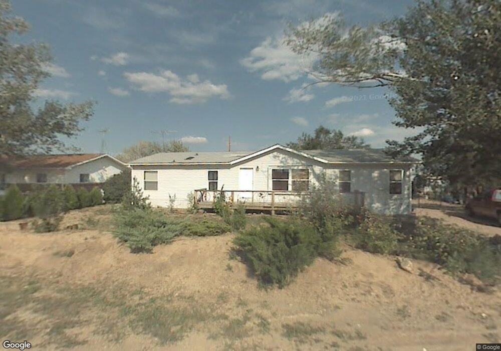
This home is located at 3329 State Highway 52, Erie, CO 80516 and is currently estimated at $568,380, approximately $350 per square foot. 3329 State Highway 52 is a home with nearby schools including Legacy Elementary School, Erie Middle School, and Erie High School.
Ownership History
Date
Name
Owned For
Owner Type
Purchase Details
Closed on
Apr 22, 2004
Sold by
Dorsey Patricia D
Bought by
Valdez Alfredo and Valdez Paulina
Current Estimated Value
Home Financials for this Owner
Home Financials are based on the most recent Mortgage that was taken out on this home.
Original Mortgage
$220,880
Outstanding Balance
$101,909
Interest Rate
5.38%
Mortgage Type
FHA
Estimated Equity
$466,471
Purchase Details
Closed on
Jul 30, 2001
Sold by
Dorsey Patricia D and Deisher Timothy L
Bought by
Dorsey Patricia D
Purchase Details
Closed on
Nov 9, 1995
Sold by
Dorsey Patricia Dawn
Bought by
Dorsey Patricia Dawn
Purchase Details
Closed on
May 19, 1992
Sold by
Lontine Joann M
Bought by
Dorsey Patricia Dawn
Purchase Details
Closed on
Feb 3, 1992
Purchase Details
Closed on
Apr 28, 1990
Sold by
Lachappell Mabel
Bought by
Renshaw Joann M
Purchase Details
Closed on
Oct 26, 1989
Create a Home Valuation Report for This Property
The Home Valuation Report is an in-depth analysis detailing your home's value as well as a comparison with similar homes in the area
Home Values in the Area
Average Home Value in this Area
Purchase History
| Date | Buyer | Sale Price | Title Company |
|---|---|---|---|
| Valdez Alfredo | $224,000 | Land Title | |
| Dorsey Patricia D | $10,000 | -- | |
| Dorsey Patricia Dawn | -- | -- | |
| Dorsey Patricia Dawn | $51,500 | -- | |
| -- | -- | -- | |
| Renshaw Joann M | $35,000 | -- | |
| -- | -- | -- |
Source: Public Records
Mortgage History
| Date | Status | Borrower | Loan Amount |
|---|---|---|---|
| Open | Valdez Alfredo | $220,880 |
Source: Public Records
Tax History Compared to Growth
Tax History
| Year | Tax Paid | Tax Assessment Tax Assessment Total Assessment is a certain percentage of the fair market value that is determined by local assessors to be the total taxable value of land and additions on the property. | Land | Improvement |
|---|---|---|---|---|
| 2025 | $2,863 | $29,000 | $13,210 | $15,790 |
| 2024 | $2,863 | $29,000 | $13,210 | $15,790 |
| 2023 | $2,732 | $34,850 | $15,070 | $19,780 |
| 2022 | $2,637 | $28,360 | $11,160 | $17,200 |
| 2021 | $2,653 | $29,170 | $11,480 | $17,690 |
| 2020 | $1,861 | $20,640 | $10,300 | $10,340 |
| 2019 | $1,891 | $20,640 | $10,300 | $10,340 |
| 2018 | $828 | $9,450 | $6,830 | $2,620 |
| 2017 | $836 | $9,450 | $6,830 | $2,620 |
| 2016 | $904 | $10,150 | $6,110 | $4,040 |
| 2015 | $874 | $10,150 | $6,110 | $4,040 |
| 2014 | $634 | $7,460 | $5,630 | $1,830 |
Source: Public Records
Map
Nearby Homes
- 3309 Quicksilver Rd
- 6516 Empire Ave
- 6334 Empire Ave
- 3310 Quicksilver Rd
- 6520 Empire Ave
- 3319 Eagle Butte Ave
- 6325 Copper Dr
- 2913 Saratoga Trail
- 3516 Little Bell Dr
- 6523 Steeple Rock Dr
- 6324 Saratoga Trail
- 6325 Saratoga Trail
- 6021 Lynx Creek Cir
- 6109 Black Mesa Rd
- 6045 Sandstone Cir
- 6244 Waterman Way
- 6009 Caribou Ct
- 6021 Sandstone Cir
- 3452 Tipple Pkwy
- 3080 S Buttercup Cir
- 3331 State Highway 52
- 3239 State Highway 52
- 3227 State Highway 52
- 3237 State Highway 52
- 3315 Lump Gulch Way
- 3311 Lump Gulch Way
- 3249 State Highway 52
- 3319 Lump Gulch Way
- 3227 Lump Gulch Way
- 3247 State Highway 52
- 3309 State Highway 52 Unit A
- 3223 Lump Gulch Way
- 3259 State Highway 52
- 3139 State Highway 52
- 3219 Lump Gulch Way
- 3306 Lump Gulch Way
- 3302 Lump Gulch Way
- 3226 Lump Gulch Way
- 3269 State Highway 52
- 3269 State Highway 52