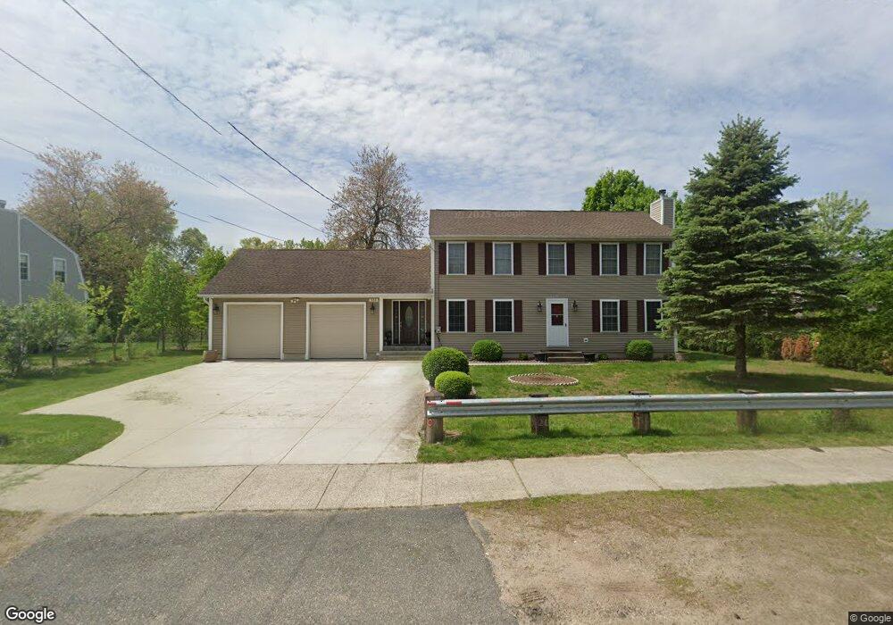
333 Amostown Rd West Springfield, MA 01089
Estimated Value: $337,000 - $472,000
4
Beds
2
Baths
1,888
Sq Ft
$221/Sq Ft
Est. Value
About This Home
This home is located at 333 Amostown Rd, West Springfield, MA 01089 and is currently estimated at $416,820, approximately $220 per square foot. 333 Amostown Rd is a home located in Hampden County with nearby schools including West Springfield High School and St Thomas The Apostle School.
Ownership History
Date
Name
Owned For
Owner Type
Purchase Details
Closed on
Nov 12, 2025
Sold by
Pantus Anatoliy and Pantus Olga
Bought by
333 Amostown Rt and Pantus
Current Estimated Value
Purchase Details
Closed on
Oct 30, 1998
Sold by
Sampson Custom Built
Bought by
Pantus Anatoliy and Pantus Olga
Home Financials for this Owner
Home Financials are based on the most recent Mortgage that was taken out on this home.
Original Mortgage
$82,400
Interest Rate
6.68%
Mortgage Type
Purchase Money Mortgage
Create a Home Valuation Report for This Property
The Home Valuation Report is an in-depth analysis detailing your home's value as well as a comparison with similar homes in the area
Home Values in the Area
Average Home Value in this Area
Purchase History
| Date | Buyer | Sale Price | Title Company |
|---|---|---|---|
| 333 Amostown Rt | -- | -- | |
| Pantus Anatoliy | $128,000 | -- |
Source: Public Records
Mortgage History
| Date | Status | Borrower | Loan Amount |
|---|---|---|---|
| Previous Owner | Pantus Anatoliy | $82,400 |
Source: Public Records
Tax History
| Year | Tax Paid | Tax Assessment Tax Assessment Total Assessment is a certain percentage of the fair market value that is determined by local assessors to be the total taxable value of land and additions on the property. | Land | Improvement |
|---|---|---|---|---|
| 2025 | $5,652 | $380,100 | $129,200 | $250,900 |
| 2024 | $5,345 | $360,900 | $129,200 | $231,700 |
| 2023 | $5,136 | $330,500 | $129,200 | $201,300 |
| 2022 | $4,689 | $297,500 | $117,500 | $180,000 |
| 2021 | $4,419 | $261,500 | $96,200 | $165,300 |
| 2020 | $4,431 | $260,800 | $96,200 | $164,600 |
| 2019 | $4,423 | $260,800 | $96,200 | $164,600 |
| 2018 | $4,447 | $260,800 | $96,200 | $164,600 |
| 2017 | $4,447 | $260,800 | $96,200 | $164,600 |
| 2016 | $4,428 | $260,600 | $90,800 | $169,800 |
| 2015 | $4,059 | $238,900 | $88,700 | $150,200 |
| 2014 | $986 | $238,900 | $88,700 | $150,200 |
Source: Public Records
Map
Nearby Homes
- 315 Amostown Rd
- 340 Amostown Rd
- 322 Amostown Rd
- 305 Amostown Rd
- 139 Lincoln St
- 362 Amostown Rd
- 152 Lincoln St
- 62 Lower Mass Ave
- 129 Lincoln St
- 38 Lower Mass Ave
- 144 Lincoln St
- 122 Chester St
- 72 Lower Mass Ave
- 123 Chester St
- 138 Lincoln St
- 121 Lincoln St
- 370 Amostown Rd
- 370 Amostown Rd Unit n/a
- 82 Lower Mass Ave
- 132 Lincoln St
Your Personal Tour Guide
Ask me questions while you tour the home.