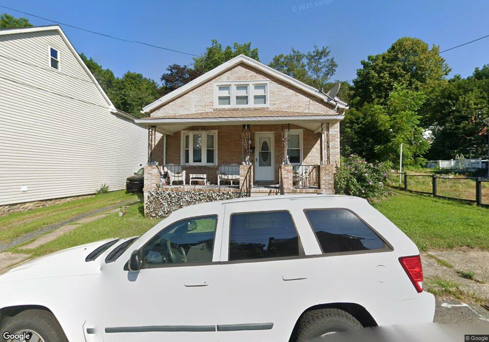
333 Coal St Port Carbon, PA 17965
Estimated Value: $95,000 - $166,000
3
Beds
1
Bath
2,115
Sq Ft
$63/Sq Ft
Est. Value
About This Home
This home is located at 333 Coal St, Port Carbon, PA 17965 and is currently estimated at $133,862, approximately $63 per square foot. 333 Coal St is a home located in Schuylkill County with nearby schools including Clarke Elementary Center, Lengel Middle School, and Pottsville Area High School.
Create a Home Valuation Report for This Property
The Home Valuation Report is an in-depth analysis detailing your home's value as well as a comparison with similar homes in the area
Home Values in the Area
Average Home Value in this Area
Tax History Compared to Growth
Tax History
| Year | Tax Paid | Tax Assessment Tax Assessment Total Assessment is a certain percentage of the fair market value that is determined by local assessors to be the total taxable value of land and additions on the property. | Land | Improvement |
|---|---|---|---|---|
| 2025 | $2,537 | $31,255 | $7,440 | $23,815 |
| 2024 | $2,311 | $31,255 | $7,440 | $23,815 |
| 2023 | $2,136 | $28,895 | $7,440 | $21,455 |
| 2022 | $2,111 | $28,895 | $7,440 | $21,455 |
| 2021 | $2,128 | $28,895 | $7,440 | $21,455 |
| 2020 | $2,082 | $28,895 | $7,440 | $21,455 |
| 2018 | $1,985 | $28,895 | $7,440 | $21,455 |
| 2017 | $1,857 | $28,895 | $7,440 | $21,455 |
| 2015 | -- | $28,895 | $7,440 | $21,455 |
| 2011 | -- | $28,895 | $0 | $0 |
Source: Public Records
Map
Nearby Homes
- 337 Coal St
- 308 Wilson Ave
- 25 N Coal St
- 5 E Washington St
- 2 Ridgeside Dr
- 542 3rd St
- 219 Pike St
- 103 Market St
- 10 Tuscarora St
- 344 E Bacon St
- 806 Park Ave
- 211 E Bacon St
- 1407 E Norwegian St
- 0 Port Carbon Saint Clair Hwy
- 111 Fox St
- 29 E Savory St
- 665 Port Carbon Saint Clair Hwy
- 21 Park St
- 702 & 698 Port Carbon St Clair Hwy
- 0 Schuylkill Manor Rd Unit PASK2018142