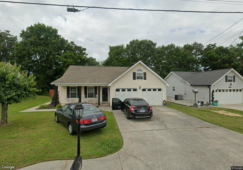
333 Colony Cir Fort Oglethorpe, GA 30742
Estimated Value: $281,000 - $315,000
3
Beds
2
Baths
1,570
Sq Ft
$188/Sq Ft
Est. Value
About This Home
This home is located at 333 Colony Cir, Fort Oglethorpe, GA 30742 and is currently estimated at $295,411, approximately $188 per square foot. 333 Colony Cir is a home located in Catoosa County with nearby schools including Cloud Springs Elementary School, Lakeview Middle School, and Lakeview-Fort Oglethorpe High School.
Ownership History
Date
Name
Owned For
Owner Type
Purchase Details
Closed on
Nov 14, 2011
Sold by
Monterroso Arlene Denise
Bought by
Monterroso Henry Alberto
Current Estimated Value
Purchase Details
Closed on
Aug 25, 2006
Sold by
Meeks Angelia R
Bought by
Monterroso Henry A
Home Financials for this Owner
Home Financials are based on the most recent Mortgage that was taken out on this home.
Original Mortgage
$91,200
Interest Rate
6.67%
Mortgage Type
New Conventional
Create a Home Valuation Report for This Property
The Home Valuation Report is an in-depth analysis detailing your home's value as well as a comparison with similar homes in the area
Home Values in the Area
Average Home Value in this Area
Purchase History
| Date | Buyer | Sale Price | Title Company |
|---|---|---|---|
| Monterroso Henry Alberto | $123,267 | -- | |
| Monterroso Henry A | $114,000 | -- |
Source: Public Records
Mortgage History
| Date | Status | Borrower | Loan Amount |
|---|---|---|---|
| Previous Owner | Monterroso Henry A | $91,200 |
Source: Public Records
Tax History Compared to Growth
Tax History
| Year | Tax Paid | Tax Assessment Tax Assessment Total Assessment is a certain percentage of the fair market value that is determined by local assessors to be the total taxable value of land and additions on the property. | Land | Improvement |
|---|---|---|---|---|
| 2024 | $2,739 | $107,637 | $11,000 | $96,637 |
| 2023 | $2,231 | $83,054 | $11,000 | $72,054 |
| 2022 | $1,721 | $64,912 | $11,000 | $53,912 |
| 2021 | $1,630 | $64,912 | $11,000 | $53,912 |
| 2020 | $1,707 | $57,800 | $11,000 | $46,800 |
| 2019 | $1,553 | $55,800 | $9,000 | $46,800 |
| 2018 | $1,749 | $55,800 | $9,000 | $46,800 |
| 2017 | $1,533 | $52,611 | $7,200 | $45,411 |
| 2016 | $1,489 | $49,124 | $7,200 | $41,924 |
| 2015 | -- | $49,124 | $7,200 | $41,924 |
| 2014 | -- | $49,124 | $7,200 | $41,924 |
| 2013 | -- | $47,159 | $6,912 | $40,247 |
Source: Public Records
Map
Nearby Homes
- 124 Colony Cir
- 183 McDonald Dr
- 351 Franklin Cir
- 180 Gem Dr
- 1002 Cedar Creek Dr
- 17 Southshore Dr
- 6 Rocky Ford Rd
- 15 Evelyn Dr
- 66 Yellow Brick Rd
- 64 Yellow Brick Rd
- 544 Neal Dr
- 504 Frieda Dr
- 239 Flagstone Dr
- 1305 Park Forrest Dr
- 17 Evergreen Cir
- 344 Flagstone Dr
- 18 Evergreen Cir
- 14 Evergreen Cir
- 129 Cedar Grove Ln
- 29 Edgewood Cir
- 347 Colony Cir
- 319 Colony Cir
- 1904 Colony Cir
- 214 Austin Cir
- 361 Colony Cir
- 307 Colony Cir
- 340 Colony Cir
- 232 Austin Cir
- 373 Colony Cir
- 358 Colony Cir
- 285 Colony Cir
- 14 Spring Place Dr
- 22 Spring Place Dr
- 372 Colony Cir
- 358 Linda Ln
- 43 Spring Place Dr
- 195 Austin Cir
- 34 Spring Place Dr
- 192 Austin Cir
- 386 Colony Cir