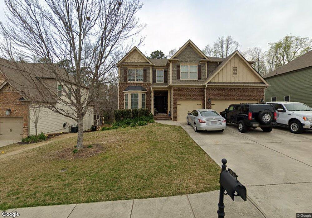
333 Liberty Dr Acworth, GA 30102
Oak Grove NeighborhoodEstimated Value: $637,468 - $709,000
5
Beds
4
Baths
4,144
Sq Ft
$162/Sq Ft
Est. Value
About This Home
This home is located at 333 Liberty Dr, Acworth, GA 30102 and is currently estimated at $673,234, approximately $162 per square foot. 333 Liberty Dr is a home located in Cherokee County with nearby schools including Clark Creek Elementary School, E. T. Booth Middle School, and Etowah High School.
Ownership History
Date
Name
Owned For
Owner Type
Purchase Details
Closed on
Jun 17, 2013
Sold by
Dr Horton Inc
Bought by
Garvey Stephen Richard
Current Estimated Value
Home Financials for this Owner
Home Financials are based on the most recent Mortgage that was taken out on this home.
Original Mortgage
$322,447
Outstanding Balance
$226,901
Interest Rate
3.25%
Mortgage Type
FHA
Estimated Equity
$446,333
Purchase Details
Closed on
Dec 19, 2012
Sold by
Ctl Of Cherokee Llc
Bought by
Dr Horton Inc
Create a Home Valuation Report for This Property
The Home Valuation Report is an in-depth analysis detailing your home's value as well as a comparison with similar homes in the area
Home Values in the Area
Average Home Value in this Area
Purchase History
| Date | Buyer | Sale Price | Title Company |
|---|---|---|---|
| Garvey Stephen Richard | $328,396 | -- | |
| Dr Horton Inc | $190,000 | -- |
Source: Public Records
Mortgage History
| Date | Status | Borrower | Loan Amount |
|---|---|---|---|
| Open | Garvey Stephen Richard | $322,447 |
Source: Public Records
Tax History Compared to Growth
Tax History
| Year | Tax Paid | Tax Assessment Tax Assessment Total Assessment is a certain percentage of the fair market value that is determined by local assessors to be the total taxable value of land and additions on the property. | Land | Improvement |
|---|---|---|---|---|
| 2024 | $6,401 | $246,320 | $44,000 | $202,320 |
| 2023 | $6,287 | $241,920 | $44,000 | $197,920 |
| 2022 | $5,284 | $201,040 | $34,000 | $167,040 |
| 2021 | $4,790 | $168,720 | $24,800 | $143,920 |
| 2020 | $4,508 | $158,640 | $24,800 | $133,840 |
| 2019 | $4,582 | $161,240 | $24,800 | $136,440 |
| 2018 | $4,208 | $147,200 | $24,800 | $122,400 |
| 2017 | $4,113 | $356,900 | $24,800 | $117,960 |
| 2016 | $4,039 | $346,800 | $24,800 | $113,920 |
| 2015 | $4,044 | $343,900 | $24,800 | $112,760 |
| 2014 | $3,818 | $324,000 | $19,200 | $110,400 |
Source: Public Records
Map
Nearby Homes
- 337 Liberty Dr
- 334 Liberty Dr
- 603 Discovery Ct
- 808 Harrison Dr
- 5706 Forest Place
- 176 Woodhouse Cir
- 113 Woodhouse Cir
- 166 Woodhouse Cir
- 413 Livingston Point
- 1981 American Way Unit 28
- 1983 American Way Unit 27
- 427 Colsen Dr
- 432 Carrera Ln
- 436 Carrera Ln
- 440 Carrera Ln
- 340 Colsen Dr
- 431 Carrera Ln
- 336 Colsen Dr
- 435 Carrera Ln
- 332 Colsen Dr
- 335 Liberty Dr
- 331 Liberty Dr
- 329 Liberty Dr
- 324 Liberty Dr
- 322 Liberty Dr
- 339 Liberty Dr Unit 71
- 339 Liberty Dr
- 0 Liberty Dr Unit 7533430
- 0 Liberty Dr Unit 8677866
- 0 Liberty Dr Unit 8669795
- 0 Liberty Dr Unit 8602641
- 0 Liberty Dr Unit 8563054
- 0 Liberty Dr Unit 8523917
- 0 Liberty Dr Unit 8502080
- 0 Liberty Dr Unit 8421400
- 0 Liberty Dr Unit 8007419
- 0 Liberty Dr Unit 8571600
- 0 Liberty Dr Unit 8212144
- 0 Liberty Dr Unit 7502325
- 0 Liberty Dr Unit 8594364