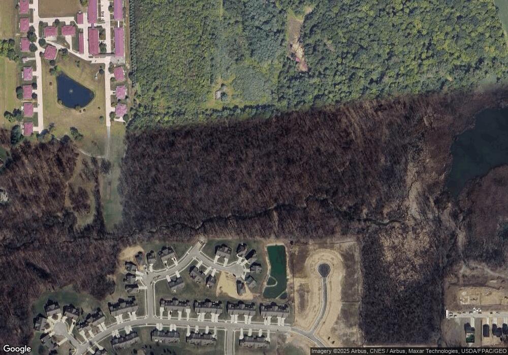
333 Logan Rd Mansfield, OH 44907
Estimated Value: $145,000 - $461,265
1
Bed
1
Bath
720
Sq Ft
$386/Sq Ft
Est. Value
About This Home
This home is located at 333 Logan Rd, Mansfield, OH 44907 and is currently estimated at $278,066, approximately $386 per square foot. 333 Logan Rd is a home located in Richland County with nearby schools including Madison High School, Mansfield Christian School, and Discovery School.
Ownership History
Date
Name
Owned For
Owner Type
Purchase Details
Closed on
Nov 22, 2016
Sold by
Hunsinger Walter W and Hunsinger Linda K
Bought by
Hunsinger Builders Llc
Current Estimated Value
Purchase Details
Closed on
Oct 2, 2002
Sold by
Hudson Properties
Bought by
Hunsinger Walter W and Hunsinger Linda K
Purchase Details
Closed on
Jul 25, 1997
Sold by
Key Trust Co Of Ohio
Bought by
Hudson Ii Janet E Wobbecke
Home Financials for this Owner
Home Financials are based on the most recent Mortgage that was taken out on this home.
Original Mortgage
$75,000
Interest Rate
7.81%
Mortgage Type
New Conventional
Purchase Details
Closed on
Sep 22, 1993
Sold by
Bolesky Harold F
Bought by
Society National Bank Trustee
Create a Home Valuation Report for This Property
The Home Valuation Report is an in-depth analysis detailing your home's value as well as a comparison with similar homes in the area
Home Values in the Area
Average Home Value in this Area
Purchase History
| Date | Buyer | Sale Price | Title Company |
|---|---|---|---|
| Hunsinger Builders Llc | -- | None Available | |
| Hunsinger Walter W | $215,000 | -- | |
| Hudson Ii Janet E Wobbecke | $140,000 | -- | |
| Society National Bank Trustee | -- | -- |
Source: Public Records
Mortgage History
| Date | Status | Borrower | Loan Amount |
|---|---|---|---|
| Previous Owner | Hudson Ii Janet E Wobbecke | $75,000 |
Source: Public Records
Tax History Compared to Growth
Tax History
| Year | Tax Paid | Tax Assessment Tax Assessment Total Assessment is a certain percentage of the fair market value that is determined by local assessors to be the total taxable value of land and additions on the property. | Land | Improvement |
|---|---|---|---|---|
| 2024 | $1,570 | $38,010 | $38,010 | $0 |
| 2023 | $1,570 | $38,470 | $38,010 | $460 |
| 2022 | $978 | $21,790 | $21,450 | $340 |
| 2021 | $978 | $21,790 | $21,450 | $340 |
| 2020 | $988 | $21,790 | $21,450 | $340 |
| 2019 | $917 | $18,280 | $17,980 | $300 |
| 2018 | $909 | $18,280 | $17,980 | $300 |
| 2017 | $1,948 | $54,830 | $42,960 | $11,870 |
| 2016 | $1,224 | $24,520 | $23,600 | $920 |
| 2015 | $1,201 | $24,520 | $23,600 | $920 |
| 2014 | $1,196 | $24,520 | $23,600 | $920 |
| 2012 | $561 | $24,520 | $23,600 | $920 |
Source: Public Records
Map
Nearby Homes
- 1011 Princeton Trace
- 154 Elderberry Dr
- 148 Elderberry Dr
- 132 Elderberry Dr
- 129 Elderberry Dr
- 65 Logan Rd
- 0 Lexington Ave Unit 224009661
- 478 Clearview Rd
- 646 Kennedy Dr
- 1179 Burkwood Rd
- 0 Yoha Dr
- 601 Karlson Dr
- 1156 Yorkwood Rd
- 1689 Middle Bellville Rd
- 531 Sequoia Ln
- 554 Sequoia Ln
- 1125 Larchwood Rd
- 591 Straub Rd W
- 615 Bailey Dr
- 1702 Middle Bellville Rd
- 301 Logan Rd
- 367 Logan Rd
- 373 Logan Rd
- 391 Logan Rd
- 395 Logan Rd
- 279 Logan Rd
- 322 Logan Rd
- 267 Logan Rd
- 225 Logan Rd
- 480 Meadowdale Dr
- 217 Logan Rd
- 475 Meadowdale Dr
- 0 Logan Rd
- 1585 Cape Cod Dr
- 209 Logan Rd
- 463 Logan Rd
- 1002 Cedar Creek Cove Unit 1002
- 1006 Cedar Creek Cove
- 1004 Cedar Creek Cove
- 485 Meadowdale Dr
