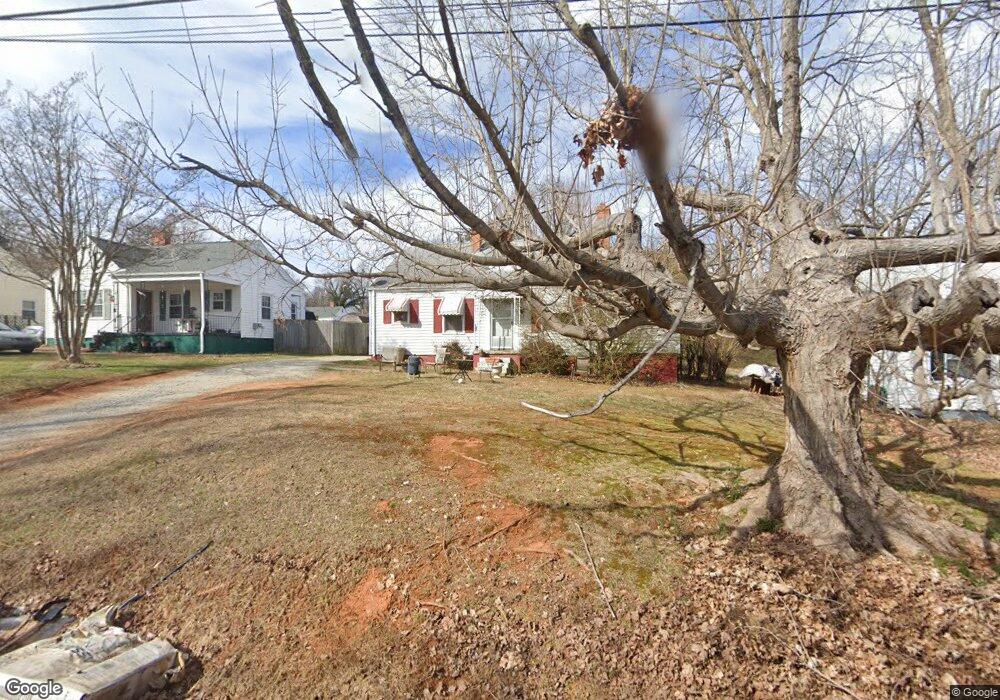
333 Nathan Hunt Dr High Point, NC 27260
Greater High Point NeighborhoodEstimated Value: $131,846 - $144,000
2
Beds
1
Bath
968
Sq Ft
$144/Sq Ft
Est. Value
About This Home
This home is located at 333 Nathan Hunt Dr, High Point, NC 27260 and is currently estimated at $138,962, approximately $143 per square foot. 333 Nathan Hunt Dr is a home located in Guilford County with nearby schools including Fairview Elementary School, Ferndale Middle School, and High Point Central High School.
Ownership History
Date
Name
Owned For
Owner Type
Purchase Details
Closed on
Jul 29, 2014
Sold by
Chambers Raymond Wayne
Bought by
Chambers Raymond W
Current Estimated Value
Purchase Details
Closed on
Dec 30, 2003
Sold by
Wells Fargo Bank Minnesota Na
Bought by
Chambers Raymone Wayne
Purchase Details
Closed on
Jun 24, 2003
Sold by
Sadler Patricia and Sadler Charles
Bought by
Wells Fargo Bank Minnesota Na
Purchase Details
Closed on
Feb 1, 2001
Sold by
Draughn Frank M and Draughn Janie
Bought by
Sadler Patricia
Home Financials for this Owner
Home Financials are based on the most recent Mortgage that was taken out on this home.
Original Mortgage
$51,900
Interest Rate
7.97%
Create a Home Valuation Report for This Property
The Home Valuation Report is an in-depth analysis detailing your home's value as well as a comparison with similar homes in the area
Home Values in the Area
Average Home Value in this Area
Purchase History
| Date | Buyer | Sale Price | Title Company |
|---|---|---|---|
| Chambers Raymond W | -- | None Available | |
| Chambers Raymone Wayne | $53,000 | -- | |
| Wells Fargo Bank Minnesota Na | $56,452 | -- | |
| Sadler Patricia | $67,000 | -- |
Source: Public Records
Mortgage History
| Date | Status | Borrower | Loan Amount |
|---|---|---|---|
| Previous Owner | Sadler Patricia | $51,900 | |
| Closed | Sadler Patricia | $15,000 |
Source: Public Records
Tax History Compared to Growth
Tax History
| Year | Tax Paid | Tax Assessment Tax Assessment Total Assessment is a certain percentage of the fair market value that is determined by local assessors to be the total taxable value of land and additions on the property. | Land | Improvement |
|---|---|---|---|---|
| 2025 | $901 | $65,400 | $10,000 | $55,400 |
| 2024 | $901 | $65,400 | $10,000 | $55,400 |
| 2023 | $901 | $65,400 | $10,000 | $55,400 |
| 2022 | $882 | $65,400 | $10,000 | $55,400 |
| 2021 | $679 | $49,300 | $10,000 | $39,300 |
| 2020 | $679 | $49,300 | $10,000 | $39,300 |
| 2019 | $679 | $49,300 | $0 | $0 |
| 2018 | $676 | $49,300 | $0 | $0 |
| 2017 | $679 | $49,300 | $0 | $0 |
| 2016 | $820 | $58,500 | $0 | $0 |
| 2015 | $825 | $58,500 | $0 | $0 |
| 2014 | $839 | $58,500 | $0 | $0 |
Source: Public Records
Map
Nearby Homes
- 1117 Jefferson St
- 1010 Grace St
- 223 Jay Place
- 312 Model Farm Rd
- 2109 Lowe Ave
- 1907 Apex Place
- 640 Wesley Dr
- 1208 Anderson Place
- 912 Grace St
- 915 Park St
- 607 Martha Place
- 304 E Springfield Rd
- 400 E Springfield Rd
- 1605 Mossbrook Cir
- 1222 Carter St
- 1215 E Russell Ave
- 4304 Griffins Gate Ln
- 707 Park St
- 702 Park St
- 1601 E Green Dr
- 331 Nathan Hunt Dr
- 335 Nathan Hunt Dr
- 329 Nathan Hunt Dr
- 337 Nathan Hunt Dr
- 322 Player Dr
- 327 Nathan Hunt Dr
- 324 Player Dr
- 339 Nathan Hunt Dr
- 320 Player Dr
- 326 Player Dr
- 318 Player Dr
- 328 Player Dr
- 325 Nathan Hunt Dr
- 316 Player Dr
- 330 Player Dr
- 323 Nathan Hunt Dr
- 314 Player Dr
- 401 Nathan Hunt Dr
- 321 Nathan Hunt Dr
- 400 Player Dr