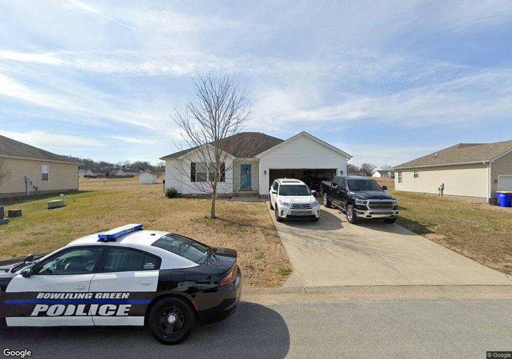
333 Saint Paul Ave Bowling Green, KY 42101
Estimated Value: $244,000 - $259,000
3
Beds
2
Baths
1,432
Sq Ft
$175/Sq Ft
Est. Value
About This Home
This home is located at 333 Saint Paul Ave, Bowling Green, KY 42101 and is currently estimated at $250,375, approximately $174 per square foot. 333 Saint Paul Ave is a home located in Warren County with nearby schools including Bristow Elementary School, Warren East Middle School, and Warren East High School.
Ownership History
Date
Name
Owned For
Owner Type
Purchase Details
Closed on
Jul 29, 2022
Sold by
Livingston Josh C and Livingston Courtney N
Bought by
Sullivan Marietta
Current Estimated Value
Purchase Details
Closed on
Mar 31, 2016
Sold by
Shrock John
Bought by
Livingston Josh C and Livingston Courtney N
Home Financials for this Owner
Home Financials are based on the most recent Mortgage that was taken out on this home.
Original Mortgage
$123,226
Interest Rate
3.37%
Mortgage Type
FHA
Create a Home Valuation Report for This Property
The Home Valuation Report is an in-depth analysis detailing your home's value as well as a comparison with similar homes in the area
Home Values in the Area
Average Home Value in this Area
Purchase History
| Date | Buyer | Sale Price | Title Company |
|---|---|---|---|
| Sullivan Marietta | $220,000 | Hardin Jason Todd | |
| Sullivan Marietta | $220,000 | Hardin Jason Todd | |
| Livingston Josh C | $125,500 | Upland Title Llc |
Source: Public Records
Mortgage History
| Date | Status | Borrower | Loan Amount |
|---|---|---|---|
| Previous Owner | Livingston Josh C | $123,226 |
Source: Public Records
Tax History Compared to Growth
Tax History
| Year | Tax Paid | Tax Assessment Tax Assessment Total Assessment is a certain percentage of the fair market value that is determined by local assessors to be the total taxable value of land and additions on the property. | Land | Improvement |
|---|---|---|---|---|
| 2025 | $2,039 | $223,200 | $0 | $0 |
| 2024 | $2,029 | $220,000 | $0 | $0 |
| 2023 | $2,043 | $220,000 | $0 | $0 |
| 2022 | $1,161 | $125,500 | $0 | $0 |
| 2021 | $1,156 | $125,500 | $0 | $0 |
| 2020 | $1,161 | $125,500 | $0 | $0 |
| 2019 | $1,159 | $125,500 | $0 | $0 |
| 2018 | $1,154 | $125,500 | $0 | $0 |
| 2017 | $1,146 | $125,500 | $0 | $0 |
| 2015 | $811 | $84,600 | $0 | $0 |
| 2014 | $807 | $85,500 | $0 | $0 |
Source: Public Records
Map
Nearby Homes
- 332 Saint Paul Ave
- 1428 Quebec Way
- 1311 Huron Way
- 1631 Calgary Way
- 333 Deluth Dr
- 1464 N Pointe Way
- 1318 Salem Cir
- 1519 N Pointe Ct
- 1201 Salem Cir
- 2530 Plum Springs Rd
- 2724 Cedrus Ave
- 423 Deluth Dr
- 498 Deluth Dr
- 471 Deluth Dr
- 2801 Gunsmoke Trail Way
- 1254 Melody Ave
- 912 Alberta Dr
- 2837 Gunsmoke Trail Way
- 2374 Plum Springs Rd
- 521 Labrador Dr
- 333 St Paul Ave
- 325 Saint Paul Ave
- 341 Saint Paul Ave
- 349 St Paul Ave
- 349 Saint Paul Ave
- 340 Saint Paul Ave
- 348 Saint Paul Ave
- 348 St Paul Ave
- 317 Saint Paul Ave
- 357 Saint Paul Ave
- 356 Saint Paul Ave
- 364 Saint Paul Ave
- 324 Saint Paul Ave
- 309 Saint Paul Ave
- 365 Saint Paul Ave
- 316 Saint Paul Ave
- 1375 Quebec Way
- 372 Saint Paul Ave
- 333 Fairbanks Ave
- 1371 Quebec Way