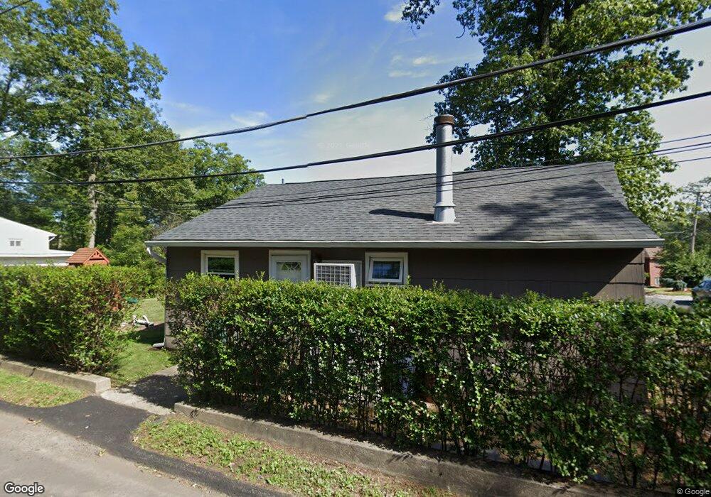
333 Squaw Trail Andover, NJ 07821
Estimated Value: $347,889 - $429,000
Studio
--
Bath
1,089
Sq Ft
$362/Sq Ft
Est. Value
About This Home
This home is located at 333 Squaw Trail, Andover, NJ 07821 and is currently estimated at $394,222, approximately $362 per square foot. 333 Squaw Trail is a home located in Sussex County with nearby schools including Hudson Maxim Elementary School, Durban Avenue Elementary School, and Tulsa Trail Elementary School.
Ownership History
Date
Name
Owned For
Owner Type
Purchase Details
Closed on
May 12, 2004
Sold by
Scibetta Carl
Bought by
Deardorff Richard W and Eigner Jill J
Current Estimated Value
Home Financials for this Owner
Home Financials are based on the most recent Mortgage that was taken out on this home.
Original Mortgage
$157,600
Interest Rate
6.25%
Mortgage Type
Purchase Money Mortgage
Purchase Details
Closed on
Jun 30, 1994
Sold by
Kerner Walter
Bought by
Kerner Walter and Kerner Elsie
Create a Home Valuation Report for This Property
The Home Valuation Report is an in-depth analysis detailing your home's value as well as a comparison with similar homes in the area
Home Values in the Area
Average Home Value in this Area
Purchase History
We collect this data history from publicly available records. To have your information removed, we recommend requesting removal directly through your county’s website.
| Date | Buyer | Sale Price | Title Company |
|---|---|---|---|
| Deardorff Richard W | $197,000 | Fidelity National Title Insu | |
| Kerner Walter | $116,500 | -- |
Source: Public Records
Mortgage History
We collect this data history from publicly available records. To have your information removed, we recommend requesting removal directly through your county’s website.
| Date | Status | Borrower | Loan Amount |
|---|---|---|---|
| Previous Owner | Deardorff Richard W | $157,600 |
Source: Public Records
Tax History
| Year | Tax Paid | Tax Assessment Tax Assessment Total Assessment is a certain percentage of the fair market value that is determined by local assessors to be the total taxable value of land and additions on the property. | Land | Improvement |
|---|---|---|---|---|
| 2025 | $5,761 | $276,300 | $121,800 | $154,500 |
| 2024 | $5,458 | $276,300 | $121,800 | $154,500 |
| 2023 | $5,458 | $156,000 | $67,900 | $88,100 |
| 2022 | $5,351 | $156,000 | $67,900 | $88,100 |
| 2021 | $5,260 | $156,000 | $67,900 | $88,100 |
| 2020 | $5,206 | $156,000 | $67,900 | $88,100 |
| 2019 | $5,184 | $156,000 | $67,900 | $88,100 |
| 2018 | $5,173 | $156,000 | $67,900 | $88,100 |
| 2017 | $5,165 | $156,000 | $67,900 | $88,100 |
| 2016 | $5,176 | $156,000 | $67,900 | $88,100 |
| 2015 | $5,059 | $156,000 | $67,900 | $88,100 |
| 2014 | $5,042 | $156,000 | $67,900 | $88,100 |
Source: Public Records
Map
Nearby Homes
- 4 Bear Pond Trail
- 47 Indian Trail
- 8 Papoose Trail
- 101 Pitney Rd
- 223 Squaw Trail
- 14 Marshall Trail
- 543 Lakeside Ave
- 208 Maxim Dr
- 385 Maxim Dr
- 44 Fordham Trail
- 34 Oklahoma Trail
- 131 Maxim Dr
- 29 Air Castle Isle
- 312 Hudson Ave
- 500A Maxim Dr
- 315 Hudson Ave
- 8 Sutton Rd
- 106 Maxim Dr
- 105 Maxim Dr
- 119 Rollins Trail
- 3 Seton Trail
- 331 Squaw Trail
- 316 Squaw Trail
- 335 Squaw Trail
- 314 Squaw Trail
- 3A Stonypoint Rd
- 4 Stonypoint Rd
- 329 Squaw Trail
- 5 Stonypoint Rd
- 322 Squaw Trail
- 327 Squaw Trail
- 337 Squaw Trail
- 7 Stonypoint Rd
- 310 Squaw Trail
- 325 Squaw Trail
- 325 Squaw Trail
- 2 Bear Pond Trail
- 6 Bear Pond Trail
- 324 Squaw Trail
- 323 Squaw Trail
Your Personal Tour Guide
Ask me questions while you tour the home.