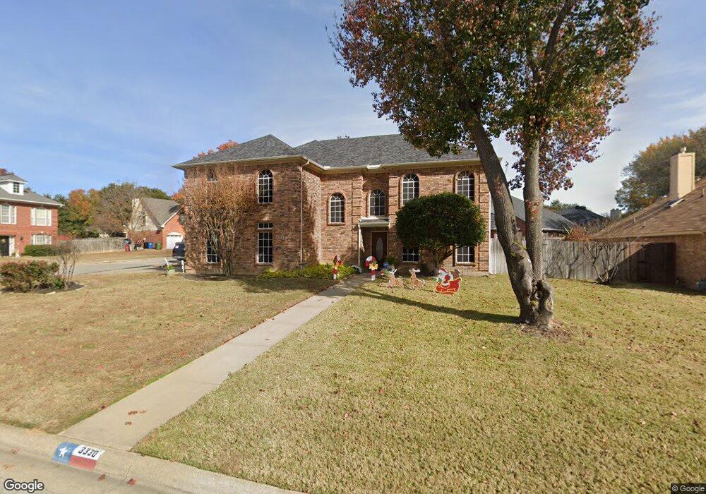
3330 Burninglog Dr Grapevine, TX 76051
Estimated Value: $626,417 - $689,000
4
Beds
2
Baths
3,058
Sq Ft
$213/Sq Ft
Est. Value
About This Home
This home is located at 3330 Burninglog Dr, Grapevine, TX 76051 and is currently estimated at $651,354, approximately $213 per square foot. 3330 Burninglog Dr is a home located in Tarrant County with nearby schools including O.C. Taylor Elementary School, Colleyville Middle School, and Holy Trinity Catholic School.
Ownership History
Date
Name
Owned For
Owner Type
Purchase Details
Closed on
Jan 11, 2006
Sold by
Taylor Steve E and Taylor Sharon L
Bought by
Hilburn Stacy M
Current Estimated Value
Home Financials for this Owner
Home Financials are based on the most recent Mortgage that was taken out on this home.
Original Mortgage
$190,400
Outstanding Balance
$106,892
Interest Rate
6.25%
Mortgage Type
Fannie Mae Freddie Mac
Estimated Equity
$544,462
Create a Home Valuation Report for This Property
The Home Valuation Report is an in-depth analysis detailing your home's value as well as a comparison with similar homes in the area
Home Values in the Area
Average Home Value in this Area
Purchase History
| Date | Buyer | Sale Price | Title Company |
|---|---|---|---|
| Hilburn Stacy M | -- | Natc |
Source: Public Records
Mortgage History
| Date | Status | Borrower | Loan Amount |
|---|---|---|---|
| Open | Hilburn Stacy M | $190,400 |
Source: Public Records
Tax History
| Year | Tax Paid | Tax Assessment Tax Assessment Total Assessment is a certain percentage of the fair market value that is determined by local assessors to be the total taxable value of land and additions on the property. | Land | Improvement |
|---|---|---|---|---|
| 2025 | $2,196 | $625,192 | $98,600 | $526,592 |
| 2024 | $2,196 | $625,192 | $98,600 | $526,592 |
| 2023 | $8,220 | $596,695 | $98,600 | $498,095 |
| 2022 | $8,831 | $473,760 | $98,600 | $375,160 |
| 2021 | $8,811 | $405,232 | $80,000 | $325,232 |
| 2020 | $8,860 | $402,798 | $80,000 | $322,798 |
| 2019 | $9,242 | $405,281 | $80,000 | $325,281 |
| 2018 | $2,227 | $374,677 | $65,000 | $309,677 |
| 2017 | $7,877 | $363,592 | $65,000 | $298,592 |
| 2016 | $7,161 | $355,591 | $65,000 | $290,591 |
| 2015 | $6,072 | $281,500 | $28,000 | $253,500 |
| 2014 | $6,072 | $281,500 | $28,000 | $253,500 |
Source: Public Records
Map
Nearby Homes
- 3229 Birch Ave
- 4150 Cedar Dr
- 3446 Spring Willow Dr
- 3104 Birch Ave
- 3218 Mapleridge Dr
- 3712 Bur Oak Dr
- 3403 Crossgate Cir S
- 3920 Kelsey Ct
- 5064 Copperglen Cir
- 3904 Wagon Wheel Dr
- 2404 Arbor Gate Ln
- 5809 N Ballantrae Dr
- 4019 Whitby Ln
- 4300 Eaton Cir
- 3509 Hightimber Dr
- 3502 Fieldwood St
- 4420 Lafite Ln
- 3216 Glade Rd
- 5508 Montclair Dr
- 2517 San Jacinto Dr
- 3326 Burninglog Dr
- 3321 Clearfield Dr
- 3330 Clearfield Dr
- 3322 Burninglog Dr
- 3341 Burninglog Dr
- 3317 Clearfield Dr
- 3337 Burninglog Dr
- 3345 Burninglog Dr
- 3326 Clearfield Dr
- 3318 Burninglog Dr
- 3322 Clearfield Dr
- 3333 Burninglog Dr
- 3313 Clearfield Dr
- 3341 Shadow Ridge
- 3318 Clearfield Dr
- 3337 Shadow Ridge
- 3353 Burninglog Dr
- 3314 Burninglog Dr
- 3333 Shadow Ridge
- 3325 Burninglog Dr
Your Personal Tour Guide
Ask me questions while you tour the home.