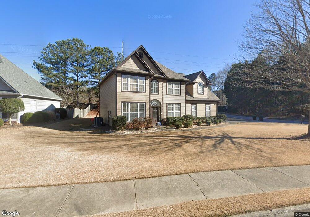
3332 Blaisdell Rd Unit 2 Buford, GA 30519
Estimated Value: $463,000 - $495,000
4
Beds
3
Baths
2,696
Sq Ft
$176/Sq Ft
Est. Value
About This Home
This home is located at 3332 Blaisdell Rd Unit 2, Buford, GA 30519 and is currently estimated at $474,847, approximately $176 per square foot. 3332 Blaisdell Rd Unit 2 is a home located in Gwinnett County with nearby schools including Harmony Elementary School and Glenn C. Jones Middle School.
Ownership History
Date
Name
Owned For
Owner Type
Purchase Details
Closed on
Nov 5, 2004
Sold by
Gant Marcie L
Bought by
Gant Christopher A and Gant Marcie
Current Estimated Value
Home Financials for this Owner
Home Financials are based on the most recent Mortgage that was taken out on this home.
Original Mortgage
$157,600
Outstanding Balance
$81,288
Interest Rate
6.5%
Mortgage Type
New Conventional
Estimated Equity
$393,559
Create a Home Valuation Report for This Property
The Home Valuation Report is an in-depth analysis detailing your home's value as well as a comparison with similar homes in the area
Home Values in the Area
Average Home Value in this Area
Purchase History
| Date | Buyer | Sale Price | Title Company |
|---|---|---|---|
| Gant Christopher A | $197,000 | -- | |
| Gant Marcie L | $197,000 | -- |
Source: Public Records
Mortgage History
| Date | Status | Borrower | Loan Amount |
|---|---|---|---|
| Open | Gant Marcie L | $157,600 |
Source: Public Records
Tax History
| Year | Tax Paid | Tax Assessment Tax Assessment Total Assessment is a certain percentage of the fair market value that is determined by local assessors to be the total taxable value of land and additions on the property. | Land | Improvement |
|---|---|---|---|---|
| 2025 | $5,283 | $192,360 | $40,000 | $152,360 |
| 2024 | $5,321 | $185,320 | $34,000 | $151,320 |
| 2023 | $5,321 | $185,320 | $34,000 | $151,320 |
| 2022 | $4,692 | $156,400 | $29,200 | $127,200 |
| 2021 | $3,940 | $117,280 | $22,800 | $94,480 |
| 2020 | $3,966 | $117,280 | $22,800 | $94,480 |
| 2019 | $3,850 | $117,280 | $22,800 | $94,480 |
| 2018 | $3,661 | $108,320 | $20,000 | $88,320 |
| 2016 | $3,381 | $94,480 | $18,000 | $76,480 |
| 2015 | $3,226 | $86,800 | $16,000 | $70,800 |
| 2014 | $3,238 | $86,800 | $16,000 | $70,800 |
Source: Public Records
Map
Nearby Homes
- 3510 Rivers End Place
- 3606 Andover Way
- 3075 Andover Trail
- 3555 Rivers End Place Unit I
- 4001 Sovereign Dr
- 3680 Ridge Rd
- 4165 Bradford Walk Trail
- 3125 Bart Johnson Rd
- Sumner Plan at Oakmead
- Essex Plan at Oakmead
- Ingram Plan at Oakmead
- Trenton Plan at Oakmead
- 4024 Dantry Ln
- 3311 Burkston Place
- 4034 Dantry Ln
- 3391 Burkston Place
- 3721 Bogan Mill Rd
- 2335 Morgan Place Dr
- 3236 Copper Creek Ln NE
- 3421 Lindenridge Dr
- 3919 Bessemer Dr Unit 2
- 3929 Bessemer Dr
- 3914 Bessemer Dr Unit 2
- 3914 Bessemer Dr
- 3321 Blaisdell Rd
- 3352 Blaisdell Rd Unit 2
- 3311 Blaisdell Rd
- 3934 Bessemer Dr Unit 28
- 3934 Bessemer Dr Unit 2
- 3934 Bessemer Dr
- 3305 Blaisdell Rd
- 3351 Blaisdell Rd
- 3301 Blaisdell Rd Unit 2
- 3362 Blaisdell Rd Unit 2
- 3361 Blaisdell Rd Unit 15
- 3361 Blaisdell Rd Unit 2
- 3944 Bessemer Dr Unit 2
- 3317 Hinsdale Ln Unit 2
- 3949 Bessemer Dr
- 3949 Bessemer Dr