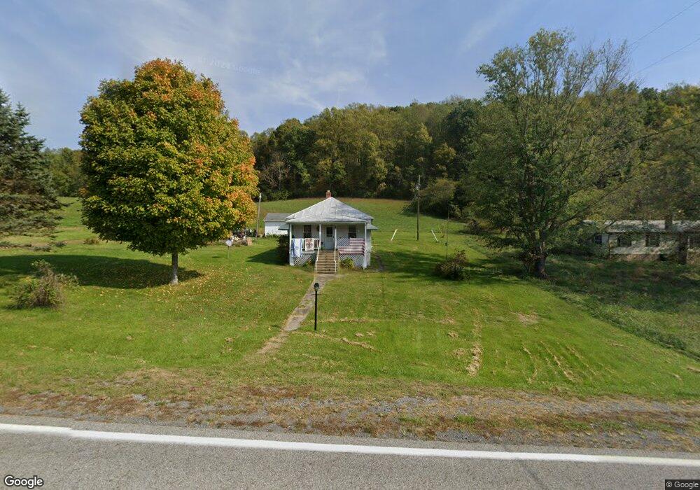
3332 Cowpasture River Hwy Millboro, VA 24460
Estimated Value: $159,465 - $172,000
3
Beds
1
Bath
888
Sq Ft
$190/Sq Ft
Est. Value
About This Home
This home is located at 3332 Cowpasture River Hwy, Millboro, VA 24460 and is currently estimated at $168,616, approximately $189 per square foot. 3332 Cowpasture River Hwy is a home located in Bath County with nearby schools including Bath County High School.
Ownership History
Date
Name
Owned For
Owner Type
Purchase Details
Closed on
Nov 18, 2014
Sold by
Mccoy Durham Sr Alvin T and Mccoy Durham Mary
Bought by
Campbell Michael J and Campbell Helen Kerri Lynn
Current Estimated Value
Home Financials for this Owner
Home Financials are based on the most recent Mortgage that was taken out on this home.
Original Mortgage
$65,600
Outstanding Balance
$50,122
Interest Rate
3.93%
Mortgage Type
New Conventional
Estimated Equity
$118,494
Create a Home Valuation Report for This Property
The Home Valuation Report is an in-depth analysis detailing your home's value as well as a comparison with similar homes in the area
Home Values in the Area
Average Home Value in this Area
Purchase History
| Date | Buyer | Sale Price | Title Company |
|---|---|---|---|
| Campbell Michael J | $90,600 | First Amer Title Ins Co |
Source: Public Records
Mortgage History
| Date | Status | Borrower | Loan Amount |
|---|---|---|---|
| Open | Campbell Michael J | $65,600 |
Source: Public Records
Tax History Compared to Growth
Tax History
| Year | Tax Paid | Tax Assessment Tax Assessment Total Assessment is a certain percentage of the fair market value that is determined by local assessors to be the total taxable value of land and additions on the property. | Land | Improvement |
|---|---|---|---|---|
| 2024 | $589 | $98,200 | $50,600 | $47,600 |
| 2023 | $589 | $98,200 | $50,600 | $47,600 |
| 2022 | $540 | $98,200 | $50,600 | $47,600 |
| 2021 | $487 | $88,500 | $44,200 | $44,300 |
| 2020 | $487 | $88,500 | $44,200 | $44,300 |
| 2019 | $443 | $88,500 | $44,200 | $44,300 |
| 2018 | $443 | $88,500 | $44,200 | $44,300 |
| 2017 | $443 | $88,500 | $44,200 | $44,300 |
| 2016 | -- | $90,600 | $41,700 | $48,900 |
| 2015 | -- | $0 | $0 | $0 |
| 2014 | -- | $0 | $0 | $0 |
| 2012 | -- | $0 | $0 | $0 |
Source: Public Records
Map
Nearby Homes
- 0 Overlook Way Unit 139064
- 0 Overlook Way Unit 914488
- 4801 Nicelytown Rd
- 277 Coffee Pot Rd
- 000 Bennington Ln
- 15 Delafield Rd
- 3114 Longdale Furnace Rd
- DR #55 N Forest Trail
- DR Lot #60 N Forest Trail
- DR #50 N Forest Trail
- 398 Crooked Spur Rd
- 1068 Sheep Meadow Rd
- 3909 Longdale Furnace Rd
- SMLot # 43 Falconry Ridge
- 0 Charlie Bird Dr
- 21 Shepherd's Trail
- SM# 19 Shepherd's Trail
- 0 Spring Hill Rd
- 2835 Airport Rd
- 6026 Sam Snead Hwy
- 3302 Cowpasture River Hwy
- 3407 Cowpasture River Hwy
- 134 Sitlington Dr
- 285 Sitlington Dr
- 3468 Cowpasture River Hwy
- 3514 Cowpasture River Hwy
- 311 Sitlington Dr
- 3571 Cowpasture River Hwy
- 3678 Cowpasture River Hwy
- 3970 Cowpasture River Hwy
- 2948 Cowpasture River Hwy
- 78 Lynchburg Camp Rd
- 37 Lynchburg Camp Rd
- 2908 Cowpasture River Hwy
- 2796 Cowpasture River Hwy
- 2741 Cowpasture River Hwy
- 2707 Cowpasture River Hwy
- 2667 Cowpasture River Hwy
- 2610 Cowpasture River Hwy
- 2297 Cowpasture River Hwy