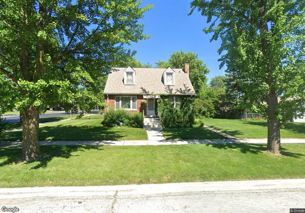
3335 Bernice Rd Lansing, IL 60438
Estimated Value: $150,000 - $233,000
2
Beds
2
Baths
787
Sq Ft
$224/Sq Ft
Est. Value
About This Home
This home is located at 3335 Bernice Rd, Lansing, IL 60438 and is currently estimated at $176,545, approximately $224 per square foot. 3335 Bernice Rd is a home located in Cook County with nearby schools including Reavis Elementary School, Memorial Jr High School, and Thornton Fractnl So High School.
Ownership History
Date
Name
Owned For
Owner Type
Purchase Details
Closed on
Aug 8, 2005
Sold by
Hopp Delphine V
Bought by
Richardson Tennille
Current Estimated Value
Home Financials for this Owner
Home Financials are based on the most recent Mortgage that was taken out on this home.
Original Mortgage
$92,000
Outstanding Balance
$76,873
Interest Rate
8.25%
Mortgage Type
Fannie Mae Freddie Mac
Estimated Equity
$99,672
Purchase Details
Closed on
Jun 30, 2003
Sold by
Hopp Delphine V
Bought by
Hopp Delphine V and Delphine V Hopp Land Trust
Create a Home Valuation Report for This Property
The Home Valuation Report is an in-depth analysis detailing your home's value as well as a comparison with similar homes in the area
Home Values in the Area
Average Home Value in this Area
Purchase History
| Date | Buyer | Sale Price | Title Company |
|---|---|---|---|
| Richardson Tennille | $115,000 | Pntn | |
| Hopp Delphine V | -- | -- |
Source: Public Records
Mortgage History
| Date | Status | Borrower | Loan Amount |
|---|---|---|---|
| Open | Richardson Tennille | $92,000 |
Source: Public Records
Tax History Compared to Growth
Tax History
| Year | Tax Paid | Tax Assessment Tax Assessment Total Assessment is a certain percentage of the fair market value that is determined by local assessors to be the total taxable value of land and additions on the property. | Land | Improvement |
|---|---|---|---|---|
| 2024 | $3,718 | $11,000 | $2,520 | $8,480 |
| 2023 | $2,522 | $11,000 | $2,520 | $8,480 |
| 2022 | $2,522 | $7,301 | $2,205 | $5,096 |
| 2021 | $2,510 | $7,301 | $2,205 | $5,096 |
| 2020 | $2,463 | $7,301 | $2,205 | $5,096 |
| 2019 | $2,179 | $7,257 | $2,047 | $5,210 |
| 2018 | $2,135 | $7,257 | $2,047 | $5,210 |
| 2017 | $2,190 | $7,257 | $2,047 | $5,210 |
| 2016 | $2,719 | $7,470 | $1,890 | $5,580 |
| 2015 | $2,463 | $7,470 | $1,890 | $5,580 |
| 2014 | $2,456 | $7,470 | $1,890 | $5,580 |
| 2013 | $2,734 | $8,702 | $1,890 | $6,812 |
Source: Public Records
Map
Nearby Homes
- 17335 Community St
- 17331 Community St
- 3409 173rd Place
- 17303 Roy St
- 17519 Community St
- 17518 Roy St
- 17318 Walter St
- 17226 Community St
- 17256 Walter St
- 17552 Roy St
- 17603 Community St
- 17614 Community St
- 3540 Bernice Rd
- 17246 Bernadine St
- 17153 Walter St
- 17128 Grant St
- 17204 Bernadine St
- 17244 Wentworth Ave
- 17132 Walter St
- 17641 Burnham Ave
- 3339 Bernice Rd
- 3347 Bernice Rd
- 17419 Community St
- 17419 Community St
- 3323 Bernice Rd
- 17423 Community St
- 3353 Bernice Rd
- 3317 Bernice Rd
- 3317 Bernice Rd
- 17416 Community St
- 3338 Bernice Rd
- 3338 Bernice Rd
- 3338 Bernice Rd
- 17418 Henry St
- 17418 Henry St
- 17427 Community St
- 3357 Bernice Rd
- 3313 Bernice Rd
- 17422 Community St
- 17422 Henry St