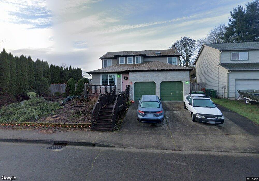
33358 Meadowbrook Dr Scappoose, OR 97056
Estimated Value: $469,336 - $522,000
4
Beds
3
Baths
1,761
Sq Ft
$282/Sq Ft
Est. Value
About This Home
This home is located at 33358 Meadowbrook Dr, Scappoose, OR 97056 and is currently estimated at $496,834, approximately $282 per square foot. 33358 Meadowbrook Dr is a home located in Columbia County with nearby schools including Scappoose High School and Scappoose Adventist School.
Ownership History
Date
Name
Owned For
Owner Type
Purchase Details
Closed on
Feb 20, 2025
Sold by
Gordon Keith T and Gordon Thea K
Bought by
Keith Gordon And Thea Gordon Revocable Living and Gordon
Current Estimated Value
Purchase Details
Closed on
Sep 25, 1996
Bought by
Gordon Keith T and Gordon Thea K
Create a Home Valuation Report for This Property
The Home Valuation Report is an in-depth analysis detailing your home's value as well as a comparison with similar homes in the area
Home Values in the Area
Average Home Value in this Area
Purchase History
| Date | Buyer | Sale Price | Title Company |
|---|---|---|---|
| Keith Gordon And Thea Gordon Revocable Living | -- | None Listed On Document | |
| Gordon Keith T | $140,000 | -- |
Source: Public Records
Tax History Compared to Growth
Tax History
| Year | Tax Paid | Tax Assessment Tax Assessment Total Assessment is a certain percentage of the fair market value that is determined by local assessors to be the total taxable value of land and additions on the property. | Land | Improvement |
|---|---|---|---|---|
| 2025 | $4,147 | $251,880 | $90,310 | $161,570 |
| 2024 | $4,032 | $244,550 | $87,680 | $156,870 |
| 2023 | $3,995 | $237,430 | $88,390 | $149,040 |
| 2022 | $3,826 | $230,520 | $85,260 | $145,260 |
| 2021 | $3,717 | $223,810 | $89,230 | $134,580 |
| 2020 | $3,447 | $217,300 | $85,930 | $131,370 |
| 2019 | $3,357 | $210,980 | $83,428 | $127,552 |
| 2018 | $3,281 | $204,840 | $88,660 | $116,180 |
| 2017 | $3,222 | $198,880 | $86,080 | $112,800 |
| 2016 | $3,181 | $193,090 | $83,580 | $109,510 |
| 2015 | $3,020 | $187,470 | $67,860 | $119,610 |
| 2014 | $2,944 | $182,010 | $63,790 | $118,220 |
Source: Public Records
Map
Nearby Homes
- 33410 Meadowbrook Dr
- 33298 SW Meadowbrook Dr
- 33279 SW Havlik Dr
- 51350 SW Randstad St
- 51692 SE 3rd St
- 51096 SW Klompen St
- 51096 SW Klompen St Unit H138
- 51557 SW Em Watts Rd
- 33340 SW Rokin Way
- 51086 SW Klompen St
- 51082 SW Klompen St
- 33366 SW Rokin Way
- 33362 SW Rokin Way
- 51925 Columbia River Hwy
- 51459 SE Westlake Dr Unit 102
- 33370 SW Rokin Way
- 51540 SE Westlake Dr Unit 56
- 33374 SW Rokin Way
- 33358 SW Rokin Way
- 33344 SW Rokin Way
- 33368 Meadowbrook Dr
- 33346 Meadowbrook Dr
- 33336 SW Meadowbrook Dr
- 33378 Meadowbrook Dr
- 33336 Meadowbrook Dr
- 33355 Meadowbrook Dr
- 51571 SW South Fork Loop
- 33345 Meadowbrook Dr
- 33363 Meadowbrook Dr
- 33326 Meadowbrook Dr
- 33337 Meadowbrook Dr
- 51573 SW South Fork Loop
- 33373 Meadowbrook Dr
- 33341 SW Havlik Dr
- 33388 Meadowbrook Dr
- 33333 SW Havlik Dr
- 51575 SW South Fork Loop
- 51572 SW South Fork Loop
- 33325 Meadowbrook Dr
- 33325 SW Meadowbrook Dr