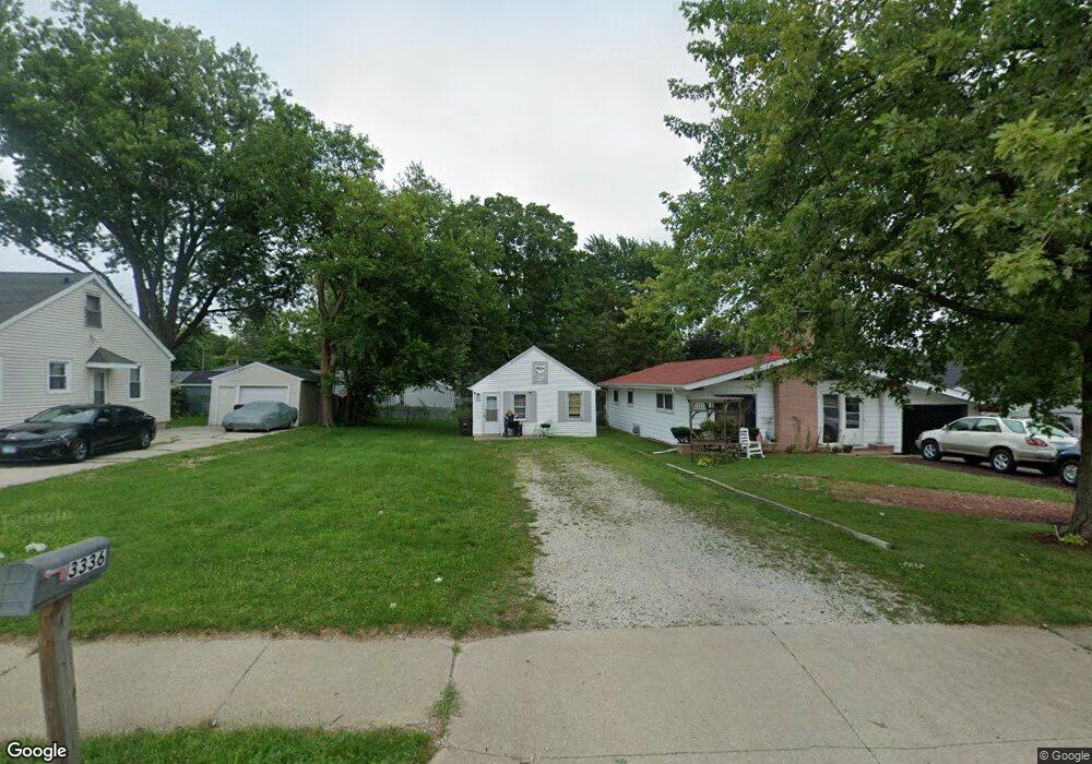
3336 N Sterling Ave Unit 1 Peoria, IL 61604
El Vista NeighborhoodEstimated Value: $35,000
1
Bed
2
Baths
440
Sq Ft
$80/Sq Ft
Est. Value
About This Home
This home is located at 3336 N Sterling Ave Unit 1, Peoria, IL 61604 and is currently priced at $35,000, approximately $79 per square foot. 3336 N Sterling Ave Unit 1 is a home located in Peoria County with nearby schools including Dr Maude A Sanders Primary School, Sterling Middle School, and Peoria High School.
Ownership History
Date
Name
Owned For
Owner Type
Purchase Details
Closed on
Aug 5, 2025
Sold by
Lambert Christopher O and Lambert Amy J
Bought by
Dinkha Helen
Current Estimated Value
Home Financials for this Owner
Home Financials are based on the most recent Mortgage that was taken out on this home.
Original Mortgage
$29,450
Outstanding Balance
$29,425
Interest Rate
6.81%
Mortgage Type
New Conventional
Purchase Details
Closed on
Oct 30, 2006
Bought by
Lambert Christopher O and Lambert Amy J
Create a Home Valuation Report for This Property
The Home Valuation Report is an in-depth analysis detailing your home's value as well as a comparison with similar homes in the area
Home Values in the Area
Average Home Value in this Area
Purchase History
| Date | Buyer | Sale Price | Title Company |
|---|---|---|---|
| Dinkha Helen | $31,000 | None Listed On Document | |
| Lambert Christopher O | $30,000 | -- |
Source: Public Records
Mortgage History
| Date | Status | Borrower | Loan Amount |
|---|---|---|---|
| Open | Dinkha Helen | $29,450 |
Source: Public Records
Tax History Compared to Growth
Tax History
| Year | Tax Paid | Tax Assessment Tax Assessment Total Assessment is a certain percentage of the fair market value that is determined by local assessors to be the total taxable value of land and additions on the property. | Land | Improvement |
|---|---|---|---|---|
| 2024 | $805 | $8,900 | $3,620 | $5,280 |
| 2023 | $768 | $8,160 | $3,320 | $4,840 |
| 2022 | $740 | $7,670 | $3,170 | $4,500 |
| 2021 | $727 | $7,310 | $3,020 | $4,290 |
| 2020 | $725 | $7,240 | $2,990 | $4,250 |
| 2019 | $736 | $7,390 | $3,050 | $4,340 |
| 2018 | $736 | $7,560 | $3,080 | $4,480 |
| 2017 | $737 | $7,640 | $3,110 | $4,530 |
| 2016 | $716 | $7,640 | $3,110 | $4,530 |
| 2015 | $752 | $7,490 | $3,050 | $4,440 |
| 2014 | $752 | $8,170 | $2,890 | $5,280 |
| 2013 | -- | $8,270 | $2,930 | $5,340 |
Source: Public Records
Map
Nearby Homes
- 3423 N El Vista Ave
- 2221 W Tripp Ave
- 2318 W Albany Ave
- 2315 W Hudson St
- 3623 N Sterling Ave Unit b-17
- 2036 W Richwoods Blvd
- 2011 W Richwoods Blvd
- 2029 W Forrest Hill Ave
- 2705 W Millbrook Ct
- 3720 N Saint Michael Ave
- 3114 N Elmcroft Terrace
- 2214 W Bainter Ln
- 2909 N Mission Rd
- 3808 N Walround Ln
- 4011 N Sterling Ave
- 3010 W Brookside Dr
- 2214 W Arrowhead Ln
- 2703 N Golf Dr
- 2910 W Westport Rd
- 2822 N Easton Place
- 3340 N Sterling Ave
- 3334 N Sterling Ave
- 2416 W Richwoods Blvd
- 3330 N Sterling Ave
- 3333 N Stanley St
- 3339 N Stanley St
- 3326 N Sterling Ave
- 3341 N Stanley St
- 0 Richwoods Blvd Unit 6390315-9480275
- 0 Richwoods Blvd Unit 6390315-11605145
- 3325 N Stanley St
- 3324 N Sterling Ave
- 2417 W Richwoods Blvd
- 3323 N Stanley St
- 3320 N Sterling Ave
- 3408 N Sterling Ave
- 3319 N Stanley St
- 3316 N Sterling Ave
- 3326 N Stanley St
- 3338 N Stanley St