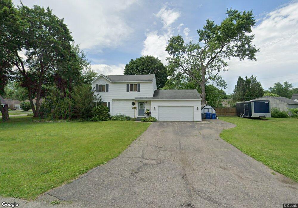
3337 Warringham Ave Waterford, MI 48329
Waterford Township NeighborhoodEstimated Value: $266,000 - $304,000
3
Beds
2
Baths
1,392
Sq Ft
$205/Sq Ft
Est. Value
About This Home
This home is located at 3337 Warringham Ave, Waterford, MI 48329 and is currently estimated at $284,679, approximately $204 per square foot. 3337 Warringham Ave is a home located in Oakland County with nearby schools including Schoolcraft Elementary School, Waterford Kettering High School, and Mason Middle School.
Ownership History
Date
Name
Owned For
Owner Type
Purchase Details
Closed on
Jul 23, 1996
Sold by
Dennis H Mladenoff Bldr
Bought by
Miles Wendy L
Current Estimated Value
Home Financials for this Owner
Home Financials are based on the most recent Mortgage that was taken out on this home.
Original Mortgage
$87,500
Outstanding Balance
$6,456
Interest Rate
8.47%
Estimated Equity
$278,223
Purchase Details
Closed on
Jan 31, 1996
Sold by
Coulter Terry
Bought by
Dennis H Mladenoff Bldr Inc
Purchase Details
Closed on
Jul 12, 1995
Sold by
Fahr Steven
Bought by
Coulter Terry
Create a Home Valuation Report for This Property
The Home Valuation Report is an in-depth analysis detailing your home's value as well as a comparison with similar homes in the area
Home Values in the Area
Average Home Value in this Area
Purchase History
| Date | Buyer | Sale Price | Title Company |
|---|---|---|---|
| Miles Wendy L | $117,500 | -- | |
| Dennis H Mladenoff Bldr Inc | $22,900 | -- | |
| Coulter Terry | $55,000 | -- |
Source: Public Records
Mortgage History
| Date | Status | Borrower | Loan Amount |
|---|---|---|---|
| Open | Miles Wendy L | $87,500 |
Source: Public Records
Tax History Compared to Growth
Tax History
| Year | Tax Paid | Tax Assessment Tax Assessment Total Assessment is a certain percentage of the fair market value that is determined by local assessors to be the total taxable value of land and additions on the property. | Land | Improvement |
|---|---|---|---|---|
| 2024 | $1,451 | $137,160 | $0 | $0 |
| 2023 | $1,384 | $124,180 | $0 | $0 |
| 2022 | $2,250 | $107,950 | $0 | $0 |
| 2021 | $2,129 | $100,430 | $0 | $0 |
| 2020 | $1,267 | $94,410 | $0 | $0 |
| 2019 | $2,081 | $88,100 | $0 | $0 |
| 2018 | $2,065 | $70,270 | $0 | $0 |
| 2017 | $1,901 | $70,270 | $0 | $0 |
| 2016 | $1,897 | $68,160 | $0 | $0 |
| 2015 | -- | $57,910 | $0 | $0 |
| 2014 | -- | $54,700 | $0 | $0 |
| 2011 | -- | $51,380 | $0 | $0 |
Source: Public Records
Map
Nearby Homes
- 6376 Lanman Dr
- 6426 Williams Lake Rd
- 6275 Williams Lake Rd
- 6215 Williams Lake Rd
- 6015 Rowley Blvd
- 6100 Williams Lake Rd
- 6625 Lanman Dr
- 3077 Nanwich Dr
- 5914 Pleasant Dr
- 2899 Airport Rd
- 6157 Barker Cir
- 6511 Crest Dr
- 6350 Elmwood Dr
- 6366 Dellwood Dr
- 3560 Dorothy Ln
- 2739 Moosewood Dr Unit 50
- 5502 Rowley Blvd
- 6031 Southward Ave
- 6354 Saline Dr
- 6175 Hatchery Rd
- 6342 Rowley Blvd
- 6335 Cleveland Dr
- 3368 Warringham Ave
- 6351 Cleveland Dr
- 3354 Warringham Ave
- 3325 Warringham Ave
- 6367 Cleveland Dr
- 6321 Cleveland Dr
- 3388 Warringham Ave
- 3324 Warringham Ave
- 6347 Rowley Blvd
- 6270 Rowley Blvd Unit Bldg-Unit
- 6270 Rowley Blvd
- 3321 Warringham Ave
- 3320 Warringham Ave
- 6377 Cleveland Dr
- 6255 Jameson Dr
- 6359 Rowley Blvd
- 6359 Rowley Dr
- 6348 Cleveland Dr