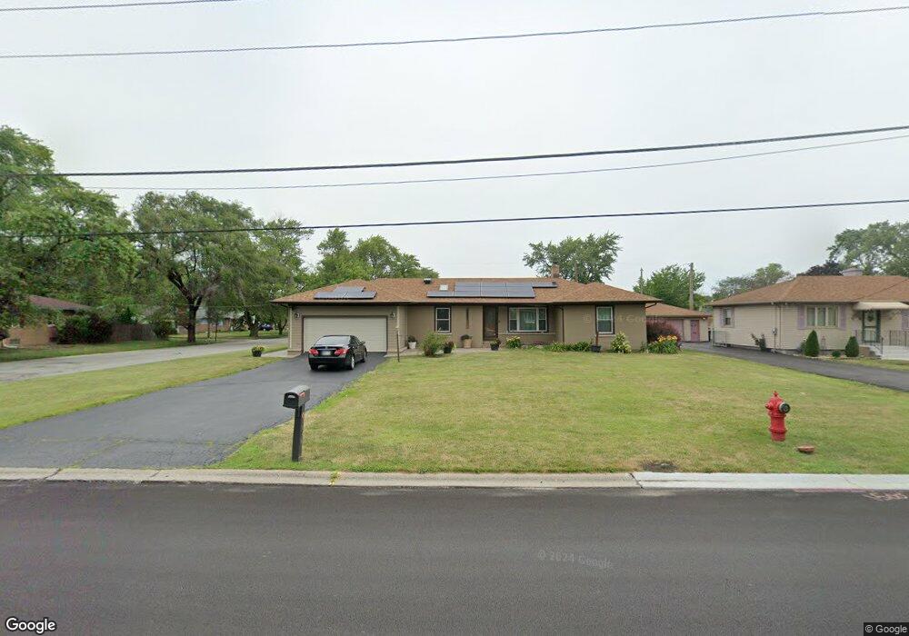
3338 Bernice Rd Lansing, IL 60438
Estimated Value: $181,000 - $226,000
3
Beds
2
Baths
1,500
Sq Ft
$135/Sq Ft
Est. Value
About This Home
This home is located at 3338 Bernice Rd, Lansing, IL 60438 and is currently estimated at $202,363, approximately $134 per square foot. 3338 Bernice Rd is a home located in Cook County with nearby schools including Reavis Elementary School, Memorial Jr High School, and Thornton Fractnl So High School.
Ownership History
Date
Name
Owned For
Owner Type
Purchase Details
Closed on
Jun 4, 2017
Sold by
First York Llc
Bought by
Pierce Michael A
Current Estimated Value
Home Financials for this Owner
Home Financials are based on the most recent Mortgage that was taken out on this home.
Original Mortgage
$66,600
Outstanding Balance
$55,397
Interest Rate
4.02%
Mortgage Type
New Conventional
Estimated Equity
$146,966
Purchase Details
Closed on
Jan 26, 2015
Sold by
Kingdom First Properties Llc
Bought by
First York Llc
Purchase Details
Closed on
Nov 5, 2014
Sold by
Wells Fargo Bank Na
Bought by
Kingdom First Properties Llc
Purchase Details
Closed on
Dec 20, 2013
Sold by
Taylor Charles and Taylor Etta
Bought by
Wells Fargo Bank Na
Create a Home Valuation Report for This Property
The Home Valuation Report is an in-depth analysis detailing your home's value as well as a comparison with similar homes in the area
Home Values in the Area
Average Home Value in this Area
Purchase History
| Date | Buyer | Sale Price | Title Company |
|---|---|---|---|
| Pierce Michael A | $74,000 | Attorney | |
| First York Llc | -- | None Available | |
| Kingdom First Properties Llc | $22,450 | None Available | |
| Wells Fargo Bank Na | -- | None Available |
Source: Public Records
Mortgage History
| Date | Status | Borrower | Loan Amount |
|---|---|---|---|
| Open | Pierce Michael A | $66,600 |
Source: Public Records
Tax History Compared to Growth
Tax History
| Year | Tax Paid | Tax Assessment Tax Assessment Total Assessment is a certain percentage of the fair market value that is determined by local assessors to be the total taxable value of land and additions on the property. | Land | Improvement |
|---|---|---|---|---|
| 2024 | $2,552 | $5,275 | $1,250 | $4,025 |
| 2023 | $2,567 | $5,275 | $1,250 | $4,025 |
| 2022 | $2,567 | $3,950 | $1,094 | $2,856 |
| 2021 | $2,496 | $3,949 | $1,093 | $2,856 |
| 2020 | $2,317 | $3,949 | $1,093 | $2,856 |
| 2019 | $2,970 | $5,216 | $1,015 | $4,201 |
| 2018 | $2,915 | $5,216 | $1,015 | $4,201 |
| 2017 | $2,943 | $5,216 | $1,015 | $4,201 |
| 2016 | $2,129 | $3,893 | $937 | $2,956 |
| 2015 | $1,978 | $3,893 | $937 | $2,956 |
| 2014 | $1,951 | $3,893 | $937 | $2,956 |
| 2013 | $2,036 | $4,522 | $937 | $3,585 |
Source: Public Records
Map
Nearby Homes
- 17335 Community St
- 17331 Community St
- 3409 173rd Place
- 17303 Roy St
- 17318 Walter St
- 17226 Community St
- 17519 Community St
- 17256 Walter St
- 17518 Roy St
- 17552 Roy St
- 3540 Bernice Rd
- 17246 Bernadine St
- 17153 Walter St
- 17603 Community St
- 17128 Grant St
- 17614 Community St
- 17204 Bernadine St
- 17244 Wentworth Ave
- 17132 Walter St
- 17611 Bernadine St
- 3338 Bernice Rd
- 3338 Bernice Rd
- 17335 Community St Unit y St
- 3324 Bernice Rd
- 3352 Bernice Rd
- 17334 Community St
- 3316 Bernice Rd
- 3316 Bernice Rd
- 3358 Bernice Rd
- 3335 Bernice Rd
- 17327 Community St
- 17330 Community St
- 17334 Henry St
- 3339 Bernice Rd
- 3347 Bernice Rd
- 3323 Bernice Rd
- 17330 Henry St
- 17326 Community St
- 17323 Community St
- 3317 Bernice Rd