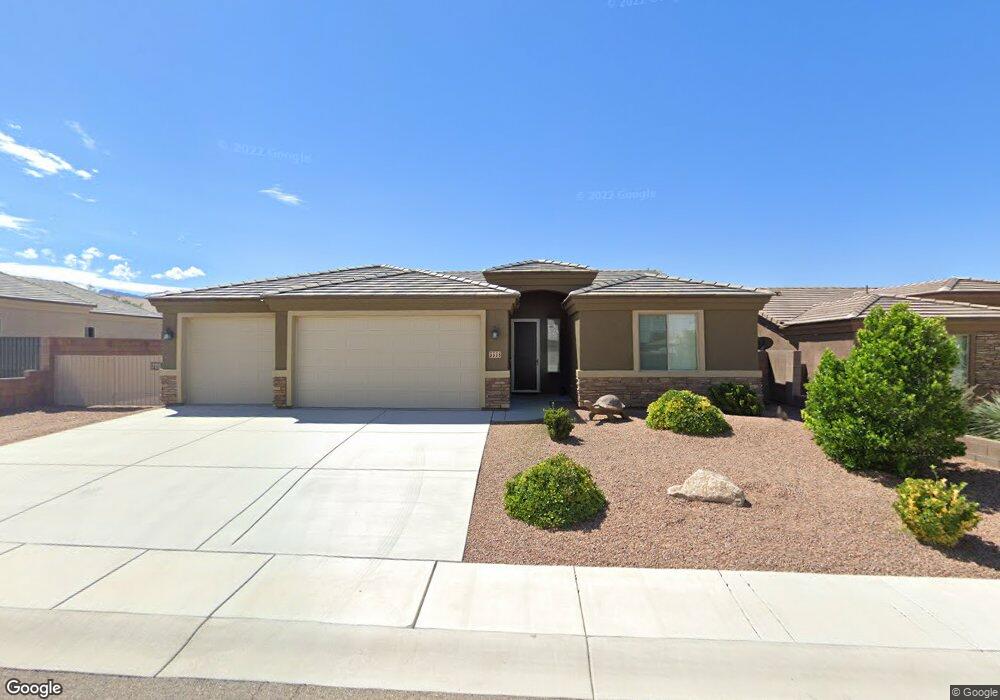
3338 Motherlode Rd Kingman, AR 86401
Estimated Value: $375,279 - $432,000
Studio
2
Baths
1,730
Sq Ft
$231/Sq Ft
Est. Value
About This Home
This home is located at 3338 Motherlode Rd, Kingman, AR 86401 and is currently estimated at $400,070, approximately $231 per square foot. 3338 Motherlode Rd is a home located in Mohave County with nearby schools including Hualapai Elementary School, White Cliffs Middle School, and Lee Williams High School.
Ownership History
Date
Name
Owned For
Owner Type
Purchase Details
Closed on
Sep 17, 2025
Sold by
Sargent Family Trust and Sargent Ralph L
Bought by
Delisle Thomas James and Delisle Luz
Current Estimated Value
Home Financials for this Owner
Home Financials are based on the most recent Mortgage that was taken out on this home.
Original Mortgage
$125,000
Outstanding Balance
$124,888
Interest Rate
6.56%
Mortgage Type
New Conventional
Estimated Equity
$275,182
Purchase Details
Closed on
Sep 30, 2021
Sold by
Turner Michael S and Turner Karen L
Bought by
Sargent Ralph L and Sargent Irene L
Home Financials for this Owner
Home Financials are based on the most recent Mortgage that was taken out on this home.
Original Mortgage
$279,920
Interest Rate
2.8%
Mortgage Type
New Conventional
Purchase Details
Closed on
May 15, 2016
Sold by
Angle Homes Inc
Bought by
Turner Michael S and Turner Karen L
Home Financials for this Owner
Home Financials are based on the most recent Mortgage that was taken out on this home.
Original Mortgage
$154,136
Interest Rate
3.71%
Mortgage Type
New Conventional
Purchase Details
Closed on
Dec 17, 2014
Sold by
Hualapai Shadows Llc
Bought by
Angle Homes Inc
Create a Home Valuation Report for This Property
The Home Valuation Report is an in-depth analysis detailing your home's value as well as a comparison with similar homes in the area
Home Values in the Area
Average Home Value in this Area
Purchase History
| Date | Buyer | Sale Price | Title Company |
|---|---|---|---|
| Delisle Thomas James | $394,300 | Chicago Title | |
| Delisle Thomas James | $394,300 | Chicago Title | |
| Sargent Ralph L | $349,900 | Chicago Title Agency Inc | |
| Sargent Ralph L | $349,900 | Chicago Title Agency Inc | |
| Turner Michael S | $192,670 | Pioneer Title Agency Inc | |
| Turner Michael S | $192,670 | Pioneer Title Agency Inc | |
| Angle Homes Inc | $234,000 | Pioneer Title Agency Inc | |
| Angle Homes Inc | $234,000 | Pioneer Title Agency Inc |
Source: Public Records
Mortgage History
| Date | Status | Borrower | Loan Amount |
|---|---|---|---|
| Open | Delisle Thomas James | $125,000 | |
| Previous Owner | Sargent Ralph L | $279,920 | |
| Previous Owner | Turner Michael S | $154,136 |
Source: Public Records
Tax History
| Year | Tax Paid | Tax Assessment Tax Assessment Total Assessment is a certain percentage of the fair market value that is determined by local assessors to be the total taxable value of land and additions on the property. | Land | Improvement |
|---|---|---|---|---|
| 2026 | $669 | -- | -- | -- |
| 2025 | $1,379 | $28,632 | $0 | $0 |
| 2024 | $1,379 | $28,649 | $0 | $0 |
| 2023 | $1,379 | $26,503 | $0 | $0 |
| 2022 | $1,563 | $22,238 | $0 | $0 |
| 2021 | $1,618 | $21,095 | $0 | $0 |
| 2019 | $1,478 | $17,658 | $0 | $0 |
| 2018 | $1,259 | $17,555 | $0 | $0 |
| 2017 | $1,142 | $17,042 | $0 | $0 |
| 2016 | $81 | $3,115 | $0 | $0 |
| 2015 | $164 | $2,981 | $0 | $0 |
Source: Public Records
Map
Nearby Homes
- 3379 Motherlode Rd
- 3369 Whitehead Ave
- 3335 Duvall Ave
- 3268 Brenda Ave
- 2144 Old Miners Rd
- 3290 Producers Mine Rd
- 3304 Producers Mine Rd
- 3316 Producers Mine Rd
- 3323 Karen Ave
- 3371 Karen Ave
- 2303 Indigo St
- 321-04-018E Hualapai Mountain Rd
- 2325 Wildflower St
- 2303 Ginger St
- 2199 Seneca St
- 071 Hualapai Mountain Rd
- 3021 Mallory Loop
- 3079 Brenda Cir
- 2080 Seneca St
- 000 Ranch Rd
- 3354 Motherlode Rd
- 3354 Motherlode Rd
- 3330 Motherlode Rd
- 3354 Motherload Rd
- 3341 Silver Hill Rd
- 3349 Silver Hill Rd
- 3329 Silver Hill Rd
- 3362 Motherlode Rd
- 3362 Motherload Rd
- 3322 Motherlode Rd
- 3322 Motherlode Rd
- 3339 Motherlode Rd
- 3339 Motherlode Rd
- 3339 Motherload Rd
- 3331 Motherload Rd
- 3319 Motherload Rd
- 3351 Motherlode Rd
- 3351 Motherlode Rd
- 3351 Motherlode Rd
- 3321 Silver Hill Rd
Your Personal Tour Guide
Ask me questions while you tour the home.