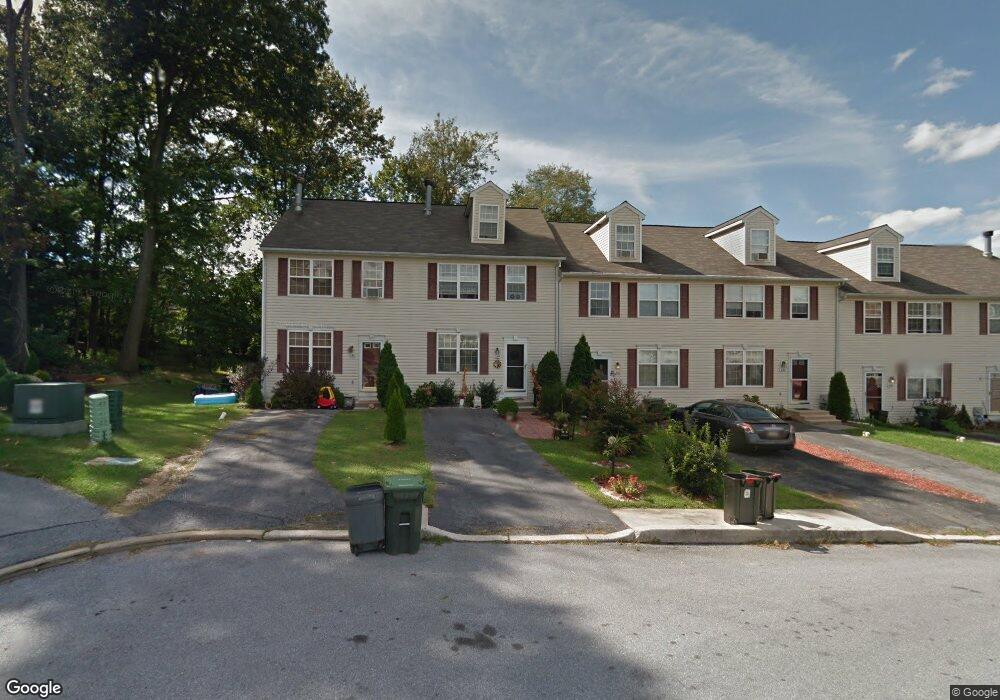
334 Andrew Cir Coatesville, PA 19320
Estimated Value: $308,000 - $334,073
2
Beds
3
Baths
2,016
Sq Ft
$161/Sq Ft
Est. Value
About This Home
This home is located at 334 Andrew Cir, Coatesville, PA 19320 and is currently estimated at $323,691, approximately $160 per square foot. 334 Andrew Cir is a home located in Chester County with nearby schools including Caln Elementary School, Coatesville Intermediate High School, and Coatesville Area Senior High School.
Ownership History
Date
Name
Owned For
Owner Type
Purchase Details
Closed on
Aug 27, 2021
Sold by
Mccann Darolyn K and Mccann Tierney N
Bought by
Pouncy Kim M and Pouncy Arthur
Current Estimated Value
Purchase Details
Closed on
Dec 16, 2015
Sold by
Pouncy Kim M and Pouncy Arthur
Bought by
Mccann Darolyn K and Mccann Tierney N
Purchase Details
Closed on
Sep 25, 2003
Sold by
Pouncy Kim M and Pouncy Arthur
Bought by
Pouncy Arthur and Pouncy Kim M
Home Financials for this Owner
Home Financials are based on the most recent Mortgage that was taken out on this home.
Original Mortgage
$130,500
Interest Rate
10.05%
Mortgage Type
Purchase Money Mortgage
Purchase Details
Closed on
Sep 6, 2001
Sold by
First Markland Corp
Bought by
Mccann Kim M
Home Financials for this Owner
Home Financials are based on the most recent Mortgage that was taken out on this home.
Original Mortgage
$95,832
Interest Rate
10.4%
Create a Home Valuation Report for This Property
The Home Valuation Report is an in-depth analysis detailing your home's value as well as a comparison with similar homes in the area
Home Values in the Area
Average Home Value in this Area
Purchase History
| Date | Buyer | Sale Price | Title Company |
|---|---|---|---|
| Pouncy Kim M | -- | None Available | |
| Mccann Darolyn K | -- | Attorney | |
| Pouncy Arthur | -- | -- | |
| Mccann Kim M | $119,790 | -- |
Source: Public Records
Mortgage History
| Date | Status | Borrower | Loan Amount |
|---|---|---|---|
| Previous Owner | Pouncy Arthur | $130,500 | |
| Previous Owner | Mccann Kim M | $95,832 |
Source: Public Records
Tax History Compared to Growth
Tax History
| Year | Tax Paid | Tax Assessment Tax Assessment Total Assessment is a certain percentage of the fair market value that is determined by local assessors to be the total taxable value of land and additions on the property. | Land | Improvement |
|---|---|---|---|---|
| 2025 | $6,192 | $119,130 | $15,580 | $103,550 |
| 2024 | $6,192 | $119,130 | $15,580 | $103,550 |
| 2023 | $6,063 | $119,130 | $15,580 | $103,550 |
| 2022 | $5,758 | $119,130 | $15,580 | $103,550 |
| 2021 | $5,577 | $119,130 | $15,580 | $103,550 |
| 2020 | $5,483 | $119,130 | $15,580 | $103,550 |
| 2019 | $5,382 | $119,130 | $15,580 | $103,550 |
| 2018 | $4,335 | $101,430 | $15,580 | $85,850 |
| 2017 | $4,188 | $101,430 | $15,580 | $85,850 |
| 2016 | $3,145 | $101,430 | $15,580 | $85,850 |
| 2015 | $3,145 | $101,430 | $15,580 | $85,850 |
| 2014 | $3,145 | $101,430 | $15,580 | $85,850 |
Source: Public Records
Map
Nearby Homes
- 214 Andrew Rd
- 284 Derby Dr
- 6 Vinebury Ln
- Sewickley Plan at Thorndale Woods - Singles
- Powell Plan at Thorndale Woods - Singles
- Saint Lawrence Plan at Thorndale Woods - Singles
- 150 Seltzer Ave
- 1263 E Diamond St
- 105 Bridle Path Ln
- 1050 Wayne Ave
- Cadence Plan at Thorndale Woods - Towns
- Aria Plan at Thorndale Woods - Towns
- Roxbury Grande Plan at Thorndale Woods - Towns
- Ballad Plan at Thorndale Woods - Towns
- 8 Widham Ln
- 2409 Widham Ln
- 2796 Shelburne Rd Unit 170W
- 826 Stirling St
- 3033 Honeymead Rd
- 824 Stirling St
- 336 336 S Andrew Cir
- 336 Andrew Cir
- 338 Andrew Cir
- 332 Andrew Cir
- 342 Andrew Cir
- 330 Andrew Cir
- 328 Andrew Cir
- 344 Andrew Rd
- 324 Andrew Cir
- 348 Andrew Cir
- 322 Andrew Cir
- 348 Andrew Rd
- 350 Andrew Cir
- 312 Andrew Cir
- 350 Andrew Rd
- 318 Andrew Cir
- 352 Andrew Cir
- 352 Andrew Rd
- 354 Andrew Cir
- 354 Andrew Rd