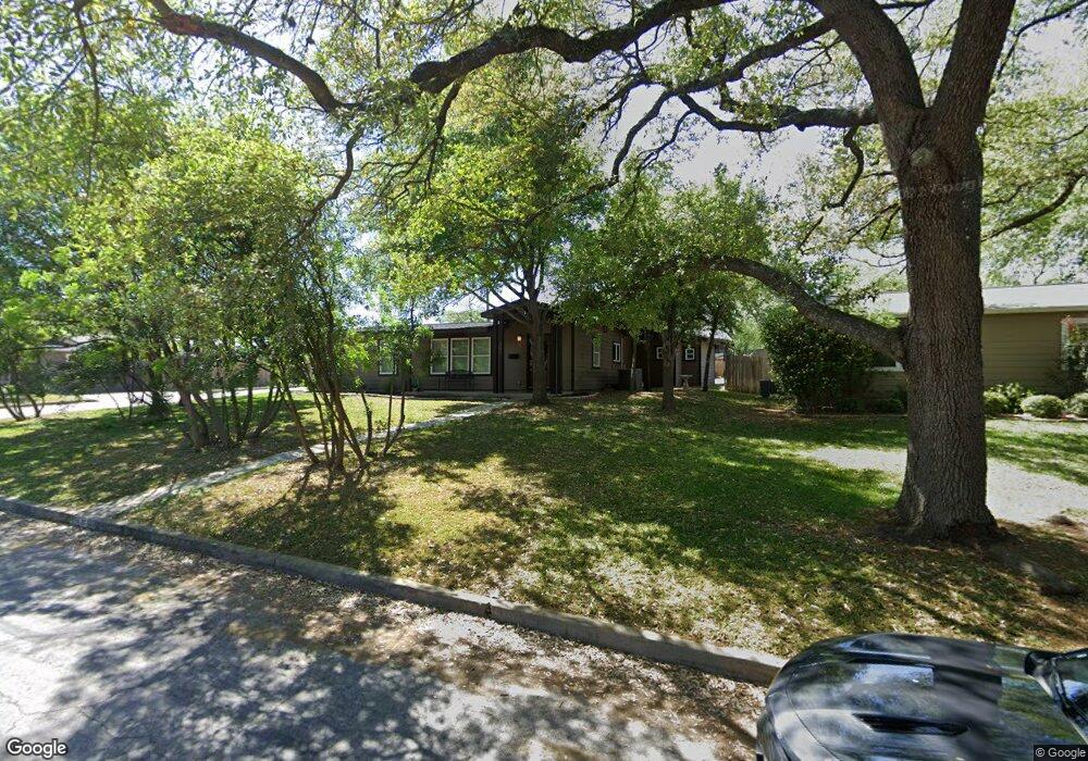
334 Burnside Dr San Antonio, TX 78209
Oak Park-Northwood NeighborhoodEstimated Value: $599,000 - $678,000
3
Beds
3
Baths
2,250
Sq Ft
$286/Sq Ft
Est. Value
About This Home
This home is located at 334 Burnside Dr, San Antonio, TX 78209 and is currently estimated at $643,334, approximately $285 per square foot. 334 Burnside Dr is a home located in Bexar County with nearby schools including Woodridge Elementary School, Alamo Heights Junior School, and Alamo Heights High School.
Ownership History
Date
Name
Owned For
Owner Type
Purchase Details
Closed on
Jan 31, 2025
Sold by
Peel Christopher Alexander
Bought by
Peel Angelina
Current Estimated Value
Purchase Details
Closed on
Dec 30, 2021
Sold by
Unknown
Bought by
Peel Christopher A and Peel Angelina
Home Financials for this Owner
Home Financials are based on the most recent Mortgage that was taken out on this home.
Original Mortgage
$462,400
Interest Rate
3.11%
Mortgage Type
New Conventional
Purchase Details
Closed on
Sep 30, 2021
Sold by
Santos Monica and Yoas Monica Santos
Bought by
Yoas Robert M
Purchase Details
Closed on
Jun 5, 2015
Sold by
Cramer Daniel Patrick and Cramer Jessie
Bought by
Yoas Robert M and Yoas Monica
Home Financials for this Owner
Home Financials are based on the most recent Mortgage that was taken out on this home.
Original Mortgage
$415,000
Interest Rate
3.68%
Mortgage Type
VA
Purchase Details
Closed on
Dec 29, 2011
Sold by
La Pila Ventures Llc
Bought by
Cramer Daniel Patrick
Home Financials for this Owner
Home Financials are based on the most recent Mortgage that was taken out on this home.
Original Mortgage
$365,750
Interest Rate
4.03%
Mortgage Type
New Conventional
Purchase Details
Closed on
Apr 5, 2011
Sold by
Mohle David
Bought by
La Pila Ventures Llc
Purchase Details
Closed on
Sep 24, 2003
Sold by
Mohle David and Mohle Jeanne
Bought by
Mohle David
Create a Home Valuation Report for This Property
The Home Valuation Report is an in-depth analysis detailing your home's value as well as a comparison with similar homes in the area
Home Values in the Area
Average Home Value in this Area
Purchase History
| Date | Buyer | Sale Price | Title Company |
|---|---|---|---|
| Peel Angelina | -- | None Listed On Document | |
| Peel Christopher A | -- | Independence Title Company | |
| Yoas Robert M | -- | None Listed On Document | |
| Yoas Robert M | -- | Chicago Title | |
| Cramer Daniel Patrick | -- | Presidio Title | |
| La Pila Ventures Llc | -- | Presidio Title | |
| Mohle David | -- | -- |
Source: Public Records
Mortgage History
| Date | Status | Borrower | Loan Amount |
|---|---|---|---|
| Previous Owner | Peel Christopher A | $462,400 | |
| Previous Owner | Yoas Robert M | $415,000 | |
| Previous Owner | Cramer Daniel Patrick | $365,750 |
Source: Public Records
Tax History Compared to Growth
Tax History
| Year | Tax Paid | Tax Assessment Tax Assessment Total Assessment is a certain percentage of the fair market value that is determined by local assessors to be the total taxable value of land and additions on the property. | Land | Improvement |
|---|---|---|---|---|
| 2025 | $11,914 | $628,090 | $257,600 | $370,490 |
| 2024 | $11,914 | $636,000 | $257,600 | $378,400 |
| 2023 | $11,914 | $608,430 | $257,600 | $350,830 |
| 2022 | $13,908 | $574,490 | $177,870 | $396,620 |
| 2021 | $11,729 | $470,000 | $154,700 | $315,300 |
| 2020 | $11,168 | $447,000 | $106,750 | $340,250 |
| 2019 | $10,724 | $419,170 | $106,750 | $312,420 |
| 2018 | $10,165 | $405,800 | $106,750 | $299,050 |
| 2017 | $9,378 | $374,410 | $106,750 | $267,660 |
| 2016 | $9,416 | $375,900 | $99,400 | $276,500 |
| 2015 | $8,233 | $366,168 | $99,400 | $271,080 |
| 2014 | $8,233 | $332,880 | $0 | $0 |
Source: Public Records
Map
Nearby Homes
- 419 Woodcrest Dr
- 215 Oakleaf Dr
- 134 Rockhill Dr
- 351 Northridge Dr
- 2603 Brookhurst Dr
- 318 Northridge Dr
- 510 Burnside Dr
- 205 Larkwood Dr
- 315 Tophill Rd
- 127 Larkwood Dr
- 623 E Nottingham Dr
- 215 Tophill Rd
- 530 Burnside Dr
- 631 Robinhood Place
- 2434 Toftrees Dr
- 411 E Nottingham Dr
- 8033 N New Braunfels Ave Unit 400D
- 8033 N New Braunfels Ave Unit 500C
- 8033 N New Braunfels Ave Unit 300E
- 303 Ridgehaven Place
- 330 Burnside Dr
- 402 Burnside Dr
- 326 Burnside Dr
- 335 Oakleaf Dr
- 331 Oakleaf Dr
- 331 Burnside Dr
- 335 Burnside Dr
- 403 Oakleaf Dr
- 327 Oakleaf Dr
- 406 Burnside Dr
- 327 Burnside Dr
- 322 Burnside Dr
- 403 Burnside Dr
- 407 Oakleaf Dr
- 323 Oakleaf Dr
- 323 Burnside Dr
- 407 Burnside Dr
- 318 Burnside Dr
- 410 Burnside Dr
- 319 Oakleaf Dr