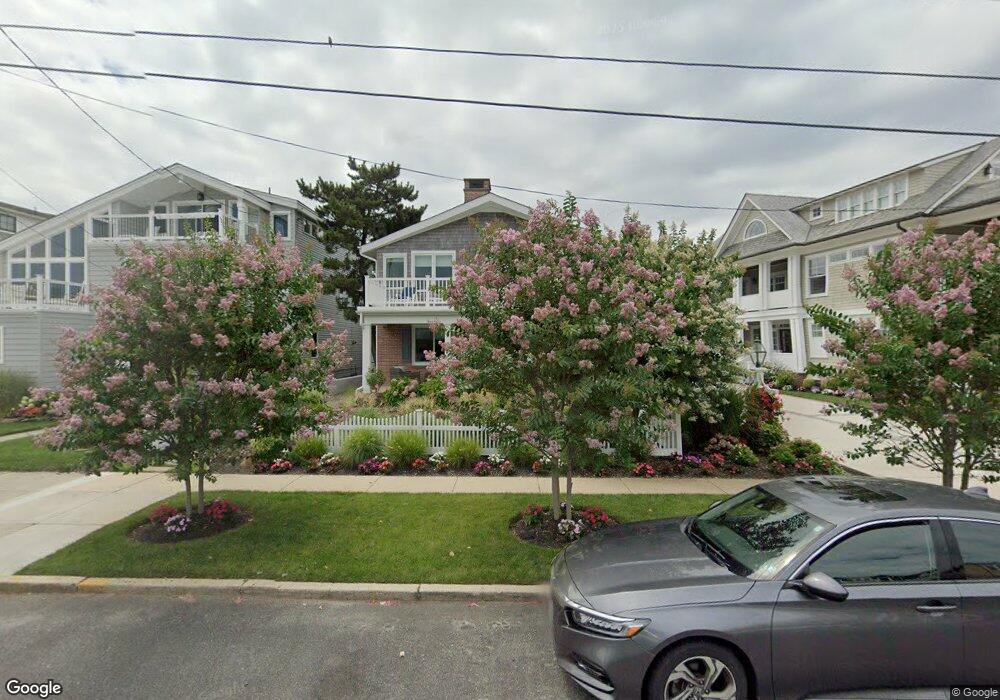
334 E Atlantic Blvd Ocean City, NJ 08226
Estimated Value: $2,600,857 - $3,745,000
--
Bed
--
Bath
2,349
Sq Ft
$1,325/Sq Ft
Est. Value
About This Home
This home is located at 334 E Atlantic Blvd, Ocean City, NJ 08226 and is currently estimated at $3,112,964, approximately $1,325 per square foot. 334 E Atlantic Blvd is a home located in Cape May County with nearby schools including Ocean City Primary School, Ocean City Intermediate School, and Ocean City High School.
Ownership History
Date
Name
Owned For
Owner Type
Purchase Details
Closed on
Apr 4, 2008
Sold by
Cavanaugh Michael and Cavanaugh Elizabeth Ann
Bought by
Dever Jonathan and Dever Christina
Current Estimated Value
Home Financials for this Owner
Home Financials are based on the most recent Mortgage that was taken out on this home.
Original Mortgage
$1,000,000
Outstanding Balance
$599,003
Interest Rate
4.95%
Mortgage Type
Purchase Money Mortgage
Estimated Equity
$2,513,961
Purchase Details
Closed on
Nov 18, 2002
Sold by
Holahan Richard
Bought by
Cavanaugh Michael and Cavanaugh Elizabeth Ann
Home Financials for this Owner
Home Financials are based on the most recent Mortgage that was taken out on this home.
Original Mortgage
$650,000
Interest Rate
6.34%
Purchase Details
Closed on
Oct 25, 2001
Sold by
Price Forrest W
Bought by
Holahan Richard and Holahan Marie
Home Financials for this Owner
Home Financials are based on the most recent Mortgage that was taken out on this home.
Original Mortgage
$580,000
Interest Rate
6.82%
Create a Home Valuation Report for This Property
The Home Valuation Report is an in-depth analysis detailing your home's value as well as a comparison with similar homes in the area
Home Values in the Area
Average Home Value in this Area
Purchase History
| Date | Buyer | Sale Price | Title Company |
|---|---|---|---|
| Dever Jonathan | $1,410,000 | The Title Company Of Jersey | |
| Cavanaugh Michael | $970,000 | -- | |
| Holahan Richard | $725,000 | -- |
Source: Public Records
Mortgage History
| Date | Status | Borrower | Loan Amount |
|---|---|---|---|
| Open | Dever Jonathan | $1,000,000 | |
| Previous Owner | Cavanaugh Michael | $650,000 | |
| Previous Owner | Holahan Richard | $580,000 |
Source: Public Records
Tax History Compared to Growth
Tax History
| Year | Tax Paid | Tax Assessment Tax Assessment Total Assessment is a certain percentage of the fair market value that is determined by local assessors to be the total taxable value of land and additions on the property. | Land | Improvement |
|---|---|---|---|---|
| 2025 | $13,449 | $1,198,700 | $1,028,900 | $169,800 |
| 2024 | $13,449 | $1,198,700 | $1,028,900 | $169,800 |
| 2023 | $12,838 | $1,198,700 | $1,028,900 | $169,800 |
| 2022 | $12,335 | $1,198,700 | $1,028,900 | $169,800 |
| 2021 | $8,923 | $1,198,700 | $1,028,900 | $169,800 |
| 2020 | $11,723 | $1,198,700 | $1,028,900 | $169,800 |
| 2019 | $11,591 | $1,198,700 | $1,028,900 | $169,800 |
| 2018 | $11,484 | $1,198,700 | $1,028,900 | $169,800 |
| 2017 | $11,304 | $1,198,700 | $1,028,900 | $169,800 |
| 2016 | $10,872 | $1,198,700 | $1,028,900 | $169,800 |
| 2015 | $10,728 | $1,198,700 | $1,028,900 | $169,800 |
| 2014 | $10,573 | $1,198,700 | $1,028,900 | $169,800 |
Source: Public Records
Map
Nearby Homes
- 319 E Seaspray Rd
- 229 Ocean Ave Unit 2nd Fl
- 301 Wesley Rd
- 162 Ocean Rd
- 154-56 Ocean Rd
- 510 Gardens Pkwy
- 118 Pinnacle Rd
- 118 Ocean Rd
- 230 W Seaspray Rd
- 112 Pinnacle Rd
- 114 Wesley Rd
- 211 W Seaspray Rd
- 12 E Newcastle Rd
- 71 Morningside Rd
- 336 W Surf Rd
- 50 Wesley Rd
- 312 W Surf Rd
- 14 Gardens Rd
- 10 Morningside Rd Unit B
- 10 Morningside Rd Unit A
- 338 E Atlantic Blvd
- 330 E Atlantic Blvd
- 328 E Atlantic Blvd
- 337 Ocean Rd
- 331 Ocean Rd
- 340 E Atlantic Blvd Unit 42
- 329 Ocean Rd
- 342 E Atlantic Blvd
- 342 E Atlantic Blvd
- 369 E Seaspray Rd
- 324 E Atlantic Blvd
- 325 Ocean Rd
- 375 E Seaspray Rd
- 335 E Atlantic Blvd
- 339 E Atlantic Blvd
- 329 E Atlantic Blvd Unit 31
- 320 E Atlantic Blvd
- 323 Ocean Rd
- 341 E Atlantic Blvd
- 325 E Atlantic Blvd Unit 27