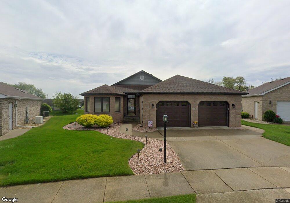
334 E Eastland Cir Lowell, IN 46356
Cedar Creek NeighborhoodEstimated Value: $288,000 - $318,073
2
Beds
2
Baths
2,059
Sq Ft
$148/Sq Ft
Est. Value
About This Home
This home is located at 334 E Eastland Cir, Lowell, IN 46356 and is currently estimated at $305,268, approximately $148 per square foot. 334 E Eastland Cir is a home located in Lake County with nearby schools including Lowell Middle School and Lowell Senior High School.
Ownership History
Date
Name
Owned For
Owner Type
Purchase Details
Closed on
Apr 21, 2023
Sold by
Onda Harriet M
Bought by
Harriet M Onda Trust
Current Estimated Value
Purchase Details
Closed on
Feb 28, 2023
Sold by
Onda Harriet M
Bought by
Harriet M Onda Trust
Purchase Details
Closed on
May 6, 2010
Sold by
Mika Joseph M and The Joseph M Mika Jr Living Tr
Bought by
Onda Charles R and Onda Harriet M
Purchase Details
Closed on
Apr 13, 2010
Sold by
Mika Joseph M and The Joseph M Mika Jr Living Tr
Bought by
Onda Charles R and Onda Harriet M
Purchase Details
Closed on
Feb 2, 2005
Sold by
Mika Joseph M and Mika Living Trust
Bought by
Mika Joseph M and Joseph M Mika Jr Living Trust
Create a Home Valuation Report for This Property
The Home Valuation Report is an in-depth analysis detailing your home's value as well as a comparison with similar homes in the area
Home Values in the Area
Average Home Value in this Area
Purchase History
| Date | Buyer | Sale Price | Title Company |
|---|---|---|---|
| Harriet M Onda Trust | -- | None Listed On Document | |
| Harriet M Onda Trust | -- | -- | |
| Onda Charles R | -- | Chicago Title Insurance Co | |
| Onda Charles R | -- | Chicago Title Insurance Co | |
| Mika Joseph M | -- | -- |
Source: Public Records
Tax History Compared to Growth
Tax History
| Year | Tax Paid | Tax Assessment Tax Assessment Total Assessment is a certain percentage of the fair market value that is determined by local assessors to be the total taxable value of land and additions on the property. | Land | Improvement |
|---|---|---|---|---|
| 2024 | $7,380 | $287,600 | $38,300 | $249,300 |
| 2023 | $2,537 | $278,400 | $38,300 | $240,100 |
| 2022 | $2,537 | $269,100 | $38,300 | $230,800 |
| 2021 | $2,039 | $228,500 | $26,900 | $201,600 |
| 2020 | $1,782 | $213,600 | $26,900 | $186,700 |
| 2019 | $1,891 | $209,400 | $26,900 | $182,500 |
| 2018 | $2,389 | $203,700 | $26,900 | $176,800 |
| 2017 | $2,314 | $188,300 | $26,900 | $161,400 |
| 2016 | $2,015 | $179,600 | $26,900 | $152,700 |
| 2014 | $1,881 | $170,600 | $26,900 | $143,700 |
| 2013 | $1,979 | $171,200 | $26,900 | $144,300 |
Source: Public Records
Map
Nearby Homes
- The Wolcott Plan at Beverly Estates
- The Sherman Plan at Beverly Estates
- The Washington Plan at Beverly Estates
- The Walton Plan at Beverly Estates
- The Walton 2 Plan at Beverly Estates
- The Revere Plan at Beverly Estates
- The Stockton Plan at Beverly Estates
- The Redbud Plan at Beverly Estates
- The Middleton Plan at Beverly Estates
- The Magnolia Plan at Beverly Estates
- The Madison Plan at Beverly Estates
- The Juniper Plan at Beverly Estates
- The Jefferson Plan at Beverly Estates
- The Harrison Plan at Beverly Estates
- The Franklin Plan at Beverly Estates
- The Firethorn Plan at Beverly Estates
- The Azalea Plan at Beverly Estates
- The Adams Plan at Beverly Estates
- 4839 Richard Dr
- 4851 Richard Dr
- 330 E Eastland Cir
- 340 E Eastland Cir
- 2010 Lucas Pkwy
- 327 E Eastland Cir
- 2068 Lucas Pkwy
- 1960 Lucas Pkwy
- 353 W Eastland Cir
- 353 E Eastland Cir
- 349 W Eastland Cir
- 2027 Lucas Pkwy
- 2003 Lucas Pkwy
- 2035 Lucas Pkwy
- 326 W Eastland Cir
- 318 W Eastland Cir
- 2043 Lucas Pkwy
- 345 W Eastland Cir
- 310 W Eastland Cir
- 274 Banyan Dr
- 1955 Lucas Pkwy
- 1940 Lucas Pkwy