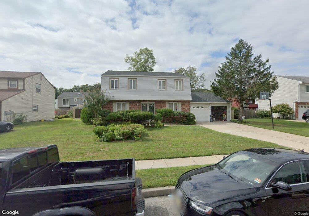
334 John F. Kennedy Blvd Lawnside, NJ 08045
Estimated Value: $320,000 - $383,000
--
Bed
--
Bath
2,620
Sq Ft
$133/Sq Ft
Est. Value
About This Home
This home is located at 334 John F. Kennedy Blvd, Lawnside, NJ 08045 and is currently estimated at $348,923, approximately $133 per square foot. 334 John F. Kennedy Blvd is a home located in Camden County with nearby schools including Lawnside Public Elementary School.
Ownership History
Date
Name
Owned For
Owner Type
Purchase Details
Closed on
Feb 11, 1994
Sold by
Federal Housing Admin
Bought by
Glenn Stanley and Glenn Brenda
Current Estimated Value
Home Financials for this Owner
Home Financials are based on the most recent Mortgage that was taken out on this home.
Original Mortgage
$81,000
Interest Rate
6.9%
Create a Home Valuation Report for This Property
The Home Valuation Report is an in-depth analysis detailing your home's value as well as a comparison with similar homes in the area
Home Values in the Area
Average Home Value in this Area
Purchase History
| Date | Buyer | Sale Price | Title Company |
|---|---|---|---|
| Glenn Stanley | $85,077 | -- |
Source: Public Records
Mortgage History
| Date | Status | Borrower | Loan Amount |
|---|---|---|---|
| Closed | Glenn Stanley | $81,000 |
Source: Public Records
Tax History Compared to Growth
Tax History
| Year | Tax Paid | Tax Assessment Tax Assessment Total Assessment is a certain percentage of the fair market value that is determined by local assessors to be the total taxable value of land and additions on the property. | Land | Improvement |
|---|---|---|---|---|
| 2025 | $7,844 | $166,500 | $39,400 | $127,100 |
| 2024 | $7,516 | $166,500 | $39,300 | $127,200 |
| 2023 | $7,516 | $166,500 | $39,300 | $127,200 |
| 2022 | $7,309 | $166,500 | $39,300 | $127,200 |
| 2021 | $7,363 | $166,500 | $39,300 | $127,200 |
| 2020 | $7,053 | $166,500 | $39,300 | $127,200 |
| 2019 | $6,938 | $166,500 | $39,300 | $127,200 |
| 2018 | $6,800 | $166,500 | $39,300 | $127,200 |
| 2017 | $6,687 | $166,500 | $39,300 | $127,200 |
| 2016 | $6,525 | $166,500 | $39,300 | $127,200 |
| 2015 | $6,505 | $166,500 | $39,300 | $127,200 |
| 2014 | $6,397 | $166,500 | $39,300 | $127,200 |
Source: Public Records
Map
Nearby Homes
- 358 Quaker Rd
- 523 Carver Ct
- 27 E Phoenix Ave
- 26 E Phoenix Ave
- 518 Carver Ct
- 95 Lane of Acres
- 1001 Wayne Rd
- 128 E Oak Ave
- 22 Center Oak Ave
- 26 Center Oak Ave
- 59 E Oak Ave
- 104 Bell Ave
- 172 E Charleston Ave
- 178 E Charleston Ave
- 315 Hutchinson Ave
- 35 Colonial Ridge Dr
- 316 N Woodstock Dr
- 134 Kent Rd
- 115 Phillips Ave
- 303 Highland Ave
- 328 John F. Kennedy Blvd
- 338 John F. Kennedy Blvd
- 341 Independence Blvd
- 335 Independence Blvd
- 345 Independence Blvd
- 331 John F. Kennedy Blvd
- 329 Independence Blvd
- 322 John F. Kennedy Blvd
- 344 John F. Kennedy Blvd
- 351 Independence Blvd
- 337 John F. Kennedy Blvd
- 325 John F. Kennedy Blvd
- 325 Independence Blvd
- 355 Independence Blvd
- 343 John F. Kennedy Blvd
- 321 John F. Kennedy Blvd
- 350 John F. Kennedy Blvd
- 314 John F. Kennedy Blvd
- 342 Independence Blvd
- 336 Independence Blvd