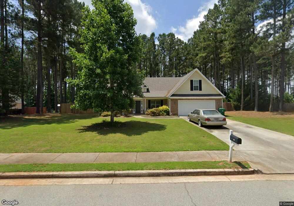
334 Laurel Ln Social Circle, GA 30025
Estimated Value: $343,465 - $399,000
3
Beds
2
Baths
2,083
Sq Ft
$182/Sq Ft
Est. Value
About This Home
This home is located at 334 Laurel Ln, Social Circle, GA 30025 and is currently estimated at $380,116, approximately $182 per square foot. 334 Laurel Ln is a home located in Walton County with nearby schools including Social Circle Primary School, Social Circle Elementary School, and Social Circle Middle School.
Ownership History
Date
Name
Owned For
Owner Type
Purchase Details
Closed on
Apr 18, 2018
Sold by
2015B Property Owner Llc
Bought by
Tah 2018 1 Borrower Llc and C/O Tricon American Homes Llc
Current Estimated Value
Purchase Details
Closed on
Apr 1, 2015
Sold by
The American Home Real Estate
Bought by
2015B Property Owner Llc
Purchase Details
Closed on
Aug 7, 2012
Sold by
Smith Marsha
Bought by
The American Home Real Estate
Purchase Details
Closed on
Mar 26, 2010
Sold by
Corvos Christian and Corvos Bethany
Bought by
Smith Marsha
Home Financials for this Owner
Home Financials are based on the most recent Mortgage that was taken out on this home.
Original Mortgage
$147,283
Interest Rate
4.91%
Mortgage Type
FHA
Create a Home Valuation Report for This Property
The Home Valuation Report is an in-depth analysis detailing your home's value as well as a comparison with similar homes in the area
Home Values in the Area
Average Home Value in this Area
Purchase History
| Date | Buyer | Sale Price | Title Company |
|---|---|---|---|
| Tah 2018 1 Borrower Llc | -- | -- | |
| 2015B Property Owner Llc | $4,347,989 | -- | |
| The American Home Real Estate | $78,401 | -- | |
| Smith Marsha | $150,000 | -- |
Source: Public Records
Mortgage History
| Date | Status | Borrower | Loan Amount |
|---|---|---|---|
| Previous Owner | Smith Marsha | $147,283 |
Source: Public Records
Tax History Compared to Growth
Tax History
| Year | Tax Paid | Tax Assessment Tax Assessment Total Assessment is a certain percentage of the fair market value that is determined by local assessors to be the total taxable value of land and additions on the property. | Land | Improvement |
|---|---|---|---|---|
| 2024 | $4,352 | $122,360 | $14,979 | $107,381 |
| 2023 | $4,424 | $122,360 | $22,000 | $100,360 |
| 2022 | $840 | $80,640 | $13,856 | $66,784 |
| 2021 | $840 | $80,640 | $13,856 | $66,784 |
| 2020 | $861 | $80,640 | $14,000 | $66,640 |
| 2019 | $831 | $71,920 | $12,000 | $59,920 |
| 2018 | $784 | $71,920 | $12,000 | $59,920 |
| 2017 | $2,915 | $69,760 | $12,000 | $57,760 |
| 2016 | $730 | $64,440 | $12,000 | $52,440 |
| 2015 | $603 | $53,600 | $8,000 | $45,600 |
| 2014 | $372 | $49,000 | $0 | $0 |
Source: Public Records
Map
Nearby Homes
- 1077 Riverstone Dr
- 1056 Riverstone Dr
- 318 Richmond Dr
- 433 Clover Dr
- 100 Saint Andrews Ct
- 226 Rogue Rd
- 355 Conner Ct
- 443 Windsong Ln
- 2049 Emily Dr
- 184 Wildflower Dr
- 1244 Morrow Dr
- 215 Park Place Trail
- 246 Azalea Farms Rd
- 210 Park Place Trail
- 357 W Hightower Trail
- 967 Park Place St
- 159 S Forest Ave
- The Trenton Plan at Town Park
- The Scottsdale Plan at Town Park
- 322 Laurel Ln
- 346 Laurel Ln
- 377 Laurel Ln
- 310 Laurel Ln
- 323 Laurel Ln
- 500 Ashlyn Ct
- 300 Laurel Ln
- 391 Laurel Ln
- 513 Ashlyn Ct
- 366 Laurel Ln
- 299 Laurel Ln
- 378 Laurel Ln Unit 76
- 378 Laurel Ln
- 403 Laurel Ln
- 525 Ashlyn Ct
- 390 Laurel Ln Unit 77
- 390 Laurel Ln
- 0 Ashlyn Ct Unit 7162626
- 0 Ashlyn Ct Unit 7145860
- 0 Ashlyn Ct Unit 8664947