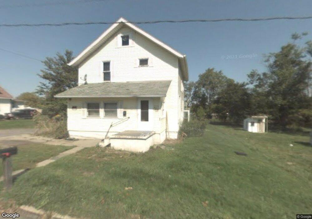
334 Longview Ave W Mansfield, OH 44903
Estimated Value: $66,000 - $130,000
3
Beds
1
Bath
1,492
Sq Ft
$62/Sq Ft
Est. Value
About This Home
This home is located at 334 Longview Ave W, Mansfield, OH 44903 and is currently estimated at $92,822, approximately $62 per square foot. 334 Longview Ave W is a home located in Richland County with nearby schools including Foundation Academy, Mansfield Elective Academy, and Interactive Media & Construction (IMAC) Academy.
Ownership History
Date
Name
Owned For
Owner Type
Purchase Details
Closed on
Jun 19, 2015
Sold by
3 Roses Property Management Llc
Bought by
Ada Homes Llc
Current Estimated Value
Purchase Details
Closed on
Jan 22, 2015
Sold by
Willard Rental Properties Llp
Bought by
3 Roses Property Management Llc
Purchase Details
Closed on
Sep 1, 2000
Sold by
U S Bank Na Trst
Bought by
Willard Rental Properties
Purchase Details
Closed on
Feb 7, 1997
Sold by
Messner Michael
Bought by
Balliett William H and Balliett Janice
Purchase Details
Closed on
Jan 3, 1997
Sold by
Karen First
Bought by
Messner Michael and Messner Bobbi N
Create a Home Valuation Report for This Property
The Home Valuation Report is an in-depth analysis detailing your home's value as well as a comparison with similar homes in the area
Home Values in the Area
Average Home Value in this Area
Purchase History
| Date | Buyer | Sale Price | Title Company |
|---|---|---|---|
| Ada Homes Llc | $5,500 | Southern Title | |
| 3 Roses Property Management Llc | $84,800 | Attorney | |
| Willard Rental Properties | $18,000 | -- | |
| Balliett William H | $38,900 | -- | |
| Messner Michael | $21,900 | -- |
Source: Public Records
Tax History Compared to Growth
Tax History
| Year | Tax Paid | Tax Assessment Tax Assessment Total Assessment is a certain percentage of the fair market value that is determined by local assessors to be the total taxable value of land and additions on the property. | Land | Improvement |
|---|---|---|---|---|
| 2024 | $231 | $4,830 | $1,770 | $3,060 |
| 2023 | $231 | $4,830 | $1,770 | $3,060 |
| 2022 | $221 | $3,870 | $1,610 | $2,260 |
| 2021 | $223 | $3,870 | $1,610 | $2,260 |
| 2020 | $228 | $3,870 | $1,610 | $2,260 |
| 2019 | $252 | $3,870 | $1,610 | $2,260 |
| 2018 | $249 | $3,870 | $1,610 | $2,260 |
| 2017 | $550 | $8,780 | $1,610 | $7,170 |
| 2016 | $227 | $3,510 | $640 | $2,870 |
| 2015 | $854 | $13,840 | $2,540 | $11,300 |
| 2014 | $823 | $13,840 | $2,540 | $11,300 |
| 2012 | $628 | $13,850 | $2,680 | $11,170 |
Source: Public Records
Map
Nearby Homes
- 743 Bowman St
- 283 Bulkley Ave
- 0 Highway 30
- 526 Bowman St
- 512 Burns St
- 426 Mcpherson St
- 156 Buckingham Ave Unit 158
- 0 Voegele Ave Unit Lot 6048, 6049, 6
- 371 Bell St
- 452 Daisy St
- 673 Armstrong St Unit 23
- 0 State Route 314 Unit 9067316
- 0 State Route 314 Unit 225021979
- 688 Mcpherson St
- 356 Warren Rd
- 237 Helen Ave
- 282 W 5th St
- 674 Averill Ave
- 269 Parkway Dr
- 219 W 5th St
- 344 Longview Ave W
- 324 Longview Ave W
- 320 Longview Ave W
- 646 Stocking Ave Unit 648
- 646-648 Stocking Ave
- 352 Longview Ave W
- 314 Longview Ave W
- 323 Longview Ave W
- 635 Stocking Ave
- 642 Stocking Ave Unit 644
- 317 Longview Ave W
- 308 Longview Ave W
- 311 Longview Ave W
- 309 Longview Ave W
- 631 Stocking Ave
- 304 Longview Ave W
- 626 Stocking Ave
- 629 Stocking Ave
- 300 Longview Ave W
- 319 Fern Ave