
Seller's Agent in 2025
Jesmely Gonzalez
Realty of America, LLC
(630) 697-0934
2 in this area
68 Total Sales
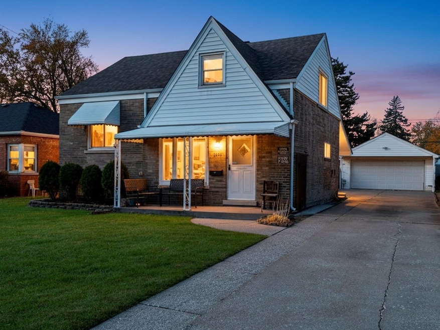
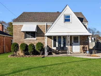
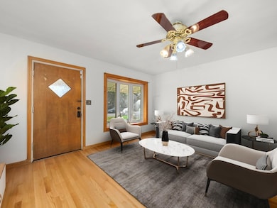
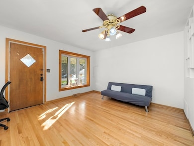

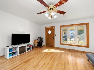

THIS IS THE ONE YOU'VE BEEN WAITING FOR! This spacious and charming Cape Cod offers incredible room to grow; tons of potential for the next lucky owner. Step inside to a warm and inviting living room with beautiful hardwood floors, perfect for relaxing after a long day. A dedicated dining room with a built-in buffet or dry bar(your choice) that leads into the vaulted ceiling kitchen a true highlight. Featuring an island, plenty of counter space and plenty of natural light. A few steps up leads to the two comfortable bedrooms and a full bath showcasing a whirlpool tub and granite accents on the vanity, walls, and floors. Head upstairs to the primary bedroom and take those stairs up to the finished attic, perfect for an office, play room (you name it) Need even more space? The basement features a cozy family room plus another full bath. Step outside and enjoy your private backyard with plenty of parking. This classic home offers the perfect blend of charm, space, and opportunity, truly one of a kind as the kitchen and primary and room four were all additions. And location? Ideal-just minutes from I-290, parks, schools, shopping, and more. A truly loved home with endless potential-schedule your showing today!
Last Agent to Sell the Property
Realty of America, LLC License #475174470 Listed on: 11/21/2025
Last Buyer's Agent
Jacqueline Colando
Redfin Corporation License #471016536
| Date | Type | Sale Price | Title Company |
|---|---|---|---|
| Warranty Deed | $330,000 | Greater Illinois Title | |
| Warranty Deed | $141,000 | First American Title | |
| Interfamily Deed Transfer | -- | Lsi | |
| Interfamily Deed Transfer | -- | None Available |
| Date | Status | Loan Amount | Loan Type |
|---|---|---|---|
| Previous Owner | $137,425 | FHA | |
| Previous Owner | $160,800 | New Conventional |
| Date | Event | Price | List to Sale | Price per Sq Ft |
|---|---|---|---|---|
| 12/30/2025 12/30/25 | Sold | $330,000 | -5.7% | $213 / Sq Ft |
| 12/06/2025 12/06/25 | Pending | -- | -- | -- |
| 11/21/2025 11/21/25 | For Sale | $349,999 | -- | $226 / Sq Ft |
| Year | Tax Paid | Tax Assessment Tax Assessment Total Assessment is a certain percentage of the fair market value that is determined by local assessors to be the total taxable value of land and additions on the property. | Land | Improvement |
|---|---|---|---|---|
| 2025 | $7,052 | $19,575 | $3,652 | $15,923 |
| 2024 | $7,052 | $19,575 | $3,652 | $15,923 |
| 2023 | $5,629 | $23,001 | $3,652 | $19,349 |
| 2022 | $5,629 | $17,690 | $3,154 | $14,536 |
| 2021 | $5,545 | $17,689 | $3,153 | $14,536 |
| 2020 | $5,473 | $17,689 | $3,153 | $14,536 |
| 2019 | $3,571 | $12,335 | $2,821 | $9,514 |
| 2018 | $3,468 | $12,335 | $2,821 | $9,514 |
| 2017 | $3,354 | $12,335 | $2,821 | $9,514 |
| 2016 | $2,910 | $10,105 | $2,489 | $7,616 |
| 2015 | $2,769 | $10,105 | $2,489 | $7,616 |
| 2014 | $4,029 | $13,739 | $2,489 | $11,250 |
| 2013 | $2,761 | $10,999 | $2,489 | $8,510 |
Seller's Agent in 2025
Jesmely Gonzalez
Realty of America, LLC
(630) 697-0934
2 in this area
68 Total Sales
J
Buyer's Agent in 2025
Jacqueline Colando
Redfin Corporation
Source: Midwest Real Estate Data (MRED)
MLS Number: 12522056
APN: 15-17-109-018-0000
Disclaimer: Certain information contained herein is derived from information provided by parties other than Homes.com. All information provided is deemed reliable, but is not guaranteed to be accurate and should be independently verified.
![]() Based on information submitted to the MLS GRID. All data is obtained from various sources and may not have been verified by broker or MLS GRID. Supplied Open House Information is subject to change without notice. All information should be independently reviewed and verified for accuracy. Properties may or may not be listed by the office/agent presenting the information. Some IDX listings have been excluded from this website.
Based on information submitted to the MLS GRID. All data is obtained from various sources and may not have been verified by broker or MLS GRID. Supplied Open House Information is subject to change without notice. All information should be independently reviewed and verified for accuracy. Properties may or may not be listed by the office/agent presenting the information. Some IDX listings have been excluded from this website.
Based on information submitted to the MLS GRID
Ask me questions while you tour the home.