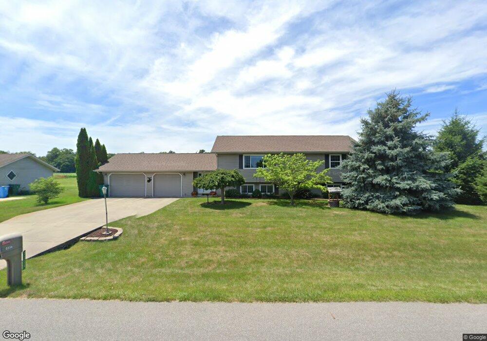
334 N Fail Rd La Porte, IN 46350
Estimated Value: $258,000 - $328,000
4
Beds
2
Baths
2,276
Sq Ft
$132/Sq Ft
Est. Value
About This Home
This home is located at 334 N Fail Rd, La Porte, IN 46350 and is currently estimated at $301,439, approximately $132 per square foot. 334 N Fail Rd is a home located in LaPorte County with nearby schools including New Prairie High School, St. John's Lutheran School, and St. Joseph's School.
Ownership History
Date
Name
Owned For
Owner Type
Purchase Details
Closed on
Jul 2, 2025
Sold by
Vaughan Timothy A
Bought by
Vaughan Diane L
Current Estimated Value
Purchase Details
Closed on
Aug 31, 2007
Sold by
Roscoe Curtis
Bought by
Vaughan Timothy A and Vaughan Diane L
Home Financials for this Owner
Home Financials are based on the most recent Mortgage that was taken out on this home.
Original Mortgage
$140,800
Interest Rate
6.72%
Mortgage Type
Purchase Money Mortgage
Purchase Details
Closed on
Feb 28, 2006
Sold by
Luginbill Rose
Bought by
Roscoe Curtis
Home Financials for this Owner
Home Financials are based on the most recent Mortgage that was taken out on this home.
Original Mortgage
$158,414
Interest Rate
6.2%
Mortgage Type
FHA
Create a Home Valuation Report for This Property
The Home Valuation Report is an in-depth analysis detailing your home's value as well as a comparison with similar homes in the area
Purchase History
| Date | Buyer | Sale Price | Title Company |
|---|---|---|---|
| Vaughan Diane L | -- | None Listed On Document | |
| Vaughan Timothy A | -- | Meridian Title Corp | |
| Roscoe Curtis | -- | Meridian Title Corp |
Source: Public Records
Mortgage History
| Date | Status | Borrower | Loan Amount |
|---|---|---|---|
| Previous Owner | Vaughan Timothy A | $140,800 | |
| Previous Owner | Roscoe Curtis | $158,414 |
Source: Public Records
Tax History
| Year | Tax Paid | Tax Assessment Tax Assessment Total Assessment is a certain percentage of the fair market value that is determined by local assessors to be the total taxable value of land and additions on the property. | Land | Improvement |
|---|---|---|---|---|
| 2025 | $1,633 | $166,900 | $23,600 | $143,300 |
| 2024 | $1,597 | $169,300 | $23,600 | $145,700 |
| 2022 | $1,480 | $156,600 | $23,600 | $133,000 |
| 2021 | $1,451 | $145,500 | $23,600 | $121,900 |
| 2020 | $1,604 | $145,500 | $23,600 | $121,900 |
| 2019 | $1,603 | $150,900 | $28,000 | $122,900 |
| 2018 | $1,348 | $140,700 | $22,600 | $118,100 |
| 2017 | $1,398 | $143,200 | $22,600 | $120,600 |
| 2016 | $1,431 | $138,800 | $18,800 | $120,000 |
| 2014 | $1,212 | $138,100 | $18,800 | $119,300 |
Source: Public Records
Map
Nearby Homes
- 535 N Fail Rd
- 235 Whispering Blvd
- 211 Whispering Blvd
- 1083 E State Hwy Unit 409
- 0 E Jefferson Ave
- 916 Ohio St
- 310 Planett St
- 6864 N Nature Ln
- 6869 N Nature Ln
- 6863 N Nature Ln Unit 3
- 6862 N Nature Ln
- 6863 N Nature Ln
- 6854 N Nature Ln
- 205 Lawrence St
- 717 E Lincolnway
- 1168 E State Road 4
- 703 Niles St
- 807 Division St
- 806 Lawrence St
- 414 Allen St
Your Personal Tour Guide
Ask me questions while you tour the home.