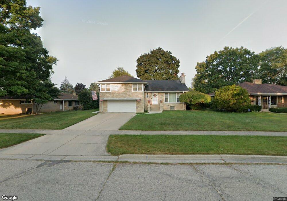
334 N Martin Ave Waukegan, IL 60085
West Waukegan NeighborhoodEstimated Value: $308,000 - $338,000
3
Beds
3
Baths
2,200
Sq Ft
$145/Sq Ft
Est. Value
About This Home
This home is located at 334 N Martin Ave, Waukegan, IL 60085 and is currently estimated at $318,284, approximately $144 per square foot. 334 N Martin Ave is a home located in Lake County with nearby schools including Whittier Elementary School, Robert E. Abbott Middle School, and Waukegan High School.
Ownership History
Date
Name
Owned For
Owner Type
Purchase Details
Closed on
Jul 14, 2020
Sold by
Dannible Richard and Dannible John
Bought by
Dannible David
Current Estimated Value
Purchase Details
Closed on
Jan 23, 1996
Sold by
Bank Of Waukegan
Bought by
Dannible Frances P and Dannible Carmin D
Create a Home Valuation Report for This Property
The Home Valuation Report is an in-depth analysis detailing your home's value as well as a comparison with similar homes in the area
Home Values in the Area
Average Home Value in this Area
Purchase History
| Date | Buyer | Sale Price | Title Company |
|---|---|---|---|
| Dannible David | -- | Chicago Title | |
| Dannible Frances P | -- | -- |
Source: Public Records
Tax History Compared to Growth
Tax History
| Year | Tax Paid | Tax Assessment Tax Assessment Total Assessment is a certain percentage of the fair market value that is determined by local assessors to be the total taxable value of land and additions on the property. | Land | Improvement |
|---|---|---|---|---|
| 2024 | $6,384 | $93,486 | $15,553 | $77,933 |
| 2023 | $6,473 | $83,699 | $13,925 | $69,774 |
| 2022 | $6,473 | $77,214 | $12,001 | $65,213 |
| 2021 | $6,263 | $71,072 | $11,102 | $59,970 |
| 2020 | $6,825 | $66,212 | $10,343 | $55,869 |
| 2019 | $6,817 | $60,673 | $9,478 | $51,195 |
| 2018 | $6,232 | $54,582 | $12,195 | $42,387 |
| 2017 | $6,016 | $48,290 | $10,789 | $37,501 |
| 2016 | $5,557 | $41,962 | $9,375 | $32,587 |
| 2015 | $5,331 | $37,557 | $8,391 | $29,166 |
| 2014 | $4,300 | $30,955 | $9,107 | $21,848 |
| 2012 | $5,549 | $33,537 | $9,867 | $23,670 |
Source: Public Records
Map
Nearby Homes
- 2115 Lydia St
- 615 Tiffany Dr
- 132 Dorchester Ct
- 1213 Grand Ave
- 0 Brookside Ave
- 49 S Lewis Ave
- 1416 Hamilton Ct
- 24 Washington Terrace
- 1521 Catalpa Ave
- 824 N Butrick St
- 1005 N Lewis Ave
- 968 Judge Ave
- 1023 N Elmwood Ave
- 23 N Jackson St
- 102 Baldwin Ave
- 1038 Indiana Ave
- 1109 Massena Ave
- 1000 Pine St
- 1117 Judge Ave
- 917 N Linden Ave
- 332 N Martin Luther Ave
- 338 N Martin Ave
- 2024 Brookside Ave
- 342 N Martin Ave
- 335 N Berwick Blvd
- 339 N Berwick Blvd
- 2106 Brookside Ave
- 343 N Berwick Blvd
- 404 N Martin Ave
- 335 N Martin Ave
- 331 N Martin Ave
- 339 N Martin Ave
- 2025 Brookside Ave
- 2020 Brookside Ave
- 405 N Berwick Blvd
- 412 N Martin Ave
- 314 N Martin Ave
- 2101 Brookside Ave
- 2015 Brookside Ave