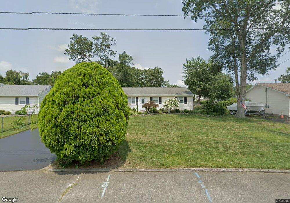
334 Normandie Dr Forked River, NJ 08731
Lacey Township NeighborhoodEstimated Value: $397,000 - $436,000
4
Beds
2
Baths
1,237
Sq Ft
$337/Sq Ft
Est. Value
About This Home
This home is located at 334 Normandie Dr, Forked River, NJ 08731 and is currently estimated at $416,579, approximately $336 per square foot. 334 Normandie Dr is a home located in Ocean County with nearby schools including Lacey Township High School.
Ownership History
Date
Name
Owned For
Owner Type
Purchase Details
Closed on
Aug 15, 2022
Sold by
Maria Haas
Bought by
Guenther Charles and Haas Maria
Current Estimated Value
Purchase Details
Closed on
Apr 27, 2004
Sold by
Sandella Jack A and Sandella Michelle A
Bought by
Haas Maria and Guenther Charles
Home Financials for this Owner
Home Financials are based on the most recent Mortgage that was taken out on this home.
Original Mortgage
$183,100
Interest Rate
5.47%
Mortgage Type
Fannie Mae Freddie Mac
Create a Home Valuation Report for This Property
The Home Valuation Report is an in-depth analysis detailing your home's value as well as a comparison with similar homes in the area
Home Values in the Area
Average Home Value in this Area
Purchase History
| Date | Buyer | Sale Price | Title Company |
|---|---|---|---|
| Guenther Charles | -- | Shearer R Douglas | |
| Guenther Charles | -- | Shearer R Douglas | |
| Haas Maria | $203,500 | Fidelity National Title Insu |
Source: Public Records
Mortgage History
| Date | Status | Borrower | Loan Amount |
|---|---|---|---|
| Previous Owner | Haas Maria | $183,100 |
Source: Public Records
Tax History Compared to Growth
Tax History
| Year | Tax Paid | Tax Assessment Tax Assessment Total Assessment is a certain percentage of the fair market value that is determined by local assessors to be the total taxable value of land and additions on the property. | Land | Improvement |
|---|---|---|---|---|
| 2025 | $5,174 | $204,200 | $82,500 | $121,700 |
| 2024 | $4,838 | $204,200 | $82,500 | $121,700 |
| 2023 | $4,621 | $204,200 | $82,500 | $121,700 |
| 2022 | $4,621 | $204,200 | $82,500 | $121,700 |
| 2021 | $4,543 | $204,200 | $82,500 | $121,700 |
| 2020 | $4,398 | $204,200 | $82,500 | $121,700 |
| 2019 | $4,321 | $204,200 | $82,500 | $121,700 |
| 2018 | $4,270 | $204,200 | $82,500 | $121,700 |
| 2017 | $4,172 | $204,200 | $82,500 | $121,700 |
| 2016 | $4,155 | $204,200 | $82,500 | $121,700 |
| 2015 | $3,970 | $204,200 | $82,500 | $121,700 |
| 2014 | $4,169 | $242,400 | $122,500 | $119,900 |
Source: Public Records
Map
Nearby Homes
- 318 Riviera Dr
- 308 Pine Forest Ln
- 307 Windjammer Ct
- 241 Juniper Ln
- 210 Sunrise Blvd
- 111 Greenwood Ln
- 28 Bayberry Dr
- 416 Irons St
- 119 Driftwood Ln
- 107 Fernwood Ln
- 502 Teakwood Dr
- 207 Sunset Dr
- 307 Sunrise Blvd
- 20 Bayberry Dr
- 218 Sunset Dr
- 507 Laurelwood Dr
- 703 Cyprus Ct
- 304 Cyprus Ct
- 424 Continental St
- 26 Jacqueline Ct
- 336 Normandie Dr
- 332 Normandie Dr
- 345 Yorktown Dr
- 347 Yorktown Dr
- 343 Yorktown Dr
- 338 Normandie Dr
- 330 Normandie Dr
- 327 Normandie Dr
- 341 Yorktown Dr
- 325 Normandie Dr
- 329 Normandie Dr
- 340 Normandie Dr
- 339 Yorktown Dr
- 351 Yorktown Dr
- 328 Normandie Dr
- 331 Normandie Dr
- 323 Normandie Dr
- 354 Yorktown Dr
- 352 Yorktown Dr
- 342 Normandie Dr