Estimated Value: $983,571 - $1,240,000
4
Beds
3
Baths
2,827
Sq Ft
$385/Sq Ft
Est. Value
About This Home
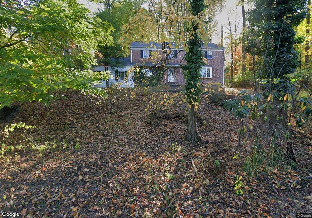
This home is located at 334 Pugh Rd, Wayne, PA 19087 and is currently estimated at $1,089,643, approximately $385 per square foot. 334 Pugh Rd is a home located in Chester County with nearby schools including New Eagle Elementary School, Valley Forge Middle School, and Conestoga Senior High School.
Ownership History
Date
Name
Owned For
Owner Type
Purchase Details
Closed on
May 29, 1998
Sold by
Falvo Lisa A
Bought by
Mcalee Joseph J and Thompson Aileen R
Current Estimated Value
Home Financials for this Owner
Home Financials are based on the most recent Mortgage that was taken out on this home.
Original Mortgage
$200,000
Interest Rate
6.89%
Purchase Details
Closed on
Dec 8, 1995
Sold by
Campe Stephen M and Campe Karen Droga
Bought by
Falvo Lisa A
Home Financials for this Owner
Home Financials are based on the most recent Mortgage that was taken out on this home.
Original Mortgage
$240,000
Interest Rate
7.43%
Create a Home Valuation Report for This Property
The Home Valuation Report is an in-depth analysis detailing your home's value as well as a comparison with similar homes in the area
Home Values in the Area
Average Home Value in this Area
Purchase History
| Date | Buyer | Sale Price | Title Company |
|---|---|---|---|
| Mcalee Joseph J | $285,000 | -- | |
| Falvo Lisa A | $300,125 | -- |
Source: Public Records
Mortgage History
| Date | Status | Borrower | Loan Amount |
|---|---|---|---|
| Previous Owner | Mcalee Joseph J | $200,000 | |
| Previous Owner | Falvo Lisa A | $240,000 | |
| Closed | Mcalee Joseph J | $56,215 |
Source: Public Records
Tax History
| Year | Tax Paid | Tax Assessment Tax Assessment Total Assessment is a certain percentage of the fair market value that is determined by local assessors to be the total taxable value of land and additions on the property. | Land | Improvement |
|---|---|---|---|---|
| 2025 | $10,037 | $284,960 | $89,260 | $195,700 |
| 2024 | $10,037 | $284,960 | $89,260 | $195,700 |
| 2023 | $9,428 | $284,960 | $89,260 | $195,700 |
| 2022 | $9,185 | $284,960 | $89,260 | $195,700 |
| 2021 | $9,011 | $284,960 | $89,260 | $195,700 |
| 2020 | $8,762 | $284,960 | $89,260 | $195,700 |
| 2019 | $8,485 | $284,960 | $89,260 | $195,700 |
| 2018 | $8,317 | $284,960 | $89,260 | $195,700 |
| 2017 | $8,119 | $284,960 | $89,260 | $195,700 |
| 2016 | -- | $284,960 | $89,260 | $195,700 |
| 2015 | -- | $284,960 | $89,260 | $195,700 |
| 2014 | -- | $284,960 | $89,260 | $195,700 |
Source: Public Records
Map
Nearby Homes
- 825 Springbank Ln
- 575 W Valley Rd
- 610 Arlyn Cir
- 66 Old Forge Crossing Unit 66
- 278 Old Forge Crossing Unit 278
- 152 Hunters Ln
- 2 Ile Dhuyere Unit 2
- 9 Avignon
- 6 Avignon Unit 6
- 261 Sunset Rd
- 170, 200, 220 Old State Rd
- 128 Homestead Rd
- 596 Tanglewood Ln
- 795 Mancill Rd
- 284 Croton Rd
- 40 Grove Ave
- 411 W Conestoga Rd Unit 22
- 107 Palmetto
- 105 Palmetto
- 340 Coldstream Dr
- 743 W Valley Rd
- 356 Pugh Rd
- 765 W Valley Rd
- 725 W Valley Rd
- 800 Springbank Ln
- 370 Pugh Rd
- 736 W Valley Rd
- 715 W Valley Rd
- 810 Springbank Ln
- 407 Pugh Rd
- 805 Springbank Ln
- 748 W Valley Rd
- 294 Pugh Rd
- 292 Radcliffe Rd
- 705 W Valley Rd
- 803 Avonwood Dr
- 820 Springbank Ln
- 275 Radcliffe Rd
- 815 Springbank Ln
- 688 Jeffrey Ln
Your Personal Tour Guide
Ask me questions while you tour the home.