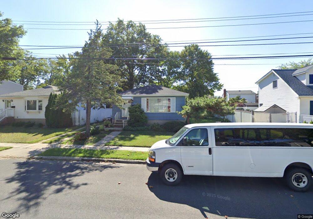
334 Thornycroft Ave Staten Island, NY 10312
Eltingville NeighborhoodEstimated Value: $680,249 - $813,000
--
Bed
4
Baths
1,120
Sq Ft
$651/Sq Ft
Est. Value
About This Home
This home is located at 334 Thornycroft Ave, Staten Island, NY 10312 and is currently estimated at $729,312, approximately $651 per square foot. 334 Thornycroft Ave is a home located in Richmond County with nearby schools including P.S. 55 The Henry M. Boehm School, I.S. 007 Elias Bernstein, and Tottenville High School.
Ownership History
Date
Name
Owned For
Owner Type
Purchase Details
Closed on
Sep 19, 2002
Sold by
Oneill Eleanor
Bought by
Ottesen Kenneth
Current Estimated Value
Home Financials for this Owner
Home Financials are based on the most recent Mortgage that was taken out on this home.
Original Mortgage
$140,000
Interest Rate
6.16%
Mortgage Type
Purchase Money Mortgage
Create a Home Valuation Report for This Property
The Home Valuation Report is an in-depth analysis detailing your home's value as well as a comparison with similar homes in the area
Home Values in the Area
Average Home Value in this Area
Purchase History
| Date | Buyer | Sale Price | Title Company |
|---|---|---|---|
| Ottesen Kenneth | $325,000 | First American Title Ins Co |
Source: Public Records
Mortgage History
| Date | Status | Borrower | Loan Amount |
|---|---|---|---|
| Previous Owner | Ottesen Kenneth | $140,000 | |
| Closed | Ottesen Kenneth | $75,000 |
Source: Public Records
Tax History Compared to Growth
Tax History
| Year | Tax Paid | Tax Assessment Tax Assessment Total Assessment is a certain percentage of the fair market value that is determined by local assessors to be the total taxable value of land and additions on the property. | Land | Improvement |
|---|---|---|---|---|
| 2025 | $6,080 | $40,320 | $12,170 | $28,150 |
| 2024 | $6,185 | $43,020 | $11,025 | $31,995 |
| 2023 | $5,869 | $32,144 | $11,164 | $20,980 |
| 2022 | $5,079 | $35,820 | $13,920 | $21,900 |
| 2021 | $5,471 | $33,180 | $13,920 | $19,260 |
| 2020 | $5,559 | $33,960 | $13,920 | $20,040 |
| 2019 | $5,281 | $35,640 | $13,920 | $21,720 |
| 2018 | $4,802 | $26,787 | $9,473 | $17,314 |
| 2017 | $4,506 | $25,272 | $12,215 | $13,057 |
| 2016 | $4,273 | $24,480 | $11,404 | $13,076 |
| 2015 | $3,932 | $24,480 | $10,052 | $14,428 |
| 2014 | $3,932 | $23,662 | $10,951 | $12,711 |
Source: Public Records
Map
Nearby Homes
- 323 Winchester Ave
- 331 Winchester Ave
- 249 Ridgecrest Ave
- 22 Crest Loop
- 4087 Richmond Ave
- 127 Ridgecrest Ave
- 125 Ridgecrest Ave
- 247 Hillcrest St
- 97 Lyndale Ave
- 232 Robinson Ave
- 0 Oakdale St
- 233 King St
- 445 Beach Rd
- 190 Oakdale St
- 324 Retford Ave
- 144 Winchester Ave
- 4262 Richmond Ave
- 139 Winchester Ave
- 107 Elmwood Ave
- 52 Rankin St
- 328 Thornycroft Ave
- 340 Thornycroft Ave
- 343 Winchester Ave
- 347 Winchester Ave
- 324 Thornycroft Ave
- 339 Winchester Ave
- 346 Thornycroft Ave
- 351 Winchester Ave
- 335 Winchester Ave
- 335 Thornycroft Ave
- 355 Winchester Ave Unit 2ND LEVEL
- 355 Winchester Ave
- 339 Thornycroft Ave
- 329 Thornycroft Ave
- 354 Thornycroft Ave
- 343 Thornycroft Ave
- 361 Winchester Ave
- 325 Thornycroft Ave
- 327 Winchester Ave
- 365 Winchester Ave