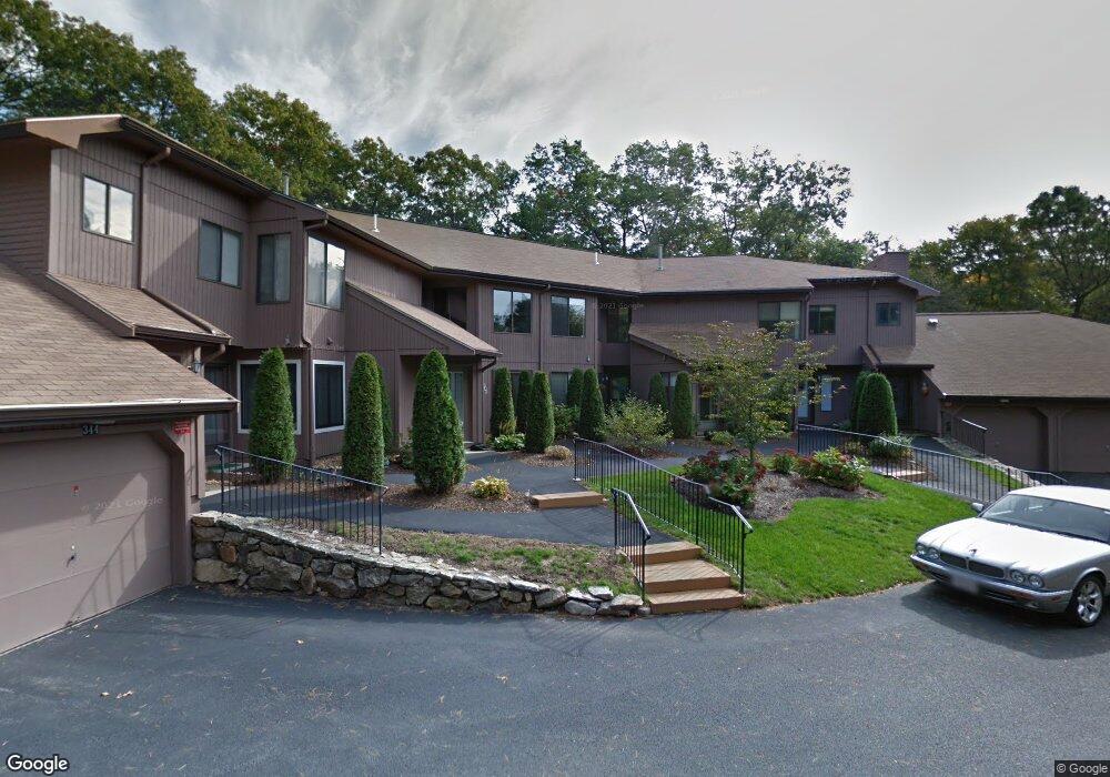
334 Trailside Way Ashland, MA 01721
Estimated Value: $445,003 - $504,000
2
Beds
2
Baths
1,260
Sq Ft
$377/Sq Ft
Est. Value
About This Home
This home is located at 334 Trailside Way, Ashland, MA 01721 and is currently estimated at $474,751, approximately $376 per square foot. 334 Trailside Way is a home located in Middlesex County with nearby schools including William Pittaway Elementary School, Henry E. Warren Elementary School, and David Mindess Elementary School.
Ownership History
Date
Name
Owned For
Owner Type
Purchase Details
Closed on
Dec 17, 2023
Sold by
Edgett Ret and Edgett
Bought by
Engel Theodore F and Engel Laura A
Current Estimated Value
Purchase Details
Closed on
Oct 24, 2022
Sold by
Edgett Ronald F and Edgett Gail A
Bought by
Edgett Ret and Edgett
Purchase Details
Closed on
May 25, 2000
Sold by
Stanley Otis C and Stanley Gladys L
Bought by
Edgett Ronald F and Edgett Gail A
Home Financials for this Owner
Home Financials are based on the most recent Mortgage that was taken out on this home.
Original Mortgage
$149,050
Interest Rate
8.1%
Mortgage Type
Purchase Money Mortgage
Purchase Details
Closed on
Jul 31, 1997
Sold by
King Robert V
Bought by
Stanley Otis C and Stanley Gladys L
Purchase Details
Closed on
Apr 4, 1994
Sold by
Malkin-Comeau Karen and Malkin Barbara
Bought by
King Robert
Create a Home Valuation Report for This Property
The Home Valuation Report is an in-depth analysis detailing your home's value as well as a comparison with similar homes in the area
Home Values in the Area
Average Home Value in this Area
Purchase History
| Date | Buyer | Sale Price | Title Company |
|---|---|---|---|
| Engel Theodore F | $410,000 | None Available | |
| Edgett Ret | -- | None Available | |
| Edgett Ronald F | $152,500 | -- | |
| Stanley Otis C | $124,500 | -- | |
| Stanley Otis C | $124,500 | -- | |
| King Robert | $100,000 | -- | |
| King Robert V | $100,000 | -- |
Source: Public Records
Mortgage History
| Date | Status | Borrower | Loan Amount |
|---|---|---|---|
| Previous Owner | King Robert V | $152,300 | |
| Previous Owner | King Robert V | $148,300 | |
| Previous Owner | King Robert V | $149,050 |
Source: Public Records
Tax History
| Year | Tax Paid | Tax Assessment Tax Assessment Total Assessment is a certain percentage of the fair market value that is determined by local assessors to be the total taxable value of land and additions on the property. | Land | Improvement |
|---|---|---|---|---|
| 2025 | $5,149 | $403,200 | $0 | $403,200 |
| 2024 | $4,939 | $373,000 | $0 | $373,000 |
| 2023 | $4,946 | $359,200 | $0 | $359,200 |
| 2022 | $4,889 | $307,900 | $0 | $307,900 |
| 2021 | $4,701 | $295,090 | $0 | $295,090 |
| 2020 | $4,438 | $274,600 | $0 | $274,600 |
| 2019 | $4,010 | $246,300 | $0 | $246,300 |
| 2018 | $3,835 | $230,900 | $0 | $230,900 |
| 2017 | $3,642 | $218,100 | $0 | $218,100 |
| 2016 | $3,664 | $215,500 | $0 | $215,500 |
| 2015 | $3,507 | $202,714 | $0 | $202,714 |
| 2014 | $3,436 | $197,600 | $0 | $197,600 |
Source: Public Records
Map
Nearby Homes
- 306 Trailside Way
- 241 Trailside Way
- 363 Eliot St
- 2 Adams Rd Unit 2
- 26 Meeting House Path Unit 26
- 74 Meeting House Path
- 1 Adams Ln Unit 1
- 147 Turner Rd Unit 80
- 9 Adams Ln Unit 9
- 207 Eliot St
- 2 Arrowhead Cir Unit 2
- 45 Half Crown Cir
- 102 Captain Eames Cir
- 59 Brooksmont Dr Unit 59
- 37 James Rd
- 140 Algonquin Trail
- 3 Danforth Dr
- 1 Danforth Dr
- 269 Concord St
- 20 Mulhall Dr
- 332 Trailside Way
- 336 Trailside Way
- 340 Trailside Way
- 344 Trailside Way
- 346 Trailside Way
- 342 Trailside Way
- 338 Trailside Way
- 334 Trailside Way Unit 334
- 346 Trailside Way Unit 14D
- 334 Trailside Way Unit 14A,334
- 344 Trailside Way Unit D1, 14
- 346 Trailside Way Unit 346
- 0 Jennings Road Subdivision
- 328 Trailside Way
- 324 Trailside Way
- 320 Trailside Way
- 316 Trailside Way
- 318 Trailside Way
- 322 Trailside Way
- 326 Trailside Way
Your Personal Tour Guide
Ask me questions while you tour the home.