
Seller's Agent in 2025
Jack McLemore
ListingResults.com
(817) 283-5134
4 in this area
1,383 Total Sales
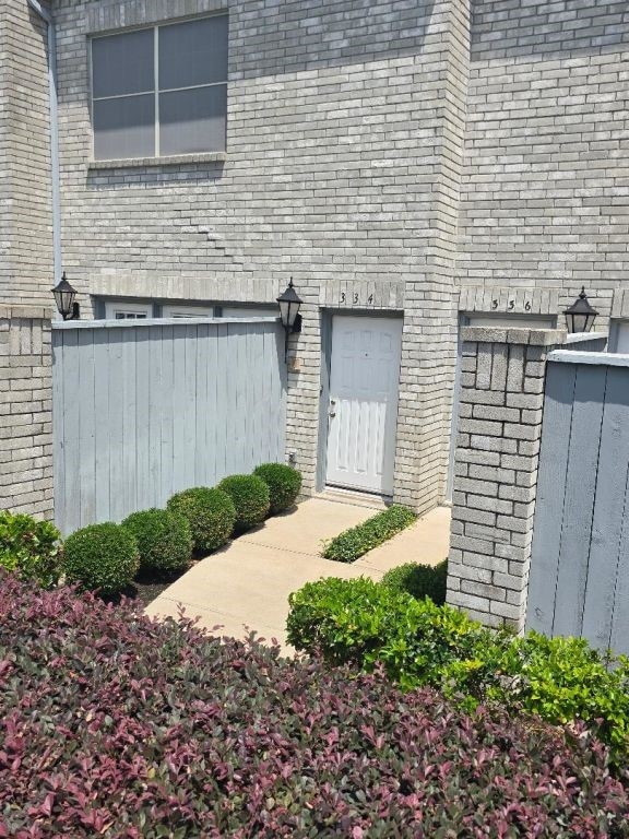
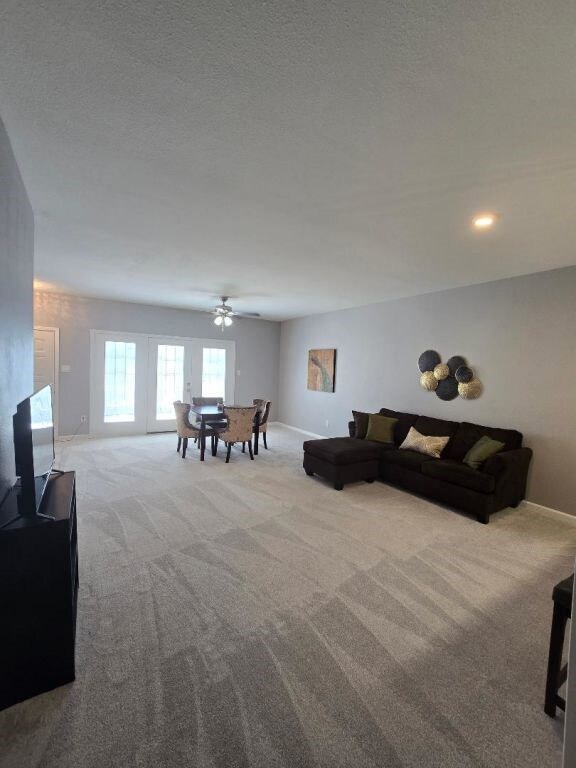
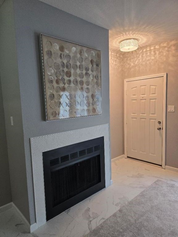
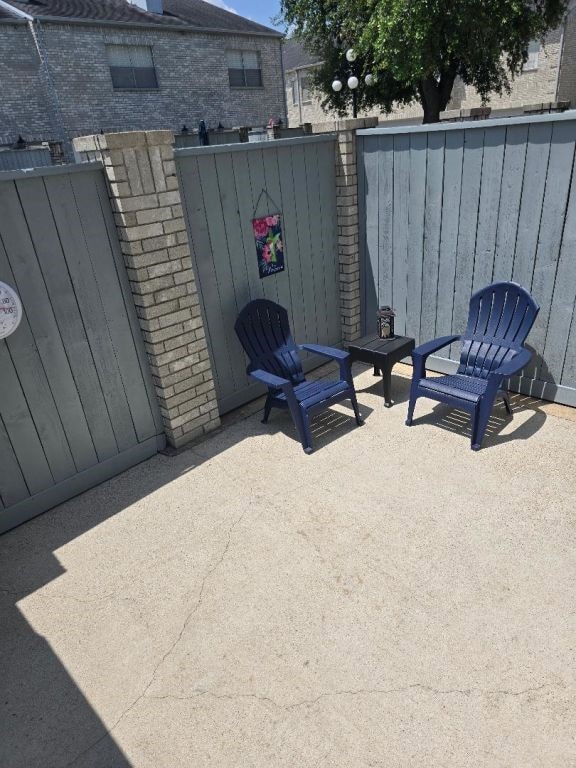
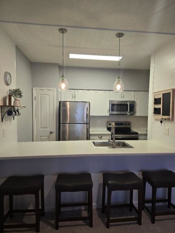
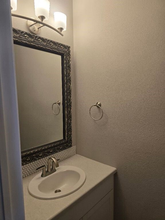

Welcome to 334 Wilcrest Drive located in Marlborough Square Townhomes with 24-7 manned security. Conveniently located next to Lakeside Country Club and adjacent to the energy corridor. This townhouse is situated in the center of the subdivision overlooking one of the community pools. French doors lead out to the private patio for outdoor entertaining. Recent remodel with many upgrades and open concept Kitchen/living area. The master bathroom is a must see! Eight feet high french doors open to a bright and spacious sanctuary. If you’re looking for stylish living in the city – then, this one is a much see!
Last Agent to Sell the Property
ListingResults.com License #0460808 Listed on: 05/22/2025
| Date | Type | Sale Price | Title Company |
|---|---|---|---|
| Warranty Deed | -- | Monarch Title | |
| Warranty Deed | -- | None Available | |
| Interfamily Deed Transfer | -- | None Available | |
| Vendors Lien | -- | Chicago Title | |
| Warranty Deed | -- | Regency Title |
| Date | Status | Loan Amount | Loan Type |
|---|---|---|---|
| Previous Owner | $57,000 | New Conventional | |
| Previous Owner | $55,600 | Purchase Money Mortgage |
| Date | Event | Price | List to Sale | Price per Sq Ft |
|---|---|---|---|---|
| 09/10/2025 09/10/25 | Sold | -- | -- | -- |
| 07/14/2025 07/14/25 | Price Changed | $204,000 | -2.4% | $117 / Sq Ft |
| 07/01/2025 07/01/25 | Price Changed | $209,000 | -2.8% | $120 / Sq Ft |
| 06/18/2025 06/18/25 | Price Changed | $215,000 | -2.7% | $124 / Sq Ft |
| 05/22/2025 05/22/25 | For Sale | $221,000 | -- | $127 / Sq Ft |
| Year | Tax Paid | Tax Assessment Tax Assessment Total Assessment is a certain percentage of the fair market value that is determined by local assessors to be the total taxable value of land and additions on the property. | Land | Improvement |
|---|---|---|---|---|
| 2025 | $4,055 | $189,776 | $36,057 | $153,719 |
| 2024 | $4,055 | $193,820 | $36,826 | $156,994 |
| 2023 | $4,055 | $197,105 | $37,450 | $159,655 |
| 2022 | $3,836 | $174,193 | $33,097 | $141,096 |
| 2021 | $3,697 | $158,638 | $30,141 | $128,497 |
| 2020 | $3,857 | $159,289 | $30,265 | $129,024 |
| 2019 | $3,959 | $156,464 | $29,728 | $126,736 |
| 2018 | $2,797 | $152,311 | $28,939 | $123,372 |
| 2017 | $3,851 | $152,311 | $28,939 | $123,372 |
| 2016 | $3,394 | $146,161 | $27,771 | $118,390 |
| 2015 | $769 | $146,161 | $27,771 | $118,390 |
| 2014 | $769 | $129,643 | $24,632 | $105,011 |
Seller's Agent in 2025
Jack McLemore
ListingResults.com
(817) 283-5134
4 in this area
1,383 Total Sales
Buyer's Agent in 2025
Michelle N. Briggs
Strada
(281) 371-4300
1 in this area
33 Total Sales
Source: Houston Association of REALTORS®
MLS Number: 49588861
APN: 1154790100004
Disclaimer: Certain information contained herein is derived from information provided by parties other than Homes.com. All information provided is deemed reliable, but is not guaranteed to be accurate and should be independently verified.
![]() Copyright 2025, Houston REALTORS® Information Service, Inc.
Copyright 2025, Houston REALTORS® Information Service, Inc.
The information provided is exclusively for consumers’ personal, non-commercial use, and may not be used for any purpose other than to identify prospective properties consumers may be interested in purchasing.
Information is deemed reliable but not guaranteed.