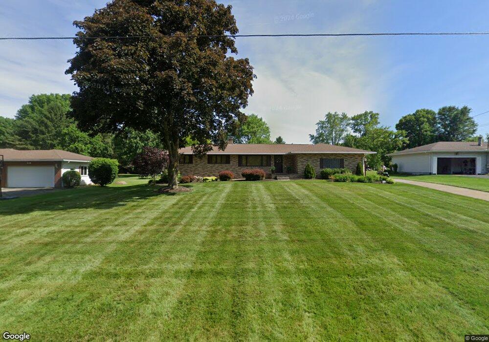
3341 Boyne Rd Barberton, OH 44203
Estimated Value: $259,199 - $303,000
3
Beds
2
Baths
1,404
Sq Ft
$201/Sq Ft
Est. Value
About This Home
This home is located at 3341 Boyne Rd, Barberton, OH 44203 and is currently estimated at $281,800, approximately $200 per square foot. 3341 Boyne Rd is a home located in Summit County with nearby schools including Copley-Fairlawn Middle School, Copley High School, and Spring Garden Waldorf School.
Ownership History
Date
Name
Owned For
Owner Type
Purchase Details
Closed on
Apr 18, 2007
Sold by
Bowser Bradley K and Bowser Patricia L
Bought by
Bowser Bradley K and Bowser Patricia L
Current Estimated Value
Purchase Details
Closed on
May 17, 1999
Sold by
Taylor Frederick D and Taylor Nancy A
Bought by
Bowser Bradley K and Bowser Patricia L
Home Financials for this Owner
Home Financials are based on the most recent Mortgage that was taken out on this home.
Original Mortgage
$133,450
Outstanding Balance
$34,338
Interest Rate
6.99%
Estimated Equity
$247,462
Create a Home Valuation Report for This Property
The Home Valuation Report is an in-depth analysis detailing your home's value as well as a comparison with similar homes in the area
Home Values in the Area
Average Home Value in this Area
Purchase History
| Date | Buyer | Sale Price | Title Company |
|---|---|---|---|
| Bowser Bradley K | -- | Attorney | |
| Bowser Bradley K | $157,000 | Title One |
Source: Public Records
Mortgage History
| Date | Status | Borrower | Loan Amount |
|---|---|---|---|
| Open | Bowser Bradley K | $133,450 |
Source: Public Records
Tax History Compared to Growth
Tax History
| Year | Tax Paid | Tax Assessment Tax Assessment Total Assessment is a certain percentage of the fair market value that is determined by local assessors to be the total taxable value of land and additions on the property. | Land | Improvement |
|---|---|---|---|---|
| 2025 | $3,562 | $76,528 | $9,951 | $66,577 |
| 2024 | $3,562 | $76,528 | $9,951 | $66,577 |
| 2023 | $3,562 | $76,528 | $9,951 | $66,577 |
| 2022 | $4,010 | $70,862 | $9,216 | $61,646 |
| 2021 | $4,220 | $70,862 | $9,216 | $61,646 |
| 2020 | $4,119 | $70,870 | $9,220 | $61,650 |
| 2019 | $3,935 | $61,060 | $9,220 | $51,840 |
| 2018 | $3,742 | $61,060 | $9,220 | $51,840 |
| 2017 | $3,240 | $61,060 | $9,220 | $51,840 |
| 2016 | $3,236 | $50,780 | $9,220 | $41,560 |
| 2015 | $3,240 | $50,780 | $9,220 | $41,560 |
| 2014 | $3,218 | $50,780 | $9,220 | $41,560 |
| 2013 | $3,301 | $52,860 | $9,220 | $43,640 |
Source: Public Records
Map
Nearby Homes
- 3371 Brenner Rd
- 2711 S Cleveland Massillon Rd
- 3666 Minor Rd
- 2394 Jacoby Rd
- 2395 Hull Dr
- 3270 Glenbrook Dr
- 3303 Glenbrook Dr
- 2817 Kay Blvd
- 2881 Wilbanks Dr
- 1842 Jacoby Rd
- 2995 Wilbanks Dr
- 3007 Wilbanks Dr
- 2515 Wright Rd
- 2973 Colon Dr
- 3520 Shellhart Rd
- 1638 S Cleveland Massillon Rd
- 3012 Shellhart Rd
- S/L 179 Belt Line Dr
- 2660 S Medina Line Rd
- 3063 Cliffside Dr