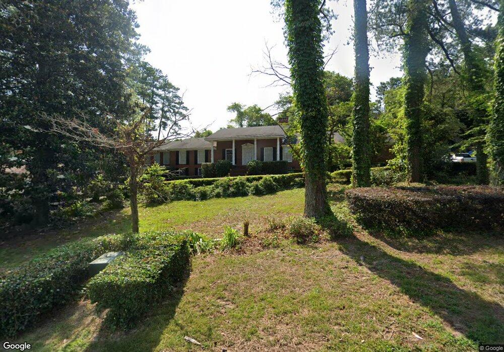
3345 Armstrong Dr N Macon, GA 31211
Estimated Value: $174,000 - $252,753
4
Beds
3
Baths
2,602
Sq Ft
$85/Sq Ft
Est. Value
About This Home
This home is located at 3345 Armstrong Dr N, Macon, GA 31211 and is currently estimated at $221,188, approximately $85 per square foot. 3345 Armstrong Dr N is a home located in Bibb County with nearby schools including Martin Luther King Jr. Elementary School, Appling Middle School, and Northeast High School.
Ownership History
Date
Name
Owned For
Owner Type
Purchase Details
Closed on
Nov 4, 2010
Sold by
The Bank Of New York Mellon
Bought by
Powell Allen and Powell Susie
Current Estimated Value
Home Financials for this Owner
Home Financials are based on the most recent Mortgage that was taken out on this home.
Original Mortgage
$86,961
Outstanding Balance
$56,867
Interest Rate
4.25%
Mortgage Type
FHA
Estimated Equity
$164,321
Purchase Details
Closed on
Jun 1, 2010
Sold by
Williams Ella R
Bought by
The Bank Of New York Mellon F/K/A The B
Create a Home Valuation Report for This Property
The Home Valuation Report is an in-depth analysis detailing your home's value as well as a comparison with similar homes in the area
Home Values in the Area
Average Home Value in this Area
Purchase History
| Date | Buyer | Sale Price | Title Company |
|---|---|---|---|
| Powell Allen | $123,000 | None Available | |
| The Bank Of New York Mellon F/K/A The B | $96,300 | -- | |
| The Bank Of New York Mellon | $96,256 | None Available |
Source: Public Records
Mortgage History
| Date | Status | Borrower | Loan Amount |
|---|---|---|---|
| Open | Powell Allen | $86,961 |
Source: Public Records
Tax History Compared to Growth
Tax History
| Year | Tax Paid | Tax Assessment Tax Assessment Total Assessment is a certain percentage of the fair market value that is determined by local assessors to be the total taxable value of land and additions on the property. | Land | Improvement |
|---|---|---|---|---|
| 2025 | $2,572 | $104,650 | $6,256 | $98,394 |
| 2024 | $2,658 | $104,650 | $6,256 | $98,394 |
| 2023 | $2,326 | $91,579 | $3,400 | $88,179 |
| 2022 | $3,538 | $102,182 | $9,796 | $92,386 |
| 2021 | $3,336 | $87,781 | $8,905 | $78,876 |
| 2020 | $3,408 | $87,781 | $8,905 | $78,876 |
| 2019 | $3,436 | $87,781 | $8,905 | $78,876 |
| 2018 | $5,442 | $87,781 | $8,905 | $78,876 |
| 2017 | $3,289 | $87,781 | $8,905 | $78,876 |
| 2016 | $3,037 | $87,781 | $8,905 | $78,876 |
| 2015 | $4,299 | $87,781 | $8,905 | $78,876 |
| 2014 | $4,601 | $87,781 | $8,905 | $78,876 |
Source: Public Records
Map
Nearby Homes
- 3339 Club Dr
- 1940 Manson Rd
- 0 Shady Road Plaza
- 0 Shady Rd
- 3145 Pasadena Dr
- 2035 Fairway Dr
- 2940 Shurling Dr
- 3128 Commodore Dr
- 3380 Warpath Rd
- 3048 Bethune Ave
- 2954 Tyler Place
- 3154 Bethune Ave
- 3320 Joycliff Rd
- 1669 Griswoldville Rd
- 157 Country World Dr
- 2720 Jordan Ave
- 144 Country World Dr
- 134 Country World Dr
- 148 Country World Dr
- 0 Armstrong Dr N
- 3359 Armstrong Dr N
- 3341 Armstrong Dr N
- 2946 Armstrong Dr
- 2948 Kevin Dr
- 3337 Armstrong Dr N
- 2960 Kevin Dr
- 2936 Kevin Dr
- 3356 Armstrong Dr N
- 2945 Paige Dr
- 3327 Armstrong Dr N
- 2924 Kevin Dr
- 3000 Kevin Dr
- 2953 Armstrong Dr
- 2951 Paige Dr
- 2949 Kevin Dr
- 2961 Kevin Dr
- 2937 Kevin Dr
- 2958 Armstrong Dr
- 3317 Armstrong Dr N