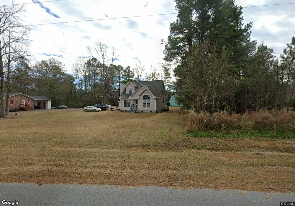
3345 Blain Ln Conway, SC 29527
Estimated Value: $292,000 - $476,000
3
Beds
2
Baths
1,808
Sq Ft
$214/Sq Ft
Est. Value
About This Home
This home is located at 3345 Blain Ln, Conway, SC 29527 and is currently estimated at $386,374, approximately $213 per square foot. 3345 Blain Ln is a home located in Horry County with nearby schools including Pee Dee Elementary School, Whittemore Park Middle School, and Conway High School.
Ownership History
Date
Name
Owned For
Owner Type
Purchase Details
Closed on
May 24, 2023
Sold by
Jones Anthony W
Bought by
Jones Anthony W and Jones Joan W
Current Estimated Value
Purchase Details
Closed on
Mar 11, 2002
Sold by
Jones Joyce Demetris and Jones Rachel
Bought by
Jones Anthony W and Jones Joan W
Home Financials for this Owner
Home Financials are based on the most recent Mortgage that was taken out on this home.
Original Mortgage
$26,012
Interest Rate
6.86%
Mortgage Type
Purchase Money Mortgage
Create a Home Valuation Report for This Property
The Home Valuation Report is an in-depth analysis detailing your home's value as well as a comparison with similar homes in the area
Home Values in the Area
Average Home Value in this Area
Purchase History
| Date | Buyer | Sale Price | Title Company |
|---|---|---|---|
| Jones Anthony W | -- | -- | |
| Jones Anthony W | -- | -- |
Source: Public Records
Mortgage History
| Date | Status | Borrower | Loan Amount |
|---|---|---|---|
| Previous Owner | Jones Anthony W | $26,012 |
Source: Public Records
Tax History Compared to Growth
Tax History
| Year | Tax Paid | Tax Assessment Tax Assessment Total Assessment is a certain percentage of the fair market value that is determined by local assessors to be the total taxable value of land and additions on the property. | Land | Improvement |
|---|---|---|---|---|
| 2024 | $1,540 | $25,915 | $5,371 | $20,544 |
| 2023 | $3,216 | $8,840 | $1,153 | $7,687 |
| 2021 | $842 | $11,740 | $1,212 | $10,528 |
| 2020 | $634 | $11,740 | $1,212 | $10,528 |
| 2019 | $634 | $11,740 | $1,212 | $10,528 |
| 2018 | $548 | $7,686 | $1,002 | $6,684 |
| 2017 | $533 | $7,686 | $1,002 | $6,684 |
| 2016 | -- | $7,686 | $1,002 | $6,684 |
| 2015 | $533 | $7,687 | $1,003 | $6,684 |
| 2014 | $492 | $7,687 | $1,003 | $6,684 |
Source: Public Records
Map
Nearby Homes
- 3120 Merganser Dr
- 3230 Merganser Dr
- 1301 Mandarin Dr
- 3524 Merganser Dr
- 1300 Ruddy Ct
- 1911 Dirty Branch Rd
- 5241 Cates Bay Hwy
- 7.4 Acs Cates Bay Hwy Unit Lot 10
- 5.47 Acs Cates Bay Hwy Unit Lot 4
- 6.97 Acs Cates Bay Hwy Unit Lot 12
- 19.09 Acs Cates Bay Hwy Unit Lot 11
- 5.73 Acs Cates Bay Hwy Unit Lot 5
- 6.84 Acs Cates Bay Hwy Unit Lot 8
- 7.39 Acs Cates Bay Hwy Unit Lot 9
- 9.33 Acs Cates Bay Hwy Unit Lot 13
- TBD New Rd
- 1048 Cadbury Ct
- 1049 Augustus Dr
- 1233 Dunraven Ct
- 1036 Augustus Dr
- TBD Blain Ln
- 3348 Blain Ln
- 3341 Blain Ln
- 9433 Carrington Dr
- 3311 Blain Ln
- 1664 Dirty Branch Rd
- 1676 Dirty Branch Rd
- 1688 Dirty Branch Rd
- 1527 Dirty Branch Rd
- 1500 Dirty Branch Rd
- 4201 Ossie Ln
- 1498 Dirty Branch Rd
- 4213 Ossie Ln
- 3150 Blain Ln
- 1496 Dirty Branch Rd
- 1465 Dirty Branch Rd
- 4221 Ossie Ln
- 1750 Dirty Branch Rd
- 1746 Dirty Branch Rd
- 1499 Dirty Branch Rd