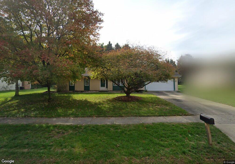
3345 Davcliff Ave Portage, MI 49024
Estimated Value: $257,299 - $287,000
3
Beds
2
Baths
1,594
Sq Ft
$172/Sq Ft
Est. Value
About This Home
This home is located at 3345 Davcliff Ave, Portage, MI 49024 and is currently estimated at $273,825, approximately $171 per square foot. 3345 Davcliff Ave is a home located in Kalamazoo County with nearby schools including Amberly Elementary School, Portage West Middle School, and Portage Northern High School.
Ownership History
Date
Name
Owned For
Owner Type
Purchase Details
Closed on
Oct 16, 2002
Sold by
Thiel Rev Steven E and Thiel Susan M
Bought by
Buell John and Buell Kathy
Current Estimated Value
Home Financials for this Owner
Home Financials are based on the most recent Mortgage that was taken out on this home.
Original Mortgage
$13,500
Interest Rate
6.18%
Mortgage Type
Stand Alone Second
Create a Home Valuation Report for This Property
The Home Valuation Report is an in-depth analysis detailing your home's value as well as a comparison with similar homes in the area
Home Values in the Area
Average Home Value in this Area
Purchase History
| Date | Buyer | Sale Price | Title Company |
|---|---|---|---|
| Buell John | -- | Chicago Title | |
| Thiel Rev Steven E | $110,000 | Chicago Title |
Source: Public Records
Mortgage History
| Date | Status | Borrower | Loan Amount |
|---|---|---|---|
| Closed | Thiel Rev Steven E | $13,500 | |
| Open | Buell John | $108,000 |
Source: Public Records
Tax History Compared to Growth
Tax History
| Year | Tax Paid | Tax Assessment Tax Assessment Total Assessment is a certain percentage of the fair market value that is determined by local assessors to be the total taxable value of land and additions on the property. | Land | Improvement |
|---|---|---|---|---|
| 2025 | $3,003 | $93,200 | $0 | $0 |
| 2024 | $2,643 | $87,200 | $0 | $0 |
| 2023 | $2,520 | $77,100 | $0 | $0 |
| 2022 | $2,723 | $74,200 | $0 | $0 |
| 2021 | $2,631 | $72,600 | $0 | $0 |
| 2020 | $2,574 | $69,900 | $0 | $0 |
| 2019 | $232 | $64,700 | $0 | $0 |
| 2018 | $0 | $62,700 | $0 | $0 |
| 2017 | $0 | $60,100 | $0 | $0 |
| 2016 | -- | $57,600 | $0 | $0 |
| 2015 | -- | $54,800 | $0 | $0 |
| 2014 | -- | $52,300 | $0 | $0 |
Source: Public Records
Map
Nearby Homes
- 3318 Davcliff Ave
- 6645 Oleander Ln
- 6876 Towhee St
- 6740 Amberly St
- 3522 Bellflower Dr
- 3320 Scots Pine Way Unit 2
- 6605 Rothbury St
- 3638 Bellflower Dr
- 2801 Daventry Ave
- 3034 Tattersall Rd
- 3737 Bellflower Dr
- 6576 Isabelle St
- 7236 Hampstead Ln Unit 18
- 2604 Radcliffe Ave
- 6427 Pepperidge Cir
- 6421 Cullys Trail
- 6748 Trotwood St
- 6636 Trotwood St
- 6439 Cypress St
- 4030 Hollow Wood Dr
- 3315 Davcliff Ave
- 3381 Davcliff Ave
- 6877 Towhee St
- 3348 Davcliff Ave
- 6895 Towhee St
- 3382 Davcliff Ave
- 3229 Davcliff Ave
- 6909 Towhee St
- 6820 Robinswood St
- 6856 Towhee St
- 3217 Davcliff Ave
- 6894 Towhee St
- 6925 Towhee St
- 3440 Davcliff Ave
- 6659 Oleander Ln
- 6810 Robinswood St
- 6908 Towhee St
- 3205 Davcliff Ave
- 3479 Davcliff Ave
- 6943 Towhee St