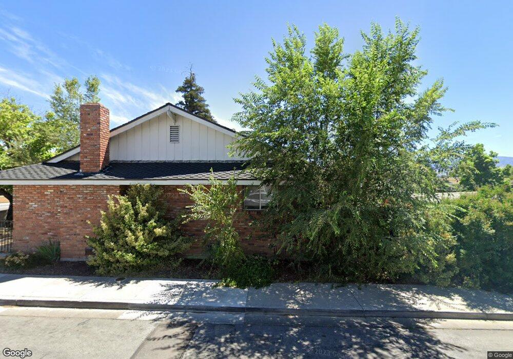
3345 Pyramid Way Sparks, NV 89431
North Rock Neighborhood
3
Beds
2
Baths
1,519
Sq Ft
0.5
Acres
About This Home
This home is located at 3345 Pyramid Way, Sparks, NV 89431. 3345 Pyramid Way is a home located in Washoe County with nearby schools including Alice Maxwell Elementary School, Sparks Middle School, and Sparks High School.
Ownership History
Date
Name
Owned For
Owner Type
Purchase Details
Closed on
Jun 14, 2018
Sold by
Regional Transporattion Commission Of Wa
Bought by
Sierra Pacific Power Company and Nv Energy
Purchase Details
Closed on
Nov 18, 2005
Sold by
Lepori Frank M and Lepori Frances A
Bought by
Lepori Ranch Llc
Purchase Details
Closed on
Nov 17, 2005
Sold by
Lepori Frank M and Lepori Frances A
Bought by
Lepori Ranch Llc
Purchase Details
Closed on
Nov 19, 1999
Sold by
Lepori Frank and Lepori Carol J
Bought by
Lepori Frank and Lepori Carol J
Create a Home Valuation Report for This Property
The Home Valuation Report is an in-depth analysis detailing your home's value as well as a comparison with similar homes in the area
Home Values in the Area
Average Home Value in this Area
Purchase History
| Date | Buyer | Sale Price | Title Company |
|---|---|---|---|
| Sierra Pacific Power Company | -- | None Available | |
| Lepori Ranch Llc | $375,000 | Ticor Title Of Nevada Inc | |
| Lepori Ranch Llc | $375,000 | Ticor Title Of Nevada Inc | |
| Lepori Frank | -- | -- | |
| Lepori Frank | -- | -- |
Source: Public Records
Tax History Compared to Growth
Tax History
| Year | Tax Paid | Tax Assessment Tax Assessment Total Assessment is a certain percentage of the fair market value that is determined by local assessors to be the total taxable value of land and additions on the property. | Land | Improvement |
|---|---|---|---|---|
| 2025 | $3,911 | $106,643 | $75,922 | $30,722 |
| 2024 | $3,911 | $106,382 | $75,922 | $30,461 |
| 2023 | $3,694 | $100,447 | $72,471 | $27,977 |
| 2022 | $3,484 | $95,231 | $72,471 | $22,761 |
| 2021 | $3,227 | $87,688 | $65,536 | $22,152 |
| 2020 | $3,193 | $87,295 | $65,536 | $21,759 |
| 2019 | $3,042 | $83,182 | $62,087 | $21,095 |
| 2018 | $2,888 | $78,585 | $58,637 | $19,948 |
| 2017 | $2,878 | $78,271 | $58,637 | $19,634 |
| 2016 | $2,882 | $78,478 | $58,637 | $19,841 |
| 2015 | $2,876 | $78,215 | $58,637 | $19,578 |
| 2014 | $2,848 | $77,436 | $58,637 | $18,799 |
| 2013 | -- | $76,787 | $58,637 | $18,150 |
Source: Public Records
Map
Nearby Homes
- 780 Emerson Way
- 3252 Holman Way
- 465 Lenwood Dr
- 3269 Valley Forge Way
- 5530 High Rock Way
- 3465 Dawn Cir
- 1125 Dodson Way
- 3607 Keogh Dr
- 3545 4th St
- 0 N Mccarran Blvd Unit 250052909
- 3245 Elaine Way
- 119 Devere Way
- 1160 York Way
- 1345 Plymouth Way
- 1110 Xman Way
- 1023 Tyler Way
- 120 E Lenwood Dr
- 10 Sheridan Way
- 1945 4th St Unit 32
- 1945 4th St Unit 33
- 3305 Pyramid Way
- 3321 Sprout Way
- 3331 Sprout Way
- 791 Mercy Ct
- 3238 Jamestown Ct
- 3248 Jamestown Ct
- 781 Mercy Ct
- 3251 Lagomarsino Dr
- 3277 Sprout Way
- 3280 Wilma Dr
- 3300 Wilma Dr
- 3270 Wilma Dr
- 3290 Wilma Dr
- 3310 Wilma Dr
- 3241 Lagomarsino Dr
- 3280 Sprout Way
- 3271 Sprout Way
- 3232 Jamestown Ct
- 3260 Wilma Dr
- 3320 Wilma Dr