Estimated Value: $72,000 - $76,000
3
Beds
1
Bath
1,216
Sq Ft
$61/Sq Ft
Est. Value
About This Home
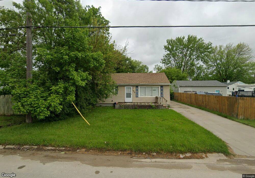
This home is located at 3346 W Mott Ave, Flint, MI 48504 and is currently estimated at $74,533, approximately $61 per square foot. 3346 W Mott Ave is a home located in Genesee County with nearby schools including Col. Donald McMonagle Elementary School, Hamady Community Middle/High School, and Eagle's Nest Academy.
Ownership History
Date
Name
Owned For
Owner Type
Purchase Details
Closed on
May 10, 2023
Sold by
Monk Stanley E
Bought by
Monk Stanley E and Sjs Llc
Current Estimated Value
Purchase Details
Closed on
Apr 8, 2016
Sold by
Brown Sandra
Bought by
Monk Stanley E
Purchase Details
Closed on
Mar 19, 2008
Sold by
Davis Kirk and Davis Edith
Bought by
Bank Of New York and Cwmbs Inc Chl Mortgage Pass Through Trus
Purchase Details
Closed on
Jul 15, 2004
Sold by
Wilson Michael L
Bought by
Davis Kirk and Davis Stephen
Home Financials for this Owner
Home Financials are based on the most recent Mortgage that was taken out on this home.
Original Mortgage
$64,490
Interest Rate
6.42%
Mortgage Type
FHA
Create a Home Valuation Report for This Property
The Home Valuation Report is an in-depth analysis detailing your home's value as well as a comparison with similar homes in the area
Home Values in the Area
Average Home Value in this Area
Purchase History
| Date | Buyer | Sale Price | Title Company |
|---|---|---|---|
| Monk Stanley E | -- | None Listed On Document | |
| Monk Stanley E | $8,000 | None Available | |
| Bank Of New York | $44,955 | None Available | |
| Davis Kirk | $65,000 | Cislo Title Company |
Source: Public Records
Mortgage History
| Date | Status | Borrower | Loan Amount |
|---|---|---|---|
| Previous Owner | Davis Kirk | $64,490 |
Source: Public Records
Tax History
| Year | Tax Paid | Tax Assessment Tax Assessment Total Assessment is a certain percentage of the fair market value that is determined by local assessors to be the total taxable value of land and additions on the property. | Land | Improvement |
|---|---|---|---|---|
| 2025 | $1,075 | $32,300 | $0 | $0 |
| 2024 | $170 | $29,900 | $0 | $0 |
| 2023 | $162 | $24,600 | $0 | $0 |
| 2022 | $953 | $21,600 | $0 | $0 |
| 2021 | $948 | $19,200 | $0 | $0 |
| 2020 | $149 | $18,500 | $0 | $0 |
| 2019 | $146 | $15,300 | $0 | $0 |
| 2018 | $880 | $12,300 | $0 | $0 |
| 2017 | $860 | $12,100 | $0 | $0 |
| 2016 | $725 | $12,000 | $0 | $0 |
| 2015 | $580 | $11,800 | $0 | $0 |
| 2014 | $111 | $9,900 | $0 | $0 |
| 2012 | -- | $11,500 | $11,500 | $0 |
Source: Public Records
Map
Nearby Homes
- 0 Gracelawn Ave
- 3299 W Ridgeway Ave
- 3289 W Hobson Ave
- 4203 Minerva Dr
- 3302 Windland Dr
- 4039 Oconner Rd
- 4184 W Pierson Rd
- 3271 W Carpenter Rd
- 5905 Cloverlawn Dr
- 4807 Birchcrest Dr
- 6310 Valorie Ln
- 5106 Cloverlawn Dr
- 6414 Valorie Ln
- 3213 N Jennings Rd
- 2106 Janice Dr
- 5620 Marlowe Dr
- 1909 Cherrylawn Dr
- 1720 Marlowe Dr
- 2013 Canniff St
- 1709 W Home Ave
- 3356 W Mott Ave
- 4127 Hunter Rd
- 4135 Hunter Rd
- 3347 W Sherman Ave
- 3351 W Sherman Ave
- 3362 W Mott Ave
- 4143 Hunter Rd
- 3363 W Sherman Ave
- 3355 W Mott Ave
- 3361 W Mott Ave
- 4111 Hunter Rd
- 4111 Hunter Rd
- 3370 W Mott Ave
- 3366 W Mott Ave
- 4134 Hunter Rd
- 4126 Hunter Rd
- 3375 W Sherman Ave
- 3340 W Sherman Ave
- 4114 Hunter Rd
- 4114 Hunter Rd
Your Personal Tour Guide
Ask me questions while you tour the home.