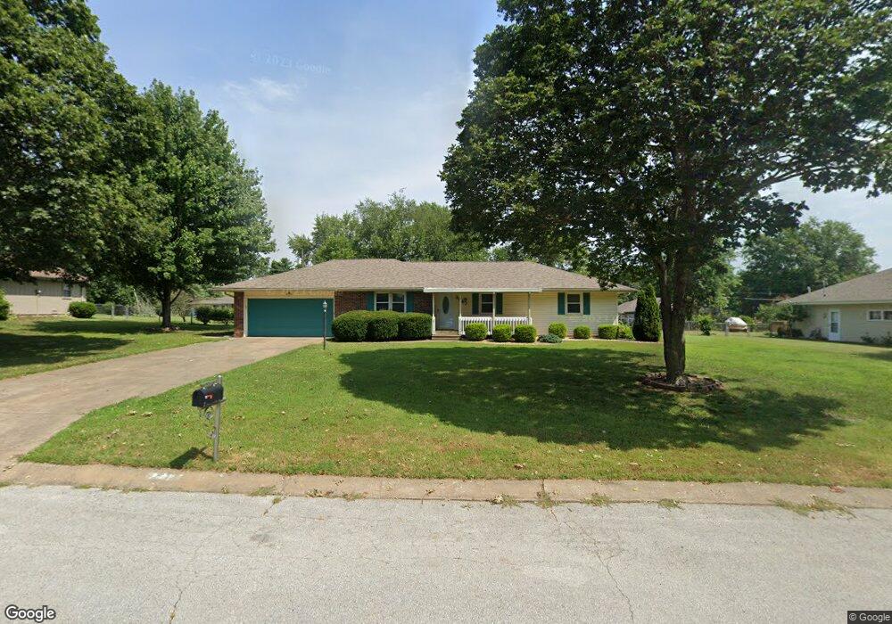
3347 W Moark St Springfield, MO 65810
Estimated Value: $222,000 - $284,000
3
Beds
2
Baths
1,371
Sq Ft
$182/Sq Ft
Est. Value
About This Home
This home is located at 3347 W Moark St, Springfield, MO 65810 and is currently estimated at $249,076, approximately $181 per square foot. 3347 W Moark St is a home located in Greene County with nearby schools including McBride Elementary School, Wilson's Creek Intermediate School, and Cherokee Middle School.
Ownership History
Date
Name
Owned For
Owner Type
Purchase Details
Closed on
Mar 28, 2022
Sold by
Central Trust
Bought by
Scott Micah
Current Estimated Value
Home Financials for this Owner
Home Financials are based on the most recent Mortgage that was taken out on this home.
Original Mortgage
$142,500
Outstanding Balance
$134,090
Interest Rate
4.42%
Mortgage Type
New Conventional
Estimated Equity
$114,986
Purchase Details
Closed on
Apr 9, 2009
Sold by
Cardwell Elizabeth K
Bought by
Cardwell Elizabeth K
Create a Home Valuation Report for This Property
The Home Valuation Report is an in-depth analysis detailing your home's value as well as a comparison with similar homes in the area
Home Values in the Area
Average Home Value in this Area
Purchase History
| Date | Buyer | Sale Price | Title Company |
|---|---|---|---|
| Scott Micah | -- | None Listed On Document | |
| Cardwell Elizabeth K | -- | None Available |
Source: Public Records
Mortgage History
| Date | Status | Borrower | Loan Amount |
|---|---|---|---|
| Open | Scott Micah | $142,500 |
Source: Public Records
Tax History
| Year | Tax Paid | Tax Assessment Tax Assessment Total Assessment is a certain percentage of the fair market value that is determined by local assessors to be the total taxable value of land and additions on the property. | Land | Improvement |
|---|---|---|---|---|
| 2025 | $1,308 | $25,380 | $6,650 | $18,730 |
| 2024 | $1,223 | $22,080 | $4,750 | $17,330 |
| 2023 | $1,216 | $22,080 | $4,750 | $17,330 |
| 2022 | $1,124 | $20,920 | $4,750 | $16,170 |
| 2021 | $1,124 | $20,920 | $4,750 | $16,170 |
| 2020 | $975 | $17,200 | $4,750 | $12,450 |
| 2019 | $947 | $17,200 | $4,750 | $12,450 |
| 2018 | $937 | $16,990 | $4,750 | $12,240 |
| 2017 | $928 | $15,850 | $4,750 | $11,100 |
| 2016 | $866 | $15,850 | $4,750 | $11,100 |
| 2015 | $859 | $15,850 | $4,750 | $11,100 |
| 2014 | $840 | $15,370 | $4,750 | $10,620 |
Source: Public Records
Map
Nearby Homes
- 3481 W Moark St
- 3475 W Farm Road 178
- 4845 S Farm Road 131
- 3551 W Cole St
- 3048 W Teton Dr
- 3223 W Melbourne St
- 2975 W Marty St
- 2992 W Nottingham St
- 5225 S April Ave
- 3049 W Edward St
- 2953 W Marty St
- 2971 W Teton Dr
- 2941 W Marty St
- 2959 W Teton Dr
- 2929 W Marty St
- 2926 W Marty St
- 2946 W Teton Dr
- 2937 W Teton Dr
- 2914 W Marty St
- 4911 S Sycamore Ave
- 3335 W Moark St
- 3357 W Moark St
- 3376 W Farm Road 178
- 3352 W Farm Road 178
- 3346 W Moark St
- 3394 W Farm Road 178
- 3334 W Moark St
- 3405 W Moark St
- 3358 W Moark St
- 3406 W Farm Road 178
- 3406 W Moark St
- 5026 S Tujunga Dr
- 5040 S Tujunga Dr
- 3421 W Moark St
- 5109 S Tujunga Dr
- 3318 W Farm Road 178
- 5052 S Tujunga Dr
- 3420 W Farm Road 178
- 3355 W Farm Road 178
- 3339 W Farm Road 178
Your Personal Tour Guide
Ask me questions while you tour the home.