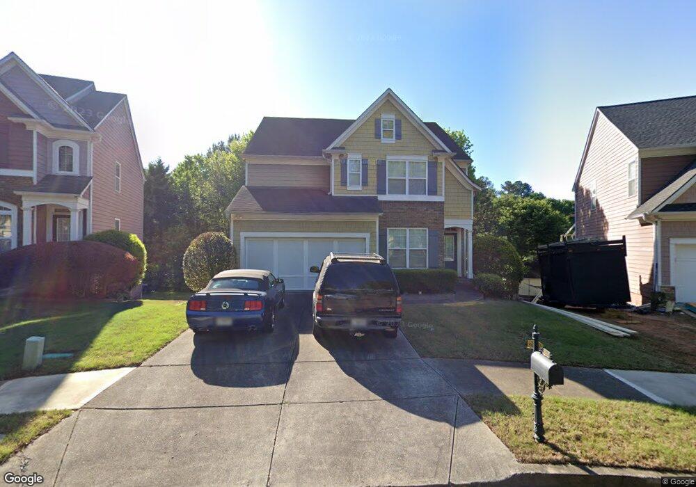
3347 Wyesham Cir Duluth, GA 30096
Estimated Value: $483,000 - $573,000
4
Beds
3
Baths
2,470
Sq Ft
$209/Sq Ft
Est. Value
About This Home
This home is located at 3347 Wyesham Cir, Duluth, GA 30096 and is currently estimated at $515,090, approximately $208 per square foot. 3347 Wyesham Cir is a home located in Gwinnett County with nearby schools including B.B. Harris Elementary School, Duluth Middle School, and Duluth High School.
Ownership History
Date
Name
Owned For
Owner Type
Purchase Details
Closed on
Sep 21, 2023
Sold by
Lee Michael
Bought by
Lee Michael Trust and Lee George Tr
Current Estimated Value
Purchase Details
Closed on
Jul 22, 2004
Sold by
Bowen Family Homes Inc
Bought by
Lee Michael
Home Financials for this Owner
Home Financials are based on the most recent Mortgage that was taken out on this home.
Original Mortgage
$49,749
Interest Rate
6.24%
Mortgage Type
New Conventional
Create a Home Valuation Report for This Property
The Home Valuation Report is an in-depth analysis detailing your home's value as well as a comparison with similar homes in the area
Home Values in the Area
Average Home Value in this Area
Purchase History
| Date | Buyer | Sale Price | Title Company |
|---|---|---|---|
| Lee Michael Trust | -- | -- | |
| Lee Michael | $248,800 | -- |
Source: Public Records
Mortgage History
| Date | Status | Borrower | Loan Amount |
|---|---|---|---|
| Previous Owner | Lee Michael | $49,749 | |
| Previous Owner | Lee Michael | $198,996 |
Source: Public Records
Tax History Compared to Growth
Tax History
| Year | Tax Paid | Tax Assessment Tax Assessment Total Assessment is a certain percentage of the fair market value that is determined by local assessors to be the total taxable value of land and additions on the property. | Land | Improvement |
|---|---|---|---|---|
| 2025 | $1,464 | $227,720 | $29,920 | $197,800 |
| 2024 | $5,104 | $211,680 | $34,800 | $176,880 |
| 2023 | $5,104 | $193,920 | $34,800 | $159,120 |
| 2022 | $3,501 | $133,040 | $24,000 | $109,040 |
| 2021 | $3,592 | $133,040 | $24,000 | $109,040 |
| 2020 | $3,406 | $122,880 | $22,000 | $100,880 |
| 2019 | $4,253 | $122,880 | $22,000 | $100,880 |
| 2018 | $3,275 | $116,360 | $18,400 | $97,960 |
| 2016 | $2,787 | $93,840 | $14,400 | $79,440 |
| 2015 | $3,407 | $93,840 | $14,400 | $79,440 |
| 2014 | -- | $85,200 | $13,600 | $71,600 |
Source: Public Records
Map
Nearby Homes
- 3357 Wyesham Cir
- 3352 Monarch Ave
- 3120 Saint Andrews Cir
- 3477 N Berkeley Lake Rd NW
- 3411 Swallowtail Terrace
- 3050 Orchard Ridge Cir
- 3024 Orchard Ridge Cir Unit 3024
- The Montgomery Plan at Evanshire - Carriage
- The Garwood Plan at Evanshire - Townhomes
- The Greenville Plan at Evanshire - Single Family
- The Madilyn Plan at Evanshire - Single Family
- The Hillsdale Plan at Evanshire - Arden
- The Wesley Plan at Evanshire - Meadowview
- The Mansfield Plan at Evanshire - Carriage
- Hampton II Plan at Evanshire - Single Family
- The Greenville Plan at Evanshire - Rowes
- The Hillsdale Plan at Evanshire - Single Family
- The Beaufort Plan at Evanshire - Carriage
- The Montgomery Plan at Evanshire - Single Family
- Hampton II Plan at Evanshire - Arden
- 3337 Wyesham Cir
- 3327 Wyesham Cir
- 3118 Devauden Ct
- 3045 Saint Andrews Dr
- 3317 Wyesham Cir
- 3108 Devauden Ct
- 0 Wyesham Cir Unit 8830270
- 0 Wyesham Cir Unit 7135394
- 0 Wyesham Cir
- 3025 Saint Andrews Dr
- 3088 Devauden Ct
- 3307 Wyesham Cir
- 3055 Saint Andrews Dr
- 3078 Devauden Ct
- 3078 Devauden Ct NW
- 3297 Wyesham Cir
- 3015 Saint Andrews Dr
- 3097 Wyesham Cir
- 0 Saint Andrews Dr Unit 7377041
- 0 Saint Andrews Dr Unit 7199301