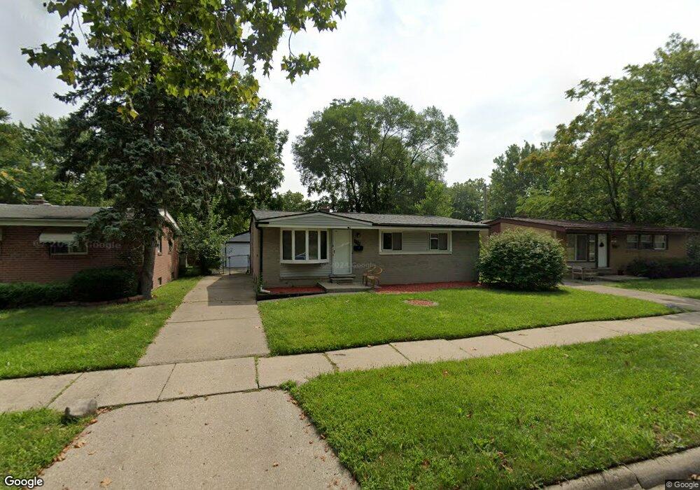
335 Bert Ln Inkster, MI 48141
Estimated Value: $133,000 - $163,000
Studio
1
Bath
1,077
Sq Ft
$141/Sq Ft
Est. Value
About This Home
This home is located at 335 Bert Ln, Inkster, MI 48141 and is currently estimated at $151,697, approximately $140 per square foot. 335 Bert Ln is a home located in Wayne County with nearby schools including David Hicks School, Adams Middle School, and John Glenn High School.
Ownership History
Date
Name
Owned For
Owner Type
Purchase Details
Closed on
Jun 29, 2022
Sold by
Bert Lane 335 Llc
Bought by
Mas Diversified Services Llc
Current Estimated Value
Purchase Details
Closed on
Jul 9, 2009
Sold by
Schawinsky Michael A
Bought by
Bert Lane 335 Llc
Purchase Details
Closed on
May 7, 2009
Sold by
Us Bank Na
Bought by
Schawinsky Michael A
Purchase Details
Closed on
Jul 17, 2008
Sold by
Taylor Jesse and Jackson Michelle
Bought by
Us Bank Na and New Century Home Equity Loan Trust Serie
Purchase Details
Closed on
May 3, 2000
Sold by
Denise M Roberson
Bought by
Jesse Taylor
Create a Home Valuation Report for This Property
The Home Valuation Report is an in-depth analysis detailing your home's value as well as a comparison with similar homes in the area
Home Values in the Area
Average Home Value in this Area
Purchase History
| Date | Buyer | Sale Price | Title Company |
|---|---|---|---|
| Mas Diversified Services Llc | -- | None Listed On Document | |
| Bert Lane 335 Llc | -- | None Available | |
| Schawinsky Michael A | $6,390 | None Available | |
| Us Bank Na | $160,001 | None Available | |
| Jesse Taylor | $95,000 | -- |
Source: Public Records
Tax History
| Year | Tax Paid | Tax Assessment Tax Assessment Total Assessment is a certain percentage of the fair market value that is determined by local assessors to be the total taxable value of land and additions on the property. | Land | Improvement |
|---|---|---|---|---|
| 2025 | $1,718 | $65,000 | $0 | $0 |
| 2024 | $1,671 | $54,900 | $0 | $0 |
| 2023 | $1,670 | $44,100 | $0 | $0 |
| 2022 | $2,034 | $36,000 | $0 | $0 |
| 2021 | $2,155 | $32,600 | $0 | $0 |
| 2020 | $2,100 | $28,000 | $0 | $0 |
| 2019 | $1,698 | $23,800 | $0 | $0 |
| 2018 | $1,605 | $22,500 | $0 | $0 |
| 2017 | $670 | $22,400 | $0 | $0 |
| 2016 | $2,056 | $22,600 | $0 | $0 |
| 2015 | $2,062 | $28,900 | $0 | $0 |
| 2013 | $1,998 | $39,000 | $0 | $0 |
| 2012 | $3,288 | $42,900 | $3,200 | $39,700 |
Source: Public Records
Map
Nearby Homes
- 29695 Birchwood St
- 29522 Grandview St
- 724 Clair St
- 30414 Cherry Hill Rd
- 29942 Avondale St
- 28999 Beechnut St
- 29800 Oakwood St
- 489 Henry Ruff Rd
- 28664 Fernwood St
- 29118 Avondale St
- 29145 Avondale St
- 28930 Birchwood St
- 29520 Glenwood St
- 30030 Glenwood St
- 28940 Grandview St
- 29985 Glenwood St
- 29959 Glenwood St
- 30129 Glenwood St
- 29537 Hazelwood St
- 964 Henry Ruff Rd
Your Personal Tour Guide
Ask me questions while you tour the home.