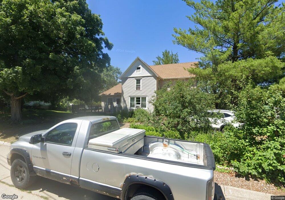
335 S Maple St West Branch, IA 52358
Estimated Value: $207,593 - $245,000
3
Beds
1
Bath
1,733
Sq Ft
$126/Sq Ft
Est. Value
About This Home
This home is located at 335 S Maple St, West Branch, IA 52358 and is currently estimated at $218,648, approximately $126 per square foot. 335 S Maple St is a home located in Cedar County with nearby schools including Hoover Elementary School, West Branch Middle School, and West Branch High School.
Ownership History
Date
Name
Owned For
Owner Type
Purchase Details
Closed on
Dec 29, 2025
Sold by
Mccrory George William and Mccrory Kellee Thorb
Bought by
George W Mccrory And Kellee Thorburn Mccrory
Current Estimated Value
Purchase Details
Closed on
Jun 12, 2007
Sold by
The City Of West Branch
Bought by
Mccrory George W and Mccrory Kellee T
Purchase Details
Closed on
May 16, 2007
Sold by
The City Of West Branch
Bought by
Mccrory George W and Mccrory Kellee T
Create a Home Valuation Report for This Property
The Home Valuation Report is an in-depth analysis detailing your home's value as well as a comparison with similar homes in the area
Home Values in the Area
Average Home Value in this Area
Purchase History
| Date | Buyer | Sale Price | Title Company |
|---|---|---|---|
| George W Mccrory And Kellee Thorburn Mccrory | -- | None Listed On Document | |
| Mccrory George W | -- | None Available | |
| Mccrory George W | -- | None Available |
Source: Public Records
Tax History
| Year | Tax Paid | Tax Assessment Tax Assessment Total Assessment is a certain percentage of the fair market value that is determined by local assessors to be the total taxable value of land and additions on the property. | Land | Improvement |
|---|---|---|---|---|
| 2025 | $2,830 | $182,890 | $43,140 | $139,750 |
| 2024 | $2,830 | $176,790 | $43,140 | $133,650 |
| 2023 | $2,726 | $172,810 | $43,140 | $129,670 |
| 2022 | $2,574 | $142,060 | $40,060 | $102,000 |
| 2021 | $2,576 | $142,060 | $40,060 | $102,000 |
| 2020 | $2,492 | $135,900 | $33,900 | $102,000 |
| 2019 | $2,234 | $131,060 | $33,900 | $102,000 |
| 2018 | $2,184 | $131,060 | $0 | $0 |
| 2017 | $2,184 | $134,710 | $0 | $0 |
| 2016 | $2,356 | $133,030 | $0 | $0 |
| 2015 | $2,346 | $131,980 | $0 | $0 |
| 2014 | $2,248 | $131,980 | $0 | $0 |
Source: Public Records
Map
Nearby Homes
- 316 S Maple St
- 316 Sycamore Dr
- 215 E Green St
- 325 N 4th St
- 168 290th St
- 426 N 1st St
- 121 Northridge Dr Unit 121-139
- 521 N 4th St Unit Louise Court Condos
- 516 N Oliphant St
- 312 W Main St
- 142 Scott Dr
- 106 Lincoln St Unit CA106
- 600 Riley Ln
- 604 Riley Ln
- 1912 Charles Ave Lot 3
- 1924 Charles Ave Lot 6
- 1932 Charles Ave Lot 8
- 1908 Charles Ave Lot 2
- 1928 Charles Ave Lot 7
- 611 Riley Ln
Your Personal Tour Guide
Ask me questions while you tour the home.