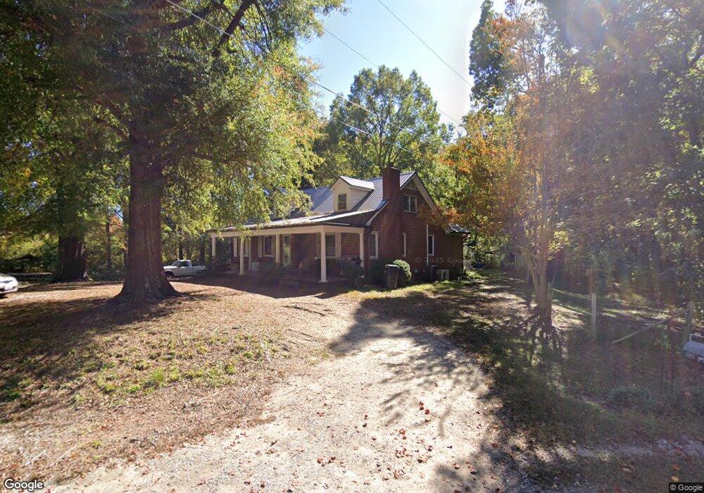
335 Sutton Rd China Grove, NC 28023
Estimated Value: $282,669 - $346,000
--
Bed
2
Baths
1,430
Sq Ft
$220/Sq Ft
Est. Value
About This Home
This home is located at 335 Sutton Rd, China Grove, NC 28023 and is currently estimated at $314,667, approximately $220 per square foot. 335 Sutton Rd is a home located in Rowan County with nearby schools including Landis Elementary School, China Grove Middle School, and South Rowan High School.
Ownership History
Date
Name
Owned For
Owner Type
Purchase Details
Closed on
Apr 22, 2014
Sold by
Sims Barbara
Bought by
Parsons William S and Parsons Janet F
Current Estimated Value
Home Financials for this Owner
Home Financials are based on the most recent Mortgage that was taken out on this home.
Original Mortgage
$95,700
Outstanding Balance
$72,722
Interest Rate
4.33%
Mortgage Type
Purchase Money Mortgage
Estimated Equity
$241,945
Purchase Details
Closed on
Jun 9, 2004
Sold by
Garver Ernest E and Garver Pauline
Bought by
Garver Ernest and Garver Pauline
Create a Home Valuation Report for This Property
The Home Valuation Report is an in-depth analysis detailing your home's value as well as a comparison with similar homes in the area
Home Values in the Area
Average Home Value in this Area
Purchase History
| Date | Buyer | Sale Price | Title Company |
|---|---|---|---|
| Parsons William S | $128,000 | None Available | |
| Garver Ernest | -- | -- |
Source: Public Records
Mortgage History
| Date | Status | Borrower | Loan Amount |
|---|---|---|---|
| Open | Parsons William S | $95,700 |
Source: Public Records
Tax History Compared to Growth
Tax History
| Year | Tax Paid | Tax Assessment Tax Assessment Total Assessment is a certain percentage of the fair market value that is determined by local assessors to be the total taxable value of land and additions on the property. | Land | Improvement |
|---|---|---|---|---|
| 2025 | $1,340 | $215,306 | $73,866 | $141,440 |
| 2024 | $1,340 | $215,306 | $73,866 | $141,440 |
| 2023 | $1,340 | $215,306 | $73,866 | $141,440 |
| 2022 | $1,043 | $149,011 | $61,562 | $87,449 |
| 2021 | $1,043 | $149,011 | $61,562 | $87,449 |
| 2020 | $1,043 | $149,011 | $61,562 | $87,449 |
| 2019 | $1,043 | $149,011 | $61,562 | $87,449 |
| 2018 | $923 | $132,888 | $61,561 | $71,327 |
| 2017 | $923 | $132,888 | $61,561 | $71,327 |
| 2016 | $923 | $132,888 | $61,561 | $71,327 |
| 2015 | $937 | $132,888 | $61,561 | $71,327 |
| 2014 | $947 | $136,884 | $62,736 | $74,148 |
Source: Public Records
Map
Nearby Homes
- 1410 Patterson St
- 440 Mt Moriah Church Rd
- 2135 Nc 152 W
- 633 Patterson St
- 136 Autumn Blaze Rd
- 150 Autumn Blaze Rd
- 180 Autumn Blaze Rd
- 518 Westside Cir
- 2785 Nc 152 W
- 321 N Kimmons St
- 514 W Blume St
- 220 Hazel St
- 219 Berrybeth Cir
- 575 Brown Rd
- 915 N Chapel St
- 00 Chapel St
- 0 Phillips St
- 868 Georgia Oak Ln
- 0 N Chapel St
- 403 Stevens St
- 420 Sutton Rd
- 330 Sutton Rd
- 415 Sutton Rd
- 270 Sutton Rd
- 435 Sutton Rd
- 220 Sutton Rd
- 215 Sutton Rd
- 455 Sutton Rd
- 1068 Brown Heights Ln
- 480 Sutton Rd
- 150 Sutton Rd
- 1114 Brown Heights Ln
- 1145 Kimball Rd
- 1065 Kimball Rd
- 1235 Kimball Rd
- 1173 Brown Heights Ln
- 1055 Kimball Rd
- 1105 Kimball Rd Unit 8
- 1275 Kimball Rd
- 1195 Brown Heights Ln