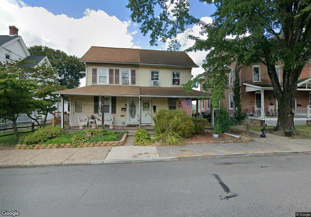
335 W Broad St Telford, PA 18969
Estimated Value: $260,438 - $365,000
3
Beds
1
Bath
1,040
Sq Ft
$291/Sq Ft
Est. Value
About This Home
This home is located at 335 W Broad St, Telford, PA 18969 and is currently estimated at $302,860, approximately $291 per square foot. 335 W Broad St is a home located in Montgomery County with nearby schools including Franconia Elementary School, Indian Crest Middle School, and Souderton Area Senior High School.
Ownership History
Date
Name
Owned For
Owner Type
Purchase Details
Closed on
Nov 30, 2006
Sold by
Marinari Robert
Bought by
Folger Katharine
Current Estimated Value
Home Financials for this Owner
Home Financials are based on the most recent Mortgage that was taken out on this home.
Original Mortgage
$112,000
Outstanding Balance
$67,148
Interest Rate
6.36%
Estimated Equity
$235,712
Purchase Details
Closed on
Jun 6, 2001
Sold by
Lyons Linda A
Bought by
Marinari Robert
Create a Home Valuation Report for This Property
The Home Valuation Report is an in-depth analysis detailing your home's value as well as a comparison with similar homes in the area
Home Values in the Area
Average Home Value in this Area
Purchase History
| Date | Buyer | Sale Price | Title Company |
|---|---|---|---|
| Folger Katharine | $140,000 | None Available | |
| Marinari Robert | $87,000 | First American Title Ins Co |
Source: Public Records
Mortgage History
| Date | Status | Borrower | Loan Amount |
|---|---|---|---|
| Open | Folger Katharine | $112,000 |
Source: Public Records
Tax History Compared to Growth
Tax History
| Year | Tax Paid | Tax Assessment Tax Assessment Total Assessment is a certain percentage of the fair market value that is determined by local assessors to be the total taxable value of land and additions on the property. | Land | Improvement |
|---|---|---|---|---|
| 2025 | $3,935 | $87,340 | $38,170 | $49,170 |
| 2024 | $3,935 | $87,340 | $38,170 | $49,170 |
| 2023 | $3,761 | $87,340 | $38,170 | $49,170 |
| 2022 | $3,658 | $87,340 | $38,170 | $49,170 |
| 2021 | $3,588 | $87,340 | $38,170 | $49,170 |
| 2020 | $3,541 | $87,340 | $38,170 | $49,170 |
| 2019 | $3,503 | $87,340 | $38,170 | $49,170 |
| 2018 | $2,397 | $87,340 | $38,170 | $49,170 |
| 2017 | $3,379 | $87,340 | $38,170 | $49,170 |
| 2016 | $3,345 | $87,340 | $38,170 | $49,170 |
| 2015 | $3,268 | $87,340 | $38,170 | $49,170 |
| 2014 | $3,268 | $87,340 | $38,170 | $49,170 |
Source: Public Records
Map
Nearby Homes
- 196 Penn Ave
- 103 Arlington Ln
- 223 W Reliance Rd
- 119 121 E Broad St
- 438 N Main St
- 554 Harleysville Pike
- 171 Hopewell Ln Unit B
- 340 S Main St
- 3443 Devlin Way
- 23 Orchard Cir
- 227 Ridge Ave
- 801 Evergreen Cir
- 805 Evergreen Cir
- 415 Wexford Way Unit D7
- 478 Smokepipe Rd
- 44 Diamond St
- 54 Reliance Ct
- 3 Carousel Dr
- 314 Harleysville Pike
- 517 Hemsing Cir
- 331 W Broad St
- 337 W Broad St
- 329 W Broad St
- 341 W Broad St
- 325 W Broad St
- 343 W Broad St
- 323 W Broad St
- 349 W Broad St
- 319 W Broad St
- 351 W Broad St
- 250 N 3rd St
- 334 W Broad St
- 317 W Broad St
- 355 W Broad St Unit 13
- 330 W Broad St
- 357 W Broad St
- 320 W Broad St
- 348 W Broad St
- 336 W Broad St
- 314 W Broad St