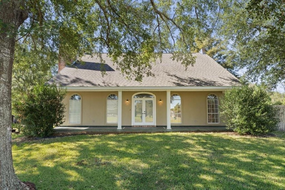
335 W Presidential Cir Lake Charles, LA 70611
Moss Bluff NeighborhoodEstimated payment $1,550/month
Highlights
- No HOA
- Central Heating and Cooling System
- East Facing Home
- Graham & Parks Alternative Public School Rated A
About This Home
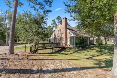
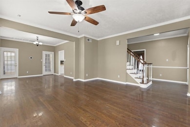
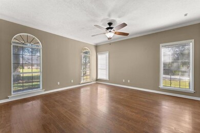
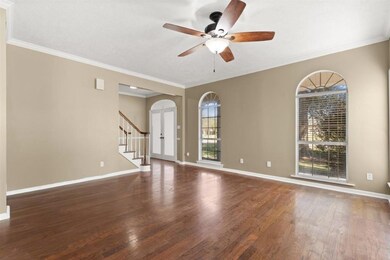
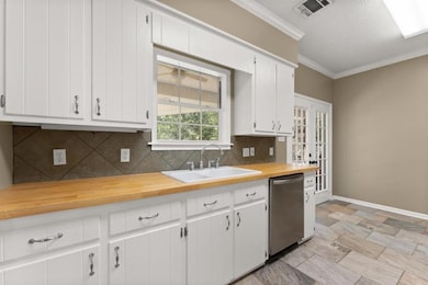
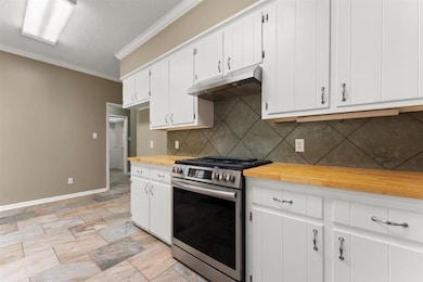
Welcome home to this beautiful 3-bedroom, 2.5-bath residence located in an established neighborhood. This spacious home sits on a shaded, oversized lot that backs up to peaceful woods, offering privacy and a serene natural view. The carport even has a workshop attached. The thoughtfully designed floor plan features the primary suite conveniently located on the main level, providing ease and comfort. The designated dining is open the the living room. Upstairs, you’ll find two large secondary bedrooms and a full bathroom. Hard surface floors throughout and fresh interior paint in most rooms, creating a clean and inviting atmosphere. Enjoy the perfect combination of tranquility and convenience — this home is situated close to schools, restaurants, and grocery stores, making everyday living effortless. Don’t miss your chance to own this wonderful property with space, comfort, and a touch of nature all in one! Flood zone X.
Home Details
Home Type
- Single Family
Est. Annual Taxes
- $1,293
Year Built
- 1995
Lot Details
- Lot Dimensions are 200x126
- East Facing Home
Parking
- 2 Carport Spaces
Schools
- Moss Bluff Elementary And Middle School
- Sam Houston High School
Utilities
- Central Heating and Cooling System
- Natural Gas Connected
- Aerobic Septic System
Additional Features
- 0.5 Bathroom
- Outside City Limits
Community Details
- No Home Owners Association
Map
Home Values in the Area
Average Home Value in this Area
Tax History
| Year | Tax Paid | Tax Assessment Tax Assessment Total Assessment is a certain percentage of the fair market value that is determined by local assessors to be the total taxable value of land and additions on the property. | Land | Improvement |
|---|---|---|---|---|
| 2024 | $1,293 | $19,530 | $2,540 | $16,990 |
| 2023 | $1,293 | $19,530 | $2,540 | $16,990 |
| 2022 | $2,064 | $19,530 | $2,540 | $16,990 |
| 2021 | $1,334 | $19,530 | $2,540 | $16,990 |
| 2020 | $1,930 | $17,730 | $2,440 | $15,290 |
| 2019 | $2,113 | $19,340 | $2,350 | $16,990 |
| 2018 | $1,296 | $19,340 | $2,350 | $16,990 |
| 2017 | $2,146 | $19,340 | $2,350 | $16,990 |
Property History
| Date | Event | Price | List to Sale | Price per Sq Ft |
|---|---|---|---|---|
| 11/21/2025 11/21/25 | Pending | -- | -- | -- |
| 10/30/2025 10/30/25 | For Sale | $275,000 | -- | $120 / Sq Ft |
Purchase History
| Date | Type | Sale Price | Title Company |
|---|---|---|---|
| Deed | $200,000 | None Available |
Mortgage History
| Date | Status | Loan Amount | Loan Type |
|---|---|---|---|
| Open | $194,930 | FHA |
Source: Southwest Louisiana Association of REALTORS®
MLS Number: SWL25101915
APN: 01277960
- 231 W Presidential Cir
- 231 N Presidential Cir
- 521 Josh St
- 211 Senator Ln
- 298 S Presidential Cir
- 290 Morrow Rd
- 647 Morrow Rd
- 627 Sam Houston Jones Hwy
- 0 Vickie Ln
- 0 Parish Rd Unit 45-679
- 0 Parish Rd Unit SWL24004393
- 276 School St
- 0 Champagne Cir Unit SWL23007471
- 724 N Huval Dr
- 179 Armistead Ln
- 201 Armistead Ln
- 928 Crawford Dr
- 863 Cooley Rd
- 833 N Huval Dr
- 751 Moss Bluff Dr
