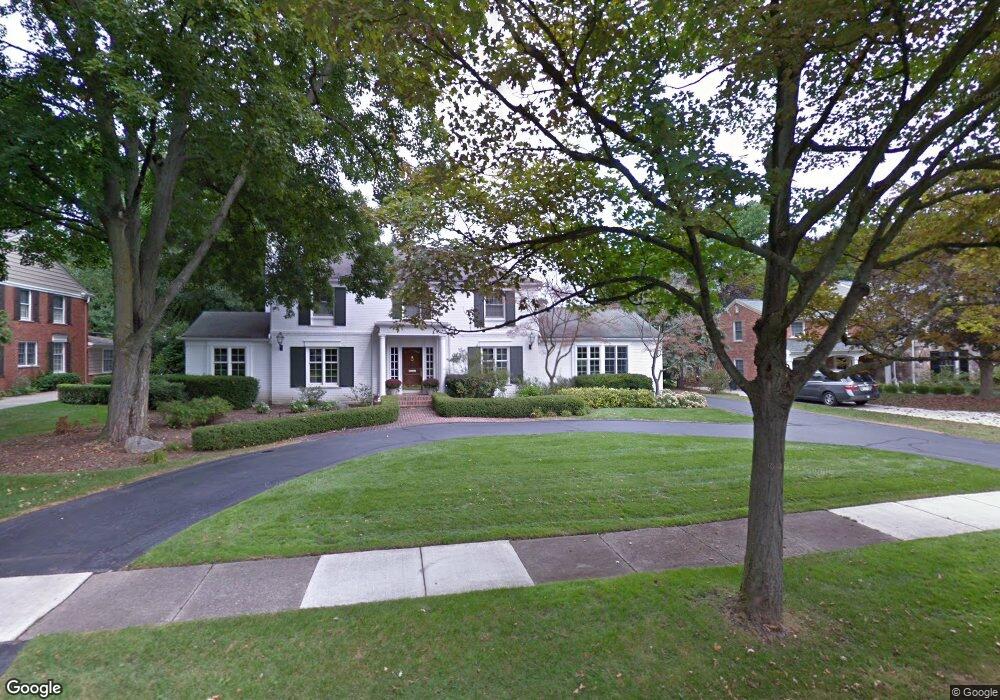
3350 Burning Bush Rd Bloomfield Hills, MI 48301
Estimated Value: $1,120,748 - $1,485,000
4
Beds
4
Baths
3,336
Sq Ft
$401/Sq Ft
Est. Value
About This Home
This home is located at 3350 Burning Bush Rd, Bloomfield Hills, MI 48301 and is currently estimated at $1,336,687, approximately $400 per square foot. 3350 Burning Bush Rd is a home located in Oakland County with nearby schools including Quarton Elementary, Derby Middle School, and Ernest W. Seaholm High School.
Ownership History
Date
Name
Owned For
Owner Type
Purchase Details
Closed on
Apr 13, 2010
Sold by
Omeara Patrick J and Omeara Judy E
Bought by
Barry Kevin M and Barry Anne M
Current Estimated Value
Home Financials for this Owner
Home Financials are based on the most recent Mortgage that was taken out on this home.
Original Mortgage
$506,191
Outstanding Balance
$337,474
Interest Rate
5.02%
Mortgage Type
Future Advance Clause Open End Mortgage
Estimated Equity
$999,213
Purchase Details
Closed on
Jan 9, 1995
Sold by
Frick Gerald M
Bought by
O'Meara Patrick J and O'Meara Judy E
Home Financials for this Owner
Home Financials are based on the most recent Mortgage that was taken out on this home.
Original Mortgage
$455,000
Interest Rate
8.63%
Mortgage Type
New Conventional
Create a Home Valuation Report for This Property
The Home Valuation Report is an in-depth analysis detailing your home's value as well as a comparison with similar homes in the area
Home Values in the Area
Average Home Value in this Area
Purchase History
| Date | Buyer | Sale Price | Title Company |
|---|---|---|---|
| Barry Kevin M | $500,000 | Land Title | |
| O'Meara Patrick J | $569,000 | -- |
Source: Public Records
Mortgage History
| Date | Status | Borrower | Loan Amount |
|---|---|---|---|
| Open | Barry Kevin M | $506,191 | |
| Previous Owner | O'Meara Patrick J | $455,000 |
Source: Public Records
Tax History Compared to Growth
Tax History
| Year | Tax Paid | Tax Assessment Tax Assessment Total Assessment is a certain percentage of the fair market value that is determined by local assessors to be the total taxable value of land and additions on the property. | Land | Improvement |
|---|---|---|---|---|
| 2024 | $7,872 | $563,260 | $0 | $0 |
| 2023 | $7,554 | $496,680 | $0 | $0 |
| 2022 | $13,319 | $461,720 | $0 | $0 |
| 2021 | $13,430 | $458,670 | $0 | $0 |
| 2020 | $7,257 | $455,450 | $0 | $0 |
| 2019 | $13,389 | $450,040 | $0 | $0 |
| 2018 | $13,246 | $428,600 | $0 | $0 |
| 2017 | $13,246 | $406,160 | $0 | $0 |
| 2016 | $13,322 | $396,400 | $0 | $0 |
| 2015 | -- | $382,680 | $0 | $0 |
| 2014 | -- | $369,510 | $0 | $0 |
| 2011 | -- | $280,110 | $0 | $0 |
Source: Public Records
Map
Nearby Homes
- 3546 Bloomfield Club Dr
- 3320 Morningview Terrace
- 1287 Charrington Rd
- 5825 Lahser Rd
- 1348 Charrington Rd
- 100 Overhill Rd
- 2579 Amberly Rd
- 231 Wadsworth Ln
- 6580 Red Maple Ln
- 1019 N Cranbrook Rd
- 6560 Red Maple Ln
- 3627 Middlebury Ln
- 6727 Lahser Rd
- 397 S Cranbrook Rd
- 596 Rudgate Rd
- 421 S Williamsbury Rd
- 270 Martell Dr
- 2802 Heathfield Rd
- 956 Westwood Dr
- 5741 Snowshoe Cir
- 3330 Burning Bush Rd
- 3370 Burning Bush Rd
- 3380 Burning Bush Rd
- 3320 Burning Bush Rd
- 3335 Burning Bush Rd
- 910 Charrington Rd
- 3345 Burning Bush Rd
- 3325 Burning Bush Rd
- 3300 Burning Bush Rd
- 747 Ardmoor Dr
- 865 Ardmoor Dr
- 3390 Burning Bush Rd
- 770 Hupp Cross Rd
- 885 Charrington Rd
- 735 Ardmoor Dr
- 3410 Burning Bush Rd
- 750 Hupp Cross Rd
- 925 Ardmoor Dr
- 685 Ardmoor Dr
- 945 Stuyvessant Rd