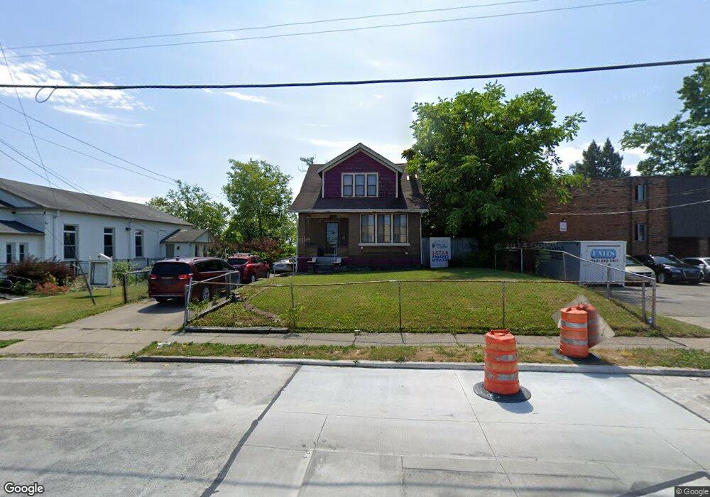
3350 Mchenry Ave Cincinnati, OH 45225
East Westwood NeighborhoodEstimated Value: $66,000 - $164,000
3
Beds
1
Bath
1,437
Sq Ft
$78/Sq Ft
Est. Value
About This Home
This home is located at 3350 Mchenry Ave, Cincinnati, OH 45225 and is currently estimated at $111,441, approximately $77 per square foot. 3350 Mchenry Ave is a home located in Hamilton County with nearby schools including Western Hills High School, Gilbert A. Dater High School, and Robert A. Taft Information Technology High School.
Ownership History
Date
Name
Owned For
Owner Type
Purchase Details
Closed on
Apr 14, 1997
Sold by
Johnson Willie L and Johnson Wilma J
Bought by
Patterson Habel Dean
Current Estimated Value
Home Financials for this Owner
Home Financials are based on the most recent Mortgage that was taken out on this home.
Original Mortgage
$47,500
Outstanding Balance
$4,929
Interest Rate
7.93%
Estimated Equity
$106,512
Create a Home Valuation Report for This Property
The Home Valuation Report is an in-depth analysis detailing your home's value as well as a comparison with similar homes in the area
Home Values in the Area
Average Home Value in this Area
Purchase History
| Date | Buyer | Sale Price | Title Company |
|---|---|---|---|
| Patterson Habel Dean | -- | -- |
Source: Public Records
Mortgage History
| Date | Status | Borrower | Loan Amount |
|---|---|---|---|
| Open | Patterson Habel Dean | $47,500 |
Source: Public Records
Tax History
| Year | Tax Paid | Tax Assessment Tax Assessment Total Assessment is a certain percentage of the fair market value that is determined by local assessors to be the total taxable value of land and additions on the property. | Land | Improvement |
|---|---|---|---|---|
| 2025 | $786 | $12,153 | $1,173 | $10,980 |
| 2024 | $785 | $12,153 | $1,173 | $10,980 |
| 2023 | $787 | $12,153 | $1,173 | $10,980 |
| 2022 | $377 | $5,103 | $826 | $4,277 |
| 2021 | $366 | $5,103 | $826 | $4,277 |
| 2020 | $367 | $5,103 | $826 | $4,277 |
| 2019 | $600 | $7,722 | $802 | $6,920 |
| 2018 | $600 | $7,722 | $802 | $6,920 |
| 2017 | $578 | $7,722 | $802 | $6,920 |
| 2016 | $656 | $8,565 | $1,467 | $7,098 |
| 2015 | $587 | $8,565 | $1,467 | $7,098 |
| 2014 | $590 | $8,565 | $1,467 | $7,098 |
| 2013 | $890 | $12,786 | $2,191 | $10,595 |
Source: Public Records
Map
Nearby Homes
- 3312 Mchenry Ave
- 2424 Westwood Northern Blvd
- 3295 Fyffe Ave
- 3384 Ninann Ct
- 3519 Mchenry Ave
- 2183 Westwood Northern Blvd
- 3521 Mchenry Ave
- 3162 Sunshine Ave
- 3041 Westknolls Ln
- 2163 Baltimore Ave
- 2505 Foxcove Ct
- 2962 Aquadale Ln
- 3116 Gobel Ave
- 2525 Millennium Place
- 2352 Iroll Ave
- 2508 Mustang Dr
- 3042 Percy Ave
- 2085 N Teralta Cir
- 2454 Mustang Dr
- 2456 Mustang Dr Unit 13
- 3344-3346 Mchenry Ave
- 3535 Mchenry Ave
- 3344 Mchenry Ave
- 2320 Westwood Northern Blvd
- 2320 Westwood Northern Blvd Unit 2
- 3351 Mchenry Ave
- 3355 Mchenry Ave
- 3347 Mchenry Ave
- 3357 Mchenry Ave
- 3368 Mchenry Ave
- 3359 Mchenry Ave
- 3345 Mchenry Ave
- 3361 Mchenry Ave
- 3343 Mchenry Ave
- 3374 Mchenry Ave
- 2302 Westwood Northern Blvd
- 3328 Mchenry Ave
- 3341 Mchenry Ave
- 3367 Mchenry Ave
- 3378 Mchenry Ave
Your Personal Tour Guide
Ask me questions while you tour the home.