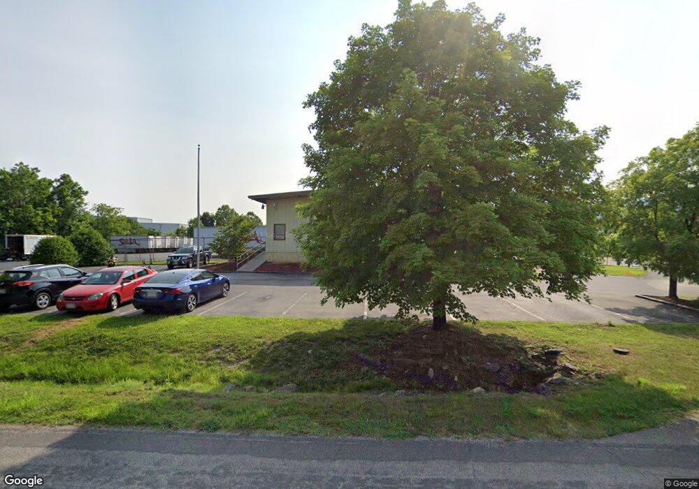
Estimated Value: $1,602,869
--
Bed
--
Bath
6,200
Sq Ft
$259/Sq Ft
Est. Value
About This Home
This home is located at 3351 Shawnee Dr, Salem, VA 24153 and is currently estimated at $1,602,869, approximately $258 per square foot. 3351 Shawnee Dr is a home located in Roanoke County with nearby schools including Fort Lewis Elementary School, Glenvar Middle School, and Glenvar High School.
Ownership History
Date
Name
Owned For
Owner Type
Purchase Details
Closed on
Mar 9, 2018
Sold by
Natmi National Fx Properties Llc
Bought by
R L R Investments L L C
Current Estimated Value
Purchase Details
Closed on
Apr 27, 2011
Sold by
Fedex Freight Inc
Bought by
Fedex National Ltd Inc and National Fx Properties Llc
Purchase Details
Closed on
Sep 1, 2006
Sold by
Freight Terminals Inc
Bought by
Fedex National Ltl Inc
Create a Home Valuation Report for This Property
The Home Valuation Report is an in-depth analysis detailing your home's value as well as a comparison with similar homes in the area
Home Values in the Area
Average Home Value in this Area
Purchase History
| Date | Buyer | Sale Price | Title Company |
|---|---|---|---|
| R L R Investments L L C | $910,000 | Fidelity National Title Insu | |
| Fedex National Ltd Inc | $521,462 | None Available | |
| Fedex National Ltl Inc | $775,000 | First American Title |
Source: Public Records
Tax History Compared to Growth
Tax History
| Year | Tax Paid | Tax Assessment Tax Assessment Total Assessment is a certain percentage of the fair market value that is determined by local assessors to be the total taxable value of land and additions on the property. | Land | Improvement |
|---|---|---|---|---|
| 2025 | $4,531 | $439,900 | $108,100 | $331,800 |
| 2024 | $4,493 | $432,000 | $106,200 | $325,800 |
| 2023 | $4,533 | $427,600 | $106,200 | $321,400 |
| 2022 | $4,589 | $421,000 | $106,200 | $314,800 |
| 2021 | $4,519 | $414,600 | $106,200 | $308,400 |
| 2020 | $4,471 | $410,200 | $106,200 | $304,000 |
| 2019 | $4,417 | $405,200 | $106,200 | $299,000 |
| 2018 | $4,308 | $397,000 | $106,200 | $290,800 |
| 2017 | $4,308 | $395,200 | $106,200 | $289,000 |
| 2016 | $4,214 | $386,600 | $96,500 | $290,100 |
| 2015 | $4,162 | $381,800 | $96,500 | $285,300 |
| 2014 | $4,167 | $382,300 | $96,500 | $285,800 |
Source: Public Records
Map
Nearby Homes
- 3411 Andrew Ave
- 4530 Lomond Cir
- 2710 Harborwood Rd
- 3713 Shelor Ave
- 2903 Creekwood Dr
- 4633 Nevis Dr
- 310 Texas Hollow Rd
- 4144 Daugherty Rd
- 2917 Elderwood Rd
- 3065 Isabel Ln
- 2221 W West Main Street St
- 2156 Stone Mill Dr
- 4273 Daugherty Rd
- 443 Ingal Blvd
- 2240 Foxfield Ln
- 2298 Foxfield Ln
- 1905 Queensmill Dr
- 2027 River Ridge Ct
- TBD New River Oaks Dr
- 4377 W Main St
- 3327 Shawnee Dr
- 3350 Shawnee Dr
- 3320 Shawnee Dr
- 3306 W Main St
- 3170 W Main St
- 3326 W Main St
- 5933 Garman Rd
- 3410 W Main St
- 3426 W Main St
- 3163 W Main St
- 3142 W Main St
- 3691 Garman Rd
- 3132 W Main St
- 3485 Mcdaniel Dr
- 3130 W Main St
- 3155 W Main St
- 3217 Locust Grove Ln
- 3222 Locust Grove Ln
- 3145 W Main St
- 3495 Mcdaniel Dr
