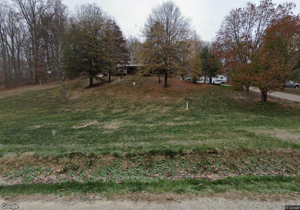
3352 Poplar Fork Rd Franklin Furnace, OH 45629
Estimated Value: $266,291 - $374,000
3
Beds
4
Baths
520
Sq Ft
$603/Sq Ft
Est. Value
About This Home
This home is located at 3352 Poplar Fork Rd, Franklin Furnace, OH 45629 and is currently estimated at $313,573, approximately $603 per square foot. 3352 Poplar Fork Rd is a home located in Scioto County with nearby schools including Bloom-Vernon Elementary School and South Webster Junior/Senior High School.
Ownership History
Date
Name
Owned For
Owner Type
Purchase Details
Closed on
Sep 23, 2008
Sold by
Hatcher Neal and Hatcher Vicky
Bought by
Campus View Associates Llc
Current Estimated Value
Purchase Details
Closed on
Aug 1, 2006
Sold by
Charles F Charles F and Campbell Ruth L
Bought by
Hom James Eric and Hom Evelyn Ko
Purchase Details
Closed on
Dec 13, 1999
Bought by
Holbrook Brian + Vonda J and Holbrook Holbrook
Purchase Details
Closed on
Jan 11, 1995
Bought by
Holbrook Brian Et Al J and Holbrook S
Create a Home Valuation Report for This Property
The Home Valuation Report is an in-depth analysis detailing your home's value as well as a comparison with similar homes in the area
Home Values in the Area
Average Home Value in this Area
Purchase History
| Date | Buyer | Sale Price | Title Company |
|---|---|---|---|
| Campus View Associates Llc | -- | -- | |
| Hom James Eric | $937,350 | -- | |
| Holbrook Brian + Vonda J | $4,000 | -- | |
| Holbrook Brian Et Al J | $8,000 | -- |
Source: Public Records
Tax History Compared to Growth
Tax History
| Year | Tax Paid | Tax Assessment Tax Assessment Total Assessment is a certain percentage of the fair market value that is determined by local assessors to be the total taxable value of land and additions on the property. | Land | Improvement |
|---|---|---|---|---|
| 2024 | $2,531 | $58,720 | $5,330 | $53,390 |
| 2023 | $2,531 | $58,720 | $5,330 | $53,390 |
| 2022 | $2,425 | $58,720 | $5,330 | $53,390 |
| 2021 | $2,164 | $52,290 | $4,630 | $47,660 |
| 2020 | $2,107 | $52,290 | $4,630 | $47,660 |
| 2019 | $2,117 | $47,850 | $4,520 | $43,330 |
| 2018 | $1,996 | $47,850 | $4,520 | $43,330 |
| 2017 | $1,947 | $47,850 | $4,520 | $43,330 |
| 2016 | $1,942 | $46,730 | $4,210 | $42,520 |
| 2015 | $1,905 | $46,730 | $4,210 | $42,520 |
| 2013 | $1,738 | $46,730 | $4,210 | $42,520 |
Source: Public Records
Map
Nearby Homes
- 2170 Snook Rd
- 2053 Snook Rd
- 0 Lick Run Lyra Rd Lot Unit Wp003
- 494 Germany Hollow Rd
- 0 Haney Rd Lot Unit Wp002
- 1318 Haney Rd
- 0 Haney Rd Unit 225025433
- 6173 Ohio 522
- 4235 Ohio 522
- 3754 Ohio 522
- 638 Sam Jones Rd Unit 2
- 638 Sam Jones Rd
- 638 Sam Jones Rd
- 3272 Big Pete Rd
- 3272 Big Pete Rd Unit A
- 0 Lick Run-Lyra Rd
- 2300 Dogwood Ridge Rd
- 2405 Ridgewood Dr
- 0 Patriot Ridge Dr
- 1177 Candlewood Dr
- 3322 Poplar Fork Rd
- 3391 Poplar Fork Rd
- 3391 Poplar Fork Rd
- 3273 Poplar Fork Rd
- 2263 Snook Rd
- 3542 Poplar Fork Rd
- 800 Schwamberger Rd
- 2255 Snook Rd
- 2068 Snook Rd
- 2068 Snook Rd
- 3773 Poplar Fork Rd
- 2006 Snook Rd
- 2935 Poplar Fork Rd
- 1967 Snook Rd
- 1955 Snook Rd
- 2895 Poplar Fork Rd
- 2859 Poplar Fork Rd
- 2827 Poplar Fork Rd
- 3773 Poplar Fork Rd
- 1856 Snook Rd